Estimated Value: $113,000 - $254,000
3
Beds
1
Bath
1,100
Sq Ft
$161/Sq Ft
Est. Value
About This Home
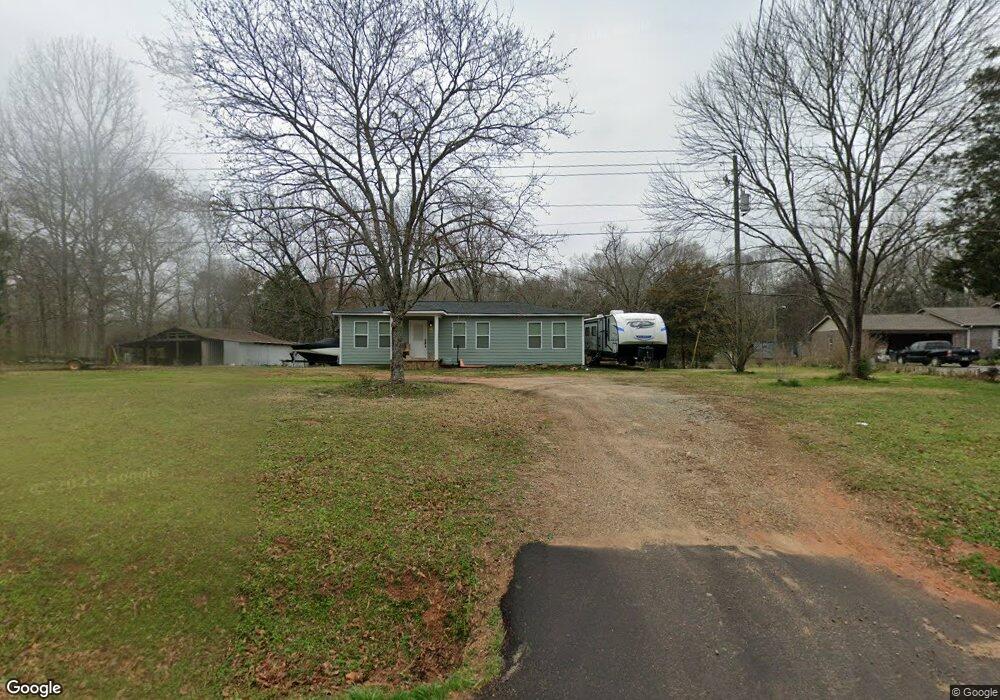
This home is located at 1859 Highway 172, Comer, GA 30629 and is currently estimated at $177,089, approximately $160 per square foot. 1859 Highway 172 is a home located in Madison County with nearby schools including Madison County High School.
Ownership History
Date
Name
Owned For
Owner Type
Purchase Details
Closed on
Aug 19, 2022
Sold by
Fagan Michelle
Bought by
Fagan Timothy
Current Estimated Value
Purchase Details
Closed on
Dec 16, 2021
Sold by
Johnson John Curtis
Bought by
Fagan Timothy and Fagan Michelle
Purchase Details
Closed on
Mar 30, 2006
Sold by
Johnson John Curtis
Bought by
Johnson John Curtis and Johnson Penny
Home Financials for this Owner
Home Financials are based on the most recent Mortgage that was taken out on this home.
Original Mortgage
$71,900
Interest Rate
6.2%
Mortgage Type
New Conventional
Purchase Details
Closed on
Jan 17, 2001
Sold by
Federal National Mor
Bought by
Hodges William L and Hodges E
Purchase Details
Closed on
May 2, 2000
Sold by
Wells Fargo Home Mor
Bought by
Federal National Mor
Purchase Details
Closed on
Feb 13, 1998
Sold by
Edwards Windy Gresha
Bought by
Ughrin Edward S
Purchase Details
Closed on
Jan 1, 1995
Bought by
Edwards Windy Gresha
Create a Home Valuation Report for This Property
The Home Valuation Report is an in-depth analysis detailing your home's value as well as a comparison with similar homes in the area
Purchase History
| Date | Buyer | Sale Price | Title Company |
|---|---|---|---|
| Fagan Timothy | -- | -- | |
| Fagan Timothy | $65,000 | -- | |
| Johnson John Curtis | -- | -- | |
| Johnson John Curtis | $71,900 | -- | |
| Hodges William L | -- | -- | |
| Federal National Mor | -- | -- | |
| Wells Fargo Home Mor | -- | -- | |
| Ughrin Edward S | $63,000 | -- | |
| Edwards Windy Gresha | -- | -- |
Source: Public Records
Mortgage History
| Date | Status | Borrower | Loan Amount |
|---|---|---|---|
| Previous Owner | Johnson John Curtis | $71,900 |
Source: Public Records
Tax History
| Year | Tax Paid | Tax Assessment Tax Assessment Total Assessment is a certain percentage of the fair market value that is determined by local assessors to be the total taxable value of land and additions on the property. | Land | Improvement |
|---|---|---|---|---|
| 2025 | $999 | $39,321 | $11,894 | $27,427 |
| 2024 | $10 | $38,414 | $11,894 | $26,520 |
| 2023 | $901 | $34,617 | $9,912 | $24,705 |
| 2022 | $785 | $28,443 | $6,816 | $21,627 |
| 2021 | $700 | $22,946 | $6,816 | $16,130 |
| 2020 | $675 | $21,955 | $5,825 | $16,130 |
| 2019 | $671 | $21,573 | $5,825 | $15,748 |
| 2018 | $631 | $20,217 | $5,329 | $14,888 |
| 2017 | $568 | $19,730 | $4,956 | $14,774 |
| 2016 | $479 | $16,688 | $4,506 | $12,182 |
| 2015 | $479 | $16,688 | $4,506 | $12,182 |
| 2014 | $490 | $16,960 | $4,587 | $12,372 |
| 2013 | -- | $18,180 | $6,032 | $12,148 |
Source: Public Records
Map
Nearby Homes
- 0 McCarty Dodd Rd Unit 10646393
- 0 McCarty Dodd Rd Unit CL344009
- 579 McCarty Dodd Rd
- 760 Fortson Compton Rd
- 116 Scarlett Oak Ln
- 52 Willow Oak Cir
- 0 Lowe Rd Unit 10614126
- 82 Fennell Ln
- 270 Lola St
- 1416 Kingston Way
- 500 Kingston Rd
- 622 Linda St
- 640 Gholston St
- 0 Bluff Rd Unit 10704957
- 0 Poss Rd Unit 11540856
- 118 Kingston Rd
- 12 Laurel Ave
- 77 Laurel Ave
- 125 Laurel Ave
- 2633 Paoli St Unit TRACT 1
- 1875 Highway 172
- 1799 Highway 172
- 1799 Highway 172
- 1799 Georgia 172
- 1886 Highway 172
- 1988 Highway 172
- 1665 Highway 172
- 2209 Brickyard Rd
- 2062 Highway 172
- 2188 Brickyard Rd
- 2228 Brickyard Rd
- 1664 Highway 172
- 2191 Brickyard Rd
- 2096 Brickyard Rd
- 2212 Highway 172
- 1608 Highway 172
- 1486 Highway 172
- 1966 Brickyard Rd
- 1391 Highway 172
- 1391 Georgia 172
Your Personal Tour Guide
Ask me questions while you tour the home.