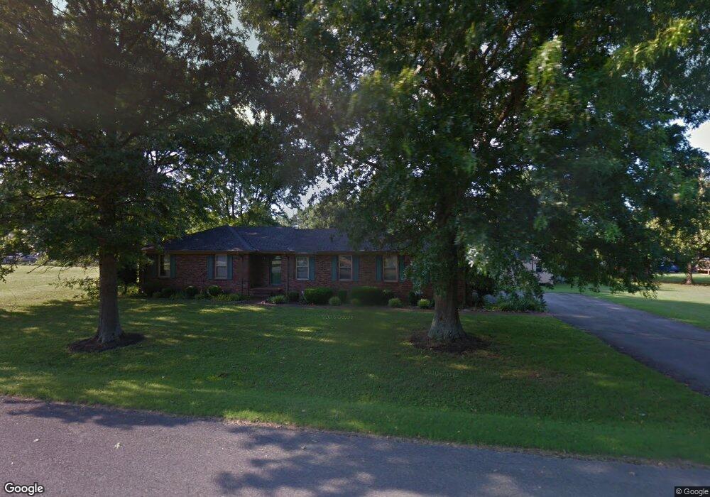
186 Amherst Dr Murfreesboro, TN 37128
Estimated Value: $381,968 - $485,000
--
Bed
2
Baths
2,366
Sq Ft
$185/Sq Ft
Est. Value
About This Home
This home is located at 186 Amherst Dr, Murfreesboro, TN 37128 and is currently estimated at $436,742, approximately $184 per square foot. 186 Amherst Dr is a home located in Rutherford County with nearby schools including Barfield Elementary School, Christiana Middle School, and Rockvale High School.
Ownership History
Date
Name
Owned For
Owner Type
Purchase Details
Closed on
Oct 14, 1998
Sold by
Graves Larry G
Bought by
Watson and Connie
Current Estimated Value
Home Financials for this Owner
Home Financials are based on the most recent Mortgage that was taken out on this home.
Original Mortgage
$119,400
Outstanding Balance
$25,488
Interest Rate
6.61%
Estimated Equity
$411,254
Purchase Details
Closed on
Dec 6, 1995
Bought by
Graves Larry G
Create a Home Valuation Report for This Property
The Home Valuation Report is an in-depth analysis detailing your home's value as well as a comparison with similar homes in the area
Home Values in the Area
Average Home Value in this Area
Purchase History
| Date | Buyer | Sale Price | Title Company |
|---|---|---|---|
| Watson | $119,500 | -- | |
| Graves Larry G | $110,000 | -- |
Source: Public Records
Mortgage History
| Date | Status | Borrower | Loan Amount |
|---|---|---|---|
| Open | Graves Larry G | $119,400 |
Source: Public Records
Tax History Compared to Growth
Tax History
| Year | Tax Paid | Tax Assessment Tax Assessment Total Assessment is a certain percentage of the fair market value that is determined by local assessors to be the total taxable value of land and additions on the property. | Land | Improvement |
|---|---|---|---|---|
| 2025 | $1,542 | $82,175 | $13,750 | $68,425 |
| 2024 | $1,542 | $82,175 | $13,750 | $68,425 |
| 2023 | $1,542 | $82,175 | $13,750 | $68,425 |
| 2022 | $1,312 | $81,150 | $13,750 | $67,400 |
| 2021 | $1,278 | $57,600 | $9,125 | $48,475 |
| 2020 | $1,278 | $57,600 | $9,125 | $48,475 |
| 2019 | $1,278 | $57,600 | $9,125 | $48,475 |
| 2018 | $1,209 | $57,600 | $0 | $0 |
| 2017 | $1,256 | $46,875 | $0 | $0 |
| 2016 | $1,256 | $46,875 | $0 | $0 |
| 2015 | $1,256 | $46,875 | $0 | $0 |
| 2014 | $1,166 | $46,875 | $0 | $0 |
| 2013 | -- | $37,400 | $0 | $0 |
Source: Public Records
Map
Nearby Homes
- 321 Amherst Dr
- 3236 Prater Ct
- 3220 Prater Ct
- 3022 London View Dr
- 338 Rowlette Cir
- 220 Rowlette Cir
- 316 Rowlette Cir
- 122 Sayre Ln
- 236 Rowlette Cir
- 233 Panther Dr
- 233 Panther Dr Unit Lot 10
- 264 Joe B Jackson Pkwy
- 235 Panther Dr
- 235 Panther Dr Unit Lot 11
- 303 Panther Dr
- 228 Panther Dr
- 206 Sayre Ln
- Cedar Plan at Tiger Hill
- 305 Panther Dr
- 307 Panther Dr
- 169 Highfield Dr
- 136 Amherst Dr
- 185 Amherst Dr
- 189 Highfield Dr
- 197 Amherst Dr
- 212 Amherst Dr
- 165 Amherst Dr
- 145 Amherst Dr
- 205 Highfield Dr
- 211 Amherst Dr
- 63 Highfield Dr
- 125 Highfield Dr
- 146 Highfield Dr
- 252 Amherst Dr
- 186 Highfield Dr
- 166 Highfield Dr
- 126 Highfield Dr
- 120 Lynnford Dr
- 196 Highfield Dr
- 235 Highfield Dr