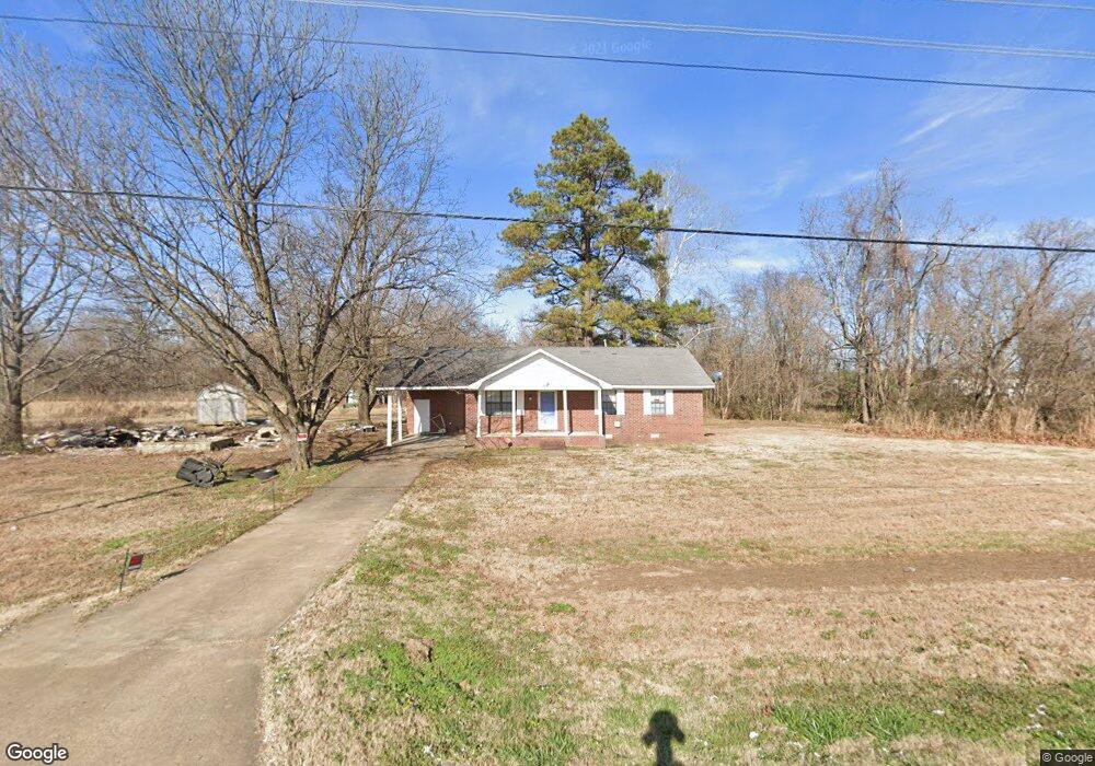
1860 Highway 59 W Covington, TN 38019
Estimated Value: $199,000 - $238,000
--
Bed
1
Bath
1,066
Sq Ft
$204/Sq Ft
Est. Value
About This Home
This home is located at 1860 Highway 59 W, Covington, TN 38019 and is currently estimated at $217,734, approximately $204 per square foot. 1860 Highway 59 W is a home located in Tipton County with nearby schools including Crestview Elementary School, Crestview Middle School, and Covington High School.
Ownership History
Date
Name
Owned For
Owner Type
Purchase Details
Closed on
Apr 21, 2004
Sold by
Harper Thomas E
Bought by
State Of Tennessee
Current Estimated Value
Purchase Details
Closed on
Sep 1, 1998
Sold by
Henderson Dora Mae H
Bought by
Harper Thomas E
Purchase Details
Closed on
Oct 18, 1994
Bought by
Henderson Dora Mae Harper
Purchase Details
Closed on
Feb 2, 1993
Bought by
Harper Dora Etvir Charlie
Purchase Details
Closed on
Oct 8, 1985
Bought by
Harper Dora Etvir Charlie
Purchase Details
Closed on
Jul 30, 1984
Purchase Details
Closed on
Aug 2, 1980
Purchase Details
Closed on
Jul 14, 1960
Create a Home Valuation Report for This Property
The Home Valuation Report is an in-depth analysis detailing your home's value as well as a comparison with similar homes in the area
Home Values in the Area
Average Home Value in this Area
Purchase History
| Date | Buyer | Sale Price | Title Company |
|---|---|---|---|
| State Of Tennessee | $5,235 | -- | |
| Harper Thomas E | -- | -- | |
| Henderson Dora Mae Harper | -- | -- | |
| Harper Dora Etvir Charlie | -- | -- | |
| Harper Dora Etvir Charlie | -- | -- | |
| -- | -- | -- | |
| -- | -- | -- | |
| -- | -- | -- |
Source: Public Records
Tax History Compared to Growth
Tax History
| Year | Tax Paid | Tax Assessment Tax Assessment Total Assessment is a certain percentage of the fair market value that is determined by local assessors to be the total taxable value of land and additions on the property. | Land | Improvement |
|---|---|---|---|---|
| 2024 | $778 | $51,150 | $14,650 | $36,500 |
| 2023 | $778 | $51,150 | $14,650 | $36,500 |
| 2022 | $737 | $36,150 | $10,775 | $25,375 |
| 2021 | $737 | $36,150 | $10,775 | $25,375 |
| 2020 | $737 | $36,150 | $10,775 | $25,375 |
| 2019 | $721 | $29,775 | $9,425 | $20,350 |
| 2018 | $721 | $29,775 | $9,425 | $20,350 |
| 2017 | $721 | $29,775 | $9,425 | $20,350 |
| 2016 | $721 | $29,775 | $9,425 | $20,350 |
| 2015 | $720 | $29,775 | $9,425 | $20,350 |
| 2014 | $720 | $29,790 | $0 | $0 |
Source: Public Records
Map
Nearby Homes
- 1364 Tennessee 59
- 1679 Walton Loop
- 65 Paulette Cir
- 513 Garland Ave
- 902 Hatchie Ave
- 202 Holly Grove Rd
- 900 Peete St
- 1329 Herring Dr
- 1202 Bucksnort Rd
- 714 W Sherrod Ave
- 600 W Sherrod Ave
- 000 Davis St
- 509 S College St
- 0 Holly Grove Rd
- 0 N Munford St Unit 10156264
- 0 N Munford St Unit 10156263
- 104 Russwood Dr
- 133 W Washington Ave
- 518 James St
- 502 James Ave
- 1790 Highway 59 W
- 1797 Highway 59 W
- 1821 Highway 59 W
- 1742 Highway 59 W
- 1742 Tennessee 59
- 1720 Highway 59 W
- 2006 Highway 59 W
- 1709 Highway 59 W
- 1688 Highway 59 W
- 1671 Highway 59 W
- 1645 Tennessee 59
- 2114 Highway 59 W
- 1645 Highway 59 W
- 1622 Highway 59 W
- 250 Bowden Dr
- 359 Bowden Dr
- 2148 Highway 59 W
- 1555 Highway 59 W
- 2158 Highway 59 W
- 2159 Highway 59 W