Estimated Value: $221,000 - $251,000
4
Beds
2
Baths
1,457
Sq Ft
$165/Sq Ft
Est. Value
About This Home
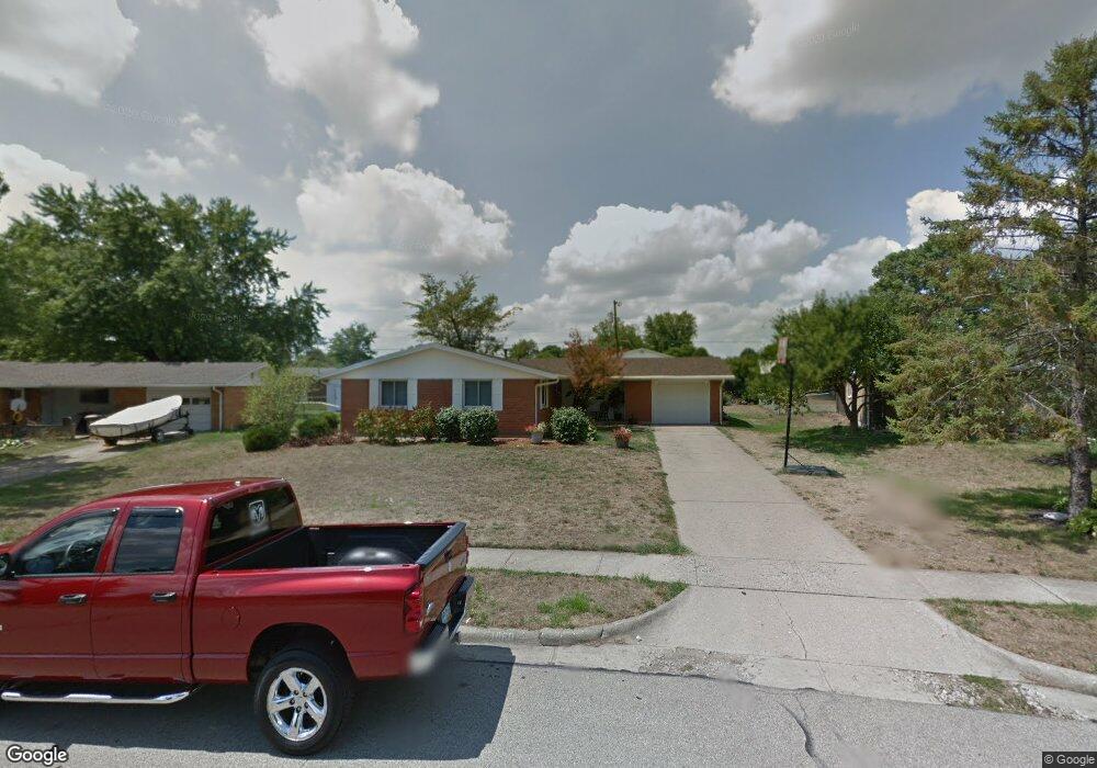
This home is located at 1860 Tahoe Dr, Xenia, OH 45385 and is currently estimated at $240,716, approximately $165 per square foot. 1860 Tahoe Dr is a home located in Greene County with nearby schools including Xenia High School and Legacy Christian Academy.
Ownership History
Date
Name
Owned For
Owner Type
Purchase Details
Closed on
Nov 19, 2021
Sold by
Hamilton Tom M
Bought by
Ray Allen Curtis and Ray Sandra F
Current Estimated Value
Home Financials for this Owner
Home Financials are based on the most recent Mortgage that was taken out on this home.
Original Mortgage
$160,821
Outstanding Balance
$147,669
Interest Rate
3.14%
Mortgage Type
New Conventional
Estimated Equity
$93,047
Purchase Details
Closed on
Aug 30, 2018
Sold by
Margioras Marc A and Margioras Danyell
Bought by
Hamilton Tom M
Home Financials for this Owner
Home Financials are based on the most recent Mortgage that was taken out on this home.
Original Mortgage
$96,000
Interest Rate
4.5%
Mortgage Type
New Conventional
Purchase Details
Closed on
Jul 19, 2001
Sold by
Mullins Joy W Bobbitt
Bought by
Margioras Marc A
Home Financials for this Owner
Home Financials are based on the most recent Mortgage that was taken out on this home.
Original Mortgage
$89,294
Interest Rate
7.22%
Mortgage Type
FHA
Create a Home Valuation Report for This Property
The Home Valuation Report is an in-depth analysis detailing your home's value as well as a comparison with similar homes in the area
Home Values in the Area
Average Home Value in this Area
Purchase History
| Date | Buyer | Sale Price | Title Company |
|---|---|---|---|
| Ray Allen Curtis | -- | None Listed On Document | |
| Hamilton Tom M | $130,000 | Fidelity Lawyers Title Agenc | |
| Margioras Marc A | $90,000 | Equity Title |
Source: Public Records
Mortgage History
| Date | Status | Borrower | Loan Amount |
|---|---|---|---|
| Open | Ray Allen Curtis | $160,821 | |
| Previous Owner | Hamilton Tom M | $96,000 | |
| Previous Owner | Margioras Marc A | $89,294 |
Source: Public Records
Tax History Compared to Growth
Tax History
| Year | Tax Paid | Tax Assessment Tax Assessment Total Assessment is a certain percentage of the fair market value that is determined by local assessors to be the total taxable value of land and additions on the property. | Land | Improvement |
|---|---|---|---|---|
| 2024 | $2,583 | $61,950 | $13,100 | $48,850 |
| 2023 | $2,583 | $61,950 | $13,100 | $48,850 |
| 2022 | $2,286 | $46,740 | $7,710 | $39,030 |
| 2021 | $2,317 | $46,740 | $7,710 | $39,030 |
| 2020 | $2,217 | $46,740 | $7,710 | $39,030 |
| 2019 | $1,742 | $34,560 | $6,960 | $27,600 |
| 2018 | $1,795 | $34,560 | $6,960 | $27,600 |
| 2017 | $1,744 | $34,560 | $6,960 | $27,600 |
| 2016 | $1,730 | $32,680 | $6,960 | $25,720 |
| 2015 | $1,735 | $32,680 | $6,960 | $25,720 |
| 2014 | $1,661 | $32,680 | $6,960 | $25,720 |
Source: Public Records
Map
Nearby Homes
- 1968 El Camino Dr
- 2094 Malibu Trail
- 2018 Tahoe Dr
- 1872 Harris Ln
- 1815 Promenade Ln
- 493 Hollywood Blvd
- 499 Hollywood Blvd
- 1791 Palmer Ct
- 1820 Palmer Ct
- 1814 Palmer Ct
- 1808 Palmer Ct
- 1802 Palmer Ct
- 1796 Palmer Ct
- 517 Hollywood Blvd
- 523 Hollywood Blvd
- 532 Hollywood Blvd
- 15 Sexton Dr
- Harmony Plan at Grandstone Trace
- Newcastle Plan at Grandstone Trace
- Pendleton Plan at Grandstone Trace
- 1846 Tahoe Dr
- 1872 Tahoe Dr
- 1855 Wilshire Dr
- 1869 Wilshire Dr
- 1839 Wilshire Dr
- 1836 Tahoe Dr
- 1969 Sierra Trail
- 184 Beverly Place
- 1885 Wilshire Dr
- 1823 Wilshire Dr
- 1985 Sierra Trail
- 1891 Tahoe Dr
- 1899 Wilshire Dr
- 1821 Tahoe Dr
- 1858 Wilshire Dr
- 2007 Sierra Trail
- 1803 Wilshire Dr
- 1874 Wilshire Dr
- 1842 Wilshire Dr
- 1808 Tahoe Dr