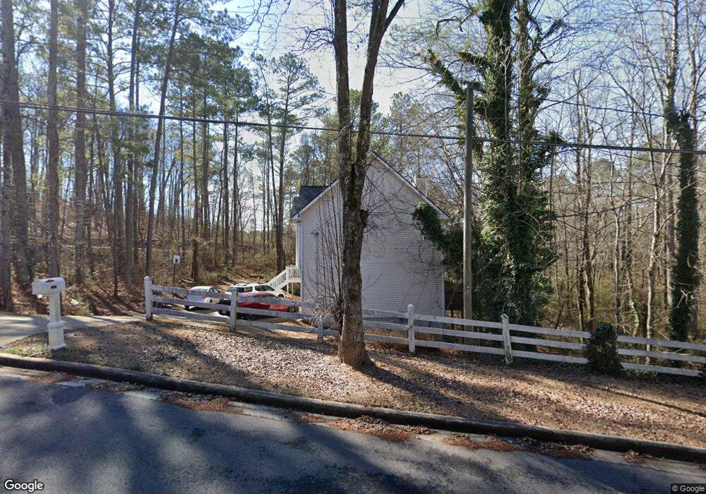
1861 Independence Dr Douglasville, GA 30134
Winston NeighborhoodEstimated Value: $254,000 - $324,686
3
Beds
4
Baths
1,250
Sq Ft
$233/Sq Ft
Est. Value
About This Home
This home is located at 1861 Independence Dr, Douglasville, GA 30134 and is currently estimated at $290,672, approximately $232 per square foot. 1861 Independence Dr is a home located in Douglas County with nearby schools including Winston Elementary School, Mason Creek Middle School, and Douglas County High School.
Ownership History
Date
Name
Owned For
Owner Type
Purchase Details
Closed on
Nov 26, 2007
Sold by
Stafford Lashaunda M
Bought by
Stafford Eddie J and Stafford Lashaunda M
Current Estimated Value
Home Financials for this Owner
Home Financials are based on the most recent Mortgage that was taken out on this home.
Original Mortgage
$146,550
Interest Rate
6.05%
Mortgage Type
New Conventional
Create a Home Valuation Report for This Property
The Home Valuation Report is an in-depth analysis detailing your home's value as well as a comparison with similar homes in the area
Home Values in the Area
Average Home Value in this Area
Purchase History
| Date | Buyer | Sale Price | Title Company |
|---|---|---|---|
| Stafford Eddie J | -- | -- | |
| Stafford Lashaunda M | $146,600 | -- |
Source: Public Records
Mortgage History
| Date | Status | Borrower | Loan Amount |
|---|---|---|---|
| Previous Owner | Stafford Lashaunda M | $146,550 |
Source: Public Records
Tax History Compared to Growth
Tax History
| Year | Tax Paid | Tax Assessment Tax Assessment Total Assessment is a certain percentage of the fair market value that is determined by local assessors to be the total taxable value of land and additions on the property. | Land | Improvement |
|---|---|---|---|---|
| 2024 | $2,908 | $114,280 | $20,800 | $93,480 |
| 2023 | $2,908 | $114,280 | $20,800 | $93,480 |
| 2022 | $2,792 | $103,760 | $19,360 | $84,400 |
| 2021 | $2,166 | $72,280 | $16,000 | $56,280 |
| 2020 | $2,354 | $79,920 | $14,040 | $65,880 |
| 2019 | $2,139 | $75,200 | $11,200 | $64,000 |
| 2018 | $1,941 | $65,200 | $10,080 | $55,120 |
| 2017 | $1,941 | $63,600 | $10,920 | $52,680 |
| 2016 | $1,655 | $52,880 | $9,400 | $43,480 |
| 2015 | $1,137 | $43,040 | $7,840 | $35,200 |
| 2014 | $1,137 | $35,520 | $7,000 | $28,520 |
| 2013 | -- | $32,080 | $6,320 | $25,760 |
Source: Public Records
Map
Nearby Homes
- 1837 Independence Dr
- 7683 Franklin Dr
- 1670 Harvest Hill Unit 2
- 1795 Hampton Pass
- 1668 Independence Dr
- 0 Richardson Rd Unit 6979235
- 8265 High Point Rd
- 7780 Poppy Dr
- 7911 Conners Rd
- 2771 Mann Rd
- 0 Brittain Rd Unit 10493602
- 0 Brittain Rd Unit 7552226
- 896 Winn Rd
- 7771 Mattie McCoy Ln
- 6470 Cedar Mountain Rd
- 534 Winn Rd
- 1517 Winn Rd
- 170 Sandstone Place
- 580 Bridge Landing
- 1864 Independence Dr
- 7705 Governors Ln
- 1851 Independence Dr
- 7709 Governors Ln
- 1854 Potomac Place
- 7711 Governors Ln Unit 1
- 1848 Potomac Place Unit 1
- 7560 Cedar Mountain Rd
- 7560 Cedar Mountain Rd Unit 119
- 0 Governors Ln Unit 3132432
- 0 Governors Ln
- 7700 Governors Ln
- 1844 Potomac Place
- 1850 Independence Dr
- 7704 Governors Ln
- 7715 Governors Ln
- 7004 Governors Ln
- 7550 Cedar Mountain Rd
- 1845 Independence Dr
- 7719 Governors Ln