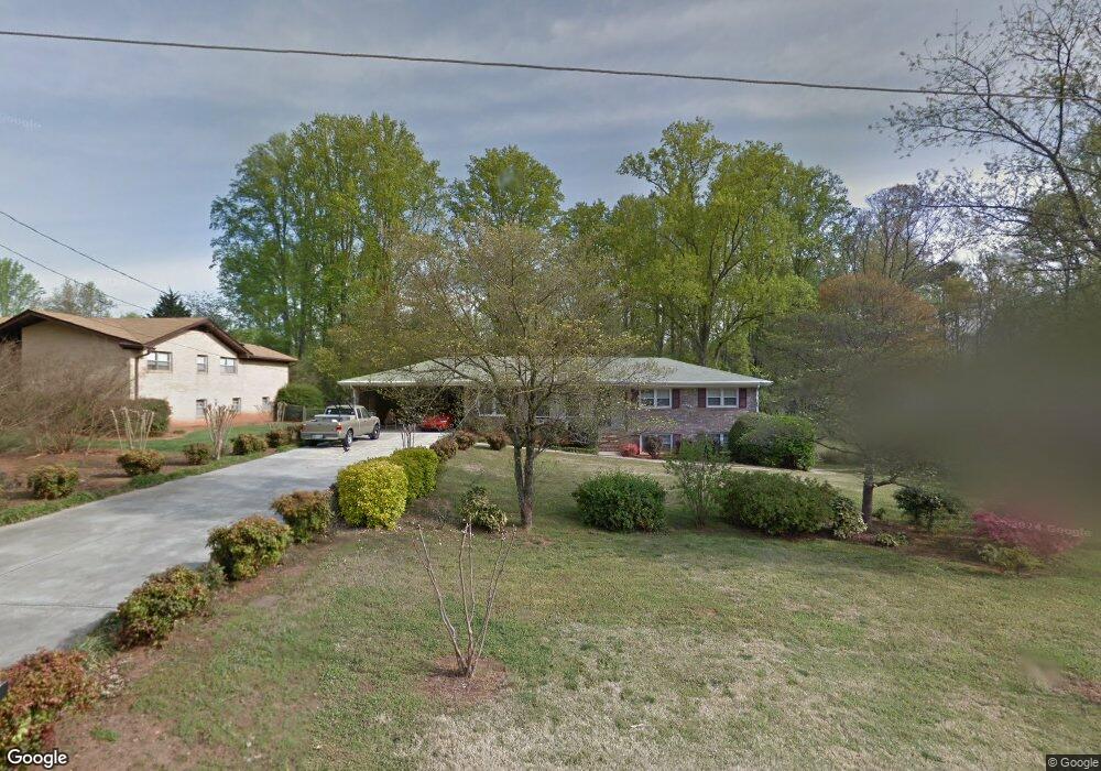
1861 Kinridge Rd Marietta, GA 30062
Eastern Marietta NeighborhoodEstimated Value: $362,000 - $416,000
3
Beds
2
Baths
1,601
Sq Ft
$246/Sq Ft
Est. Value
About This Home
This home is located at 1861 Kinridge Rd, Marietta, GA 30062 and is currently estimated at $393,282, approximately $245 per square foot. 1861 Kinridge Rd is a home located in Cobb County with nearby schools including Kincaid Elementary School, Simpson Middle School, and Sprayberry High School.
Ownership History
Date
Name
Owned For
Owner Type
Purchase Details
Closed on
Jan 24, 2025
Sold by
Sfr Xii Atl Owner 2 Lp
Bought by
Star Borrower Sfr5 Lp
Current Estimated Value
Purchase Details
Closed on
Aug 31, 2021
Sold by
Sfr Xii Atl Owner 1 Lp
Bought by
Sfr Xii Atl Owner 2 Lp
Purchase Details
Closed on
Jul 20, 2021
Sold by
Macey Financial Llc
Bought by
Sfr Xii Atl Owner 1 Lp
Purchase Details
Closed on
May 27, 2005
Sold by
Gildersleeve George R and Gildersleeve Karyl
Bought by
Hamby Erisie and Hamby Pauline
Create a Home Valuation Report for This Property
The Home Valuation Report is an in-depth analysis detailing your home's value as well as a comparison with similar homes in the area
Home Values in the Area
Average Home Value in this Area
Purchase History
| Date | Buyer | Sale Price | Title Company |
|---|---|---|---|
| Star Borrower Sfr5 Lp | $750,000 | Os National Title | |
| Star Borrower Sfr5 Lp | $750,000 | Os National Title | |
| Sfr Xii Atl Owner 2 Lp | -- | None Listed On Document | |
| Sfr Xii Atl Owner 1 Lp | $295,000 | None Available | |
| Macey Financial Llc | $270,000 | None Available | |
| Hamby Erisie | $192,500 | -- |
Source: Public Records
Tax History Compared to Growth
Tax History
| Year | Tax Paid | Tax Assessment Tax Assessment Total Assessment is a certain percentage of the fair market value that is determined by local assessors to be the total taxable value of land and additions on the property. | Land | Improvement |
|---|---|---|---|---|
| 2025 | $4,298 | $142,636 | $32,000 | $110,636 |
| 2024 | $4,300 | $142,636 | $32,000 | $110,636 |
| 2023 | $4,300 | $142,636 | $32,000 | $110,636 |
| 2022 | $3,170 | $104,456 | $26,800 | $77,656 |
| 2021 | $534 | $104,456 | $26,800 | $77,656 |
| 2020 | $542 | $107,388 | $24,800 | $82,588 |
| 2019 | $480 | $86,520 | $16,000 | $70,520 |
| 2018 | $480 | $86,520 | $16,000 | $70,520 |
| 2017 | $415 | $82,116 | $14,000 | $68,116 |
| 2016 | $372 | $67,852 | $14,000 | $53,852 |
| 2015 | $397 | $67,852 | $14,000 | $53,852 |
| 2014 | $379 | $60,540 | $0 | $0 |
Source: Public Records
Map
Nearby Homes
- 1780 Kinridge Rd
- 2020 Starlight Dr
- 1822 Hasty Rd
- 1991 Kinridge Rd
- 2116 Morgan Rd NE
- 1972 Granite Mill Rd
- 1900 Branch View Dr
- 2252 Carefree Cir Unit 3
- 2314 Sandy Oaks Dr
- 1833 Tree Top Ct
- 1854 Butterfly Way
- 1850 Butterfly Way NE
- Robie Plan at The Village at Sandy Plains
- Harbor Plan at The Village at Sandy Plains
- Hanover Plan at The Village at Sandy Plains
- Bowen Plan at The Village at Sandy Plains
- Elston Plan at The Village at Sandy Plains
- BALDWIN Plan at The Village at Sandy Plains
- 1838 Butterfly NE
- 1851 Kinridge Rd
- 1850 Twin Branch Dr
- 1841 Kinridge Rd Unit 21
- 1881 Kinridge Rd
- 1860 Twin Branch Dr
- 1840 Twin Branch Dr
- 1860 Kinridge Rd
- 1850 Kinridge Rd
- 1831 Kinridge Rd
- 1830 Twin Branch Dr Unit 3
- 1830 Twin Branch Dr
- 1880 Kinridge Rd
- 1830 Kinridge Rd
- 1890 Kinridge Rd
- 1821 Kinridge Rd
- 1890 Twin Branch Dr
- 1861 Twin Branch Dr
- 1851 Twin Branch Dr Unit 1851
- 1851 Twin Branch Dr
- 1879 Sierra Dr