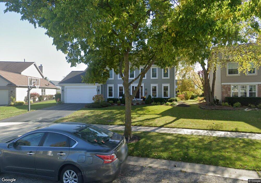
1861 Waverly Ln Algonquin, IL 60102
Estimated Value: $468,000 - $498,000
4
Beds
3
Baths
2,401
Sq Ft
$199/Sq Ft
Est. Value
About This Home
This home is located at 1861 Waverly Ln, Algonquin, IL 60102 and is currently estimated at $478,833, approximately $199 per square foot. 1861 Waverly Ln is a home located in Kane County with nearby schools including Westfield Community School, United Junior High School, and Harry D Jacobs High School.
Ownership History
Date
Name
Owned For
Owner Type
Purchase Details
Closed on
Sep 1, 2000
Sold by
Koscielny Michael W and Koscielny Deborah L
Bought by
Knuerr Robert A and Knuerr Charlene T
Current Estimated Value
Home Financials for this Owner
Home Financials are based on the most recent Mortgage that was taken out on this home.
Original Mortgage
$156,500
Outstanding Balance
$57,200
Interest Rate
8.14%
Estimated Equity
$421,633
Create a Home Valuation Report for This Property
The Home Valuation Report is an in-depth analysis detailing your home's value as well as a comparison with similar homes in the area
Home Values in the Area
Average Home Value in this Area
Purchase History
| Date | Buyer | Sale Price | Title Company |
|---|---|---|---|
| Knuerr Robert A | $256,500 | Chicago Title Insurance Co |
Source: Public Records
Mortgage History
| Date | Status | Borrower | Loan Amount |
|---|---|---|---|
| Open | Knuerr Robert A | $156,500 |
Source: Public Records
Tax History Compared to Growth
Tax History
| Year | Tax Paid | Tax Assessment Tax Assessment Total Assessment is a certain percentage of the fair market value that is determined by local assessors to be the total taxable value of land and additions on the property. | Land | Improvement |
|---|---|---|---|---|
| 2024 | $9,725 | $135,914 | $25,730 | $110,184 |
| 2023 | $9,302 | $122,291 | $23,151 | $99,140 |
| 2022 | $8,369 | $106,142 | $23,151 | $82,991 |
| 2021 | $8,124 | $100,219 | $21,859 | $78,360 |
| 2020 | $7,967 | $97,966 | $21,368 | $76,598 |
| 2019 | $7,725 | $93,000 | $20,285 | $72,715 |
| 2018 | $7,852 | $91,158 | $19,883 | $71,275 |
| 2017 | $7,537 | $85,274 | $18,600 | $66,674 |
| 2016 | $7,352 | $78,816 | $18,009 | $60,807 |
| 2015 | -- | $72,229 | $17,040 | $55,189 |
| 2014 | -- | $66,785 | $16,569 | $50,216 |
| 2013 | -- | $68,829 | $17,076 | $51,753 |
Source: Public Records
Map
Nearby Homes
- 1900 Waverly Ln
- 30 Arbordale Ct Unit 4284
- 1971 Peach Tree Ln
- 2101 Peach Tree Ln Unit 4094
- 2043 Peach Tree Ln Unit 4122
- 2060 Dorchester Ave
- Adams Plan at Algonquin Meadows - Single Family
- Sequoia Plan at Algonquin Meadows - Single Family
- Bryce Plan at Algonquin Meadows - Single Family
- Rainier Plan at Algonquin Meadows - Single Family
- Santa Rosa Plan at Algonquin Meadows - Single Family
- Biscayne Plan at Algonquin Meadows - Single Family
- Marianne Plan at Algonquin Meadows - Traditional Townhomes
- Darcy Plan at Algonquin Meadows - Traditional Townhomes
- Charlotte Plan at Algonquin Meadows - Traditional Townhomes
- 000 County Line Rd
- Amherst Plan at Algonquin Meadows - Urban Townhomes
- Chatham Plan at Algonquin Meadows - Urban Townhomes
- Chelsea Plan at Algonquin Meadows - Urban Townhomes
- 2161 Burnham Ct
- 1901 Waverly Ln
- 1851 Waverly Ln
- 1960 Wynnfield Dr
- 1950 Wynnfield Dr
- 1911 Waverly Ln
- 1841 Waverly Ln
- 1970 Wynnfield Dr
- 1940 Wynnfield Dr
- 1840 Waverly Ln
- 1830 Waverly Ln
- 2000 Wynnfield Dr
- 1921 Waverly Ln
- 1831 Waverly Ln
- 1870 Haverford Dr
- 1850 Haverford Dr
- 2010 Wynnfield Dr
- 1910 Waverly Ln
- 1931 Waverly Ln
- 1821 Waverly Ln
- 1840 Haverford Dr