Estimated Value: $285,000 - $406,736
3
Beds
3
Baths
1,410
Sq Ft
$233/Sq Ft
Est. Value
About This Home
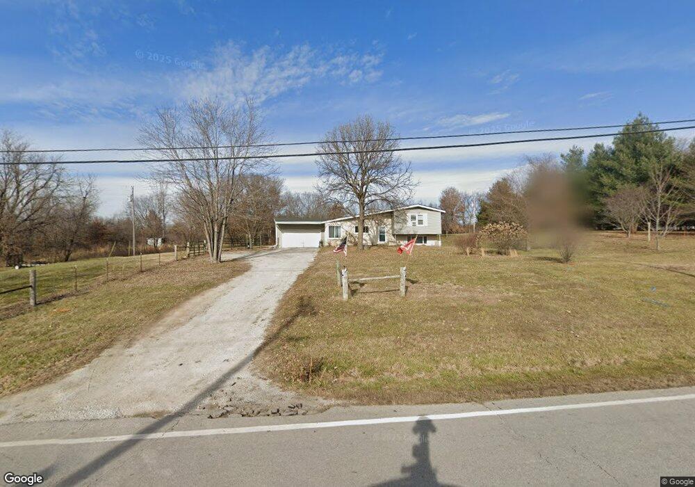
This home is located at 18616 State Route 33, Holt, MO 64048 and is currently estimated at $328,434, approximately $232 per square foot. 18616 State Route 33 is a home located in Clay County with nearby schools including Kearney Junior High School, Kearney High School, and Northern Hills Christian Academy.
Ownership History
Date
Name
Owned For
Owner Type
Purchase Details
Closed on
Dec 22, 2021
Sold by
Hornaday Stanley and Hornaday Geri L
Bought by
Zimmer Doug J and Zimmer Douglas J
Current Estimated Value
Home Financials for this Owner
Home Financials are based on the most recent Mortgage that was taken out on this home.
Original Mortgage
$303,200
Outstanding Balance
$278,902
Interest Rate
3.12%
Estimated Equity
$49,532
Purchase Details
Closed on
Mar 20, 2006
Sold by
Hornaday Stanley and Hornaday Geri L
Bought by
Hornaday Stanley and Hornaday Geri L
Home Financials for this Owner
Home Financials are based on the most recent Mortgage that was taken out on this home.
Original Mortgage
$160,000
Interest Rate
8.05%
Mortgage Type
Stand Alone Refi Refinance Of Original Loan
Create a Home Valuation Report for This Property
The Home Valuation Report is an in-depth analysis detailing your home's value as well as a comparison with similar homes in the area
Home Values in the Area
Average Home Value in this Area
Purchase History
| Date | Buyer | Sale Price | Title Company |
|---|---|---|---|
| Zimmer Doug J | -- | Security 1St Title Llc | |
| Hornaday Stanley | -- | Accommodation |
Source: Public Records
Mortgage History
| Date | Status | Borrower | Loan Amount |
|---|---|---|---|
| Open | Zimmer Doug J | $303,200 | |
| Previous Owner | Hornaday Stanley | $160,000 |
Source: Public Records
Tax History
| Year | Tax Paid | Tax Assessment Tax Assessment Total Assessment is a certain percentage of the fair market value that is determined by local assessors to be the total taxable value of land and additions on the property. | Land | Improvement |
|---|---|---|---|---|
| 2025 | $2,105 | $36,010 | -- | -- |
| 2024 | $2,105 | $31,330 | -- | -- |
| 2023 | $2,009 | $31,330 | $0 | $0 |
| 2022 | $1,760 | $26,900 | $0 | $0 |
| 2021 | $1,762 | $26,904 | $8,968 | $17,936 |
| 2020 | $1,818 | $25,710 | $0 | $0 |
| 2019 | $1,824 | $25,707 | $8,360 | $17,347 |
Source: Public Records
Map
Nearby Homes
- 606 Water St
- 610 Waters St
- 175 3rd St
- 7129 SE Cannon Ball Rd
- 0 Lot 3 Arnold Park Lot N A Unit HMS2572330
- 0 Lot 5 Arnold Park Lot N A Unit HMS2572371
- 16605 County Road Cc
- 18208 Crestview Dr
- 15016 NE 186th St
- 887 201st St
- TBD 188th Street N A
- 17504 State Route 33
- 52 SE 208th St
- Tbd Northeast 188th St
- 22612 N Prestige Dr
- 5775 SE West Hwy
- 16816 Landmark Loop
- 5275 SE Fox Run Rd
- 5650 SE West Hwy
- Tract 2 Nation Rd
- 18616 Missouri 33
- 18803 State Route 33
- 18402 Hwy 33 Hwy
- 18402 State Route 33
- 19619 Burris Rd
- 19509 Burris Rd
- 785 Cleveland St
- 18625 Cleveland St
- 18605 Cleveland St
- 18421 Cleveland St
- 19707 Burris Rd
- 19503 Burris Rd
- 18801 Cleveland St
- 19610 Burris Rd
- 780 Cleveland St
- 18610 Cleveland St
- 290 Dykes Ln
- 430 State Route 33
- 280 Misty Ln
- 18811 Cleveland St
Your Personal Tour Guide
Ask me questions while you tour the home.