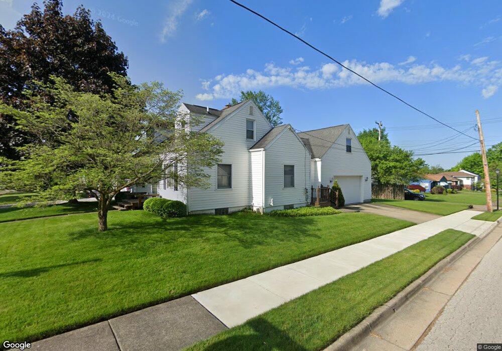
1862 Glenmount Ave Akron, OH 44301
Firestone Park NeighborhoodEstimated Value: $152,000 - $156,107
3
Beds
1
Bath
878
Sq Ft
$175/Sq Ft
Est. Value
About This Home
This home is located at 1862 Glenmount Ave, Akron, OH 44301 and is currently estimated at $154,027, approximately $175 per square foot. 1862 Glenmount Ave is a home located in Summit County with nearby schools including Kenmore Garfield Community Learning Center, Main Preparatory Academy, and Eagle Elementary.
Ownership History
Date
Name
Owned For
Owner Type
Purchase Details
Closed on
Jul 15, 1994
Sold by
Piesciuk Stephen F
Bought by
Grywalski Susanne L
Current Estimated Value
Home Financials for this Owner
Home Financials are based on the most recent Mortgage that was taken out on this home.
Original Mortgage
$40,000
Interest Rate
8.6%
Mortgage Type
New Conventional
Create a Home Valuation Report for This Property
The Home Valuation Report is an in-depth analysis detailing your home's value as well as a comparison with similar homes in the area
Home Values in the Area
Average Home Value in this Area
Purchase History
| Date | Buyer | Sale Price | Title Company |
|---|---|---|---|
| Grywalski Susanne L | $75,000 | -- |
Source: Public Records
Mortgage History
| Date | Status | Borrower | Loan Amount |
|---|---|---|---|
| Closed | Grywalski Susanne L | $40,000 |
Source: Public Records
Tax History Compared to Growth
Tax History
| Year | Tax Paid | Tax Assessment Tax Assessment Total Assessment is a certain percentage of the fair market value that is determined by local assessors to be the total taxable value of land and additions on the property. | Land | Improvement |
|---|---|---|---|---|
| 2025 | $2,270 | $37,870 | $10,262 | $27,608 |
| 2024 | $2,270 | $37,870 | $10,262 | $27,608 |
| 2023 | $2,270 | $37,870 | $10,262 | $27,608 |
| 2022 | $2,669 | $35,893 | $7,438 | $28,455 |
| 2021 | $2,672 | $35,893 | $7,438 | $28,455 |
| 2020 | $2,635 | $35,900 | $7,440 | $28,460 |
| 2019 | $2,361 | $28,730 | $7,440 | $21,290 |
| 2018 | $2,333 | $28,730 | $7,440 | $21,290 |
| 2017 | $2,366 | $28,730 | $7,440 | $21,290 |
| 2016 | $2,367 | $28,730 | $7,440 | $21,290 |
| 2015 | $2,366 | $28,730 | $7,440 | $21,290 |
| 2014 | $2,349 | $28,730 | $7,440 | $21,290 |
| 2013 | $2,308 | $28,770 | $7,440 | $21,330 |
Source: Public Records
Map
Nearby Homes
- 739 S Firestone Blvd
- 291 Selden Ave
- 315 Clinton Ave
- 146 E Woodsdale Ave
- 1699 Redwood Ave
- 1698 Sunset Ave
- 1614 Glenmount Ave
- 361 Mission Dr
- 79 Selden Ave
- 249 Naomi St
- 2069 Penguin Ave
- 1663 Sunset Ave
- 1635 Brown St
- 1638 Sunset Ave
- 40 E Dresden Ave
- 1731 Highview Ave
- 74 E Catawba Ave
- 1637 Rockford St
- 37 Selden Ave
- 23 Selden Ave
- 1866 Glenmount Ave
- 1872 Glenmount Ave Unit 1874
- 1872 Glenmount Ave
- 1850 Glenmount Ave
- 310 E Woodsdale Ave
- 1874 Glenmount Ave
- 1846 Glenmount Ave
- 311 E Woodsdale Ave
- 321 E Ralston Ave
- 311 E Ralston Ave
- 300 E Woodsdale Ave
- 1840 Glenmount Ave
- 339 E Woodsdale Ave
- 305 E Ralston Ave
- 1845 Glenmount Ave
- 299 E Ralston Ave
- 320 E Ralston Ave
- 1843 Glenmount Ave
- 295 E Woodsdale Ave
- 308 E Linwood Ave