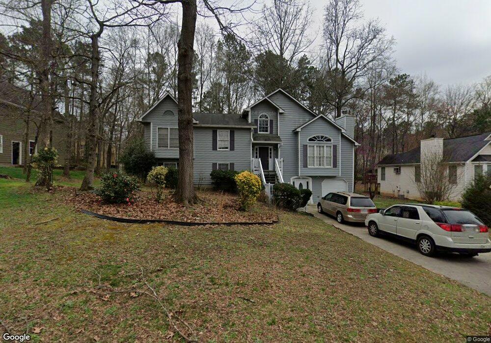
1864 Keith Dr SW Marietta, GA 30064
West Cobb NeighborhoodEstimated Value: $354,000 - $415,000
3
Beds
2
Baths
2,122
Sq Ft
$182/Sq Ft
Est. Value
About This Home
This home is located at 1864 Keith Dr SW, Marietta, GA 30064 and is currently estimated at $386,384, approximately $182 per square foot. 1864 Keith Dr SW is a home located in Cobb County with nearby schools including Dowell Elementary School, Lovinggood Middle School, and Hillgrove High School.
Ownership History
Date
Name
Owned For
Owner Type
Purchase Details
Closed on
Jul 19, 2006
Sold by
Preferred Homebuyers Lc
Bought by
Lamothe Noemie
Current Estimated Value
Home Financials for this Owner
Home Financials are based on the most recent Mortgage that was taken out on this home.
Original Mortgage
$134,000
Outstanding Balance
$78,649
Interest Rate
6.54%
Mortgage Type
New Conventional
Estimated Equity
$307,735
Create a Home Valuation Report for This Property
The Home Valuation Report is an in-depth analysis detailing your home's value as well as a comparison with similar homes in the area
Home Values in the Area
Average Home Value in this Area
Purchase History
| Date | Buyer | Sale Price | Title Company |
|---|---|---|---|
| Lamothe Noemie | $168,000 | -- |
Source: Public Records
Mortgage History
| Date | Status | Borrower | Loan Amount |
|---|---|---|---|
| Open | Lamothe Noemie | $134,000 |
Source: Public Records
Tax History Compared to Growth
Tax History
| Year | Tax Paid | Tax Assessment Tax Assessment Total Assessment is a certain percentage of the fair market value that is determined by local assessors to be the total taxable value of land and additions on the property. | Land | Improvement |
|---|---|---|---|---|
| 2025 | $885 | $151,260 | $34,000 | $117,260 |
| 2024 | $3,207 | $136,392 | $26,000 | $110,392 |
| 2023 | $2,664 | $136,392 | $26,000 | $110,392 |
| 2022 | $2,728 | $113,376 | $16,000 | $97,376 |
| 2021 | $2,400 | $98,356 | $16,000 | $82,356 |
| 2020 | $2,215 | $89,940 | $10,000 | $79,940 |
| 2019 | $2,215 | $89,940 | $10,000 | $79,940 |
| 2018 | $1,893 | $75,228 | $10,000 | $65,228 |
| 2017 | $1,559 | $63,668 | $12,000 | $51,668 |
| 2016 | $1,560 | $63,668 | $12,000 | $51,668 |
| 2015 | $1,599 | $63,620 | $12,000 | $51,620 |
| 2014 | $1,113 | $46,304 | $0 | $0 |
Source: Public Records
Map
Nearby Homes
- 2040 Hardwood Cir SW Unit 3
- 2093 Breconridge Dr SW
- 1884 Dovonshire Rd SW
- 2409 Caneridge Point SW
- 1853 Edington Rd SW
- 1843 Edington Rd SW
- 1841 Edington Rd SW
- 1646 Desford Ct SW
- 2117 Caneridge Dr SW
- 1985 Freestone Way
- 2009 Freestone Way
- Monteluce Plan at Freestone Station
- Hillside Plan at Freestone Station
- Oakshire Plan at Freestone Station
- Hendricks Plan at Freestone Station
- Hedgerow Plan at Freestone Station
- Antioch Plan at Freestone Station
- 1952 Freestone Way
- 1946 MacLand Rd SW
- 2403 Bonshaw Ln
- 1868 Keith Dr SW
- 1860 Keith Dr SW
- 2521 Lorne Ct SW
- 1858 Keith Dr SW
- 1870 Keith Dr SW
- 1861 Keith Dr SW
- 2519 Lorne Ct SW
- 1863 Keith Dr SW
- 1859 Keith Dr SW
- 2517 Lorne Ct SW
- 2523 Lorne Ct SW
- 1865 Keith Dr SW
- 1857 Keith Dr SW
- 2525 Lorne Ct SW
- 1856 Keith Dr SW
- 1867 Keith Dr SW
- 2515 Lorne Ct SW
- 2524 Lorne Ct SW
- 2522 Lorne Ct SW
- 1855 Keith Dr SW