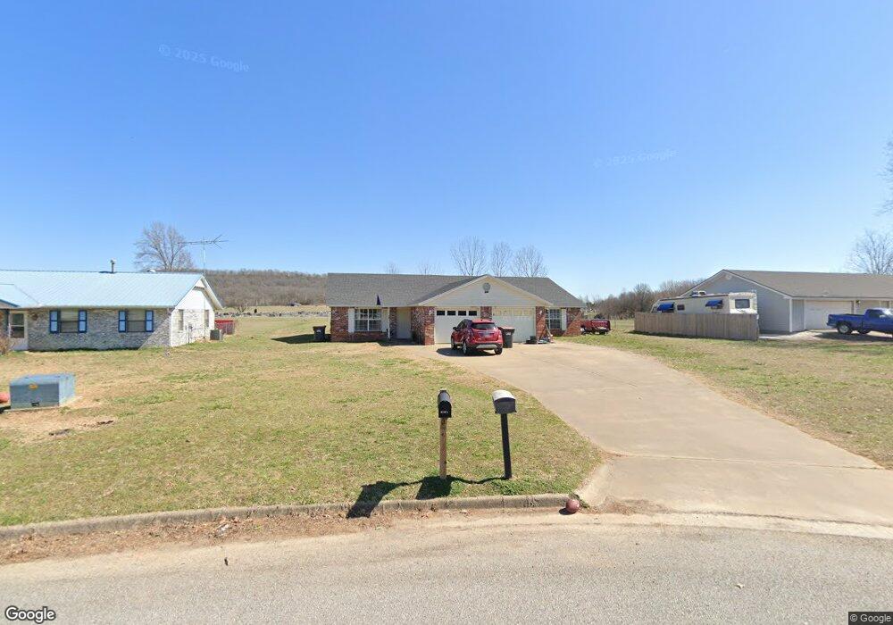
1865 Green Acres Cir Unit A Springdale, AR 72764
Estimated Value: $288,000 - $340,000
--
Bed
4
Baths
2,136
Sq Ft
$146/Sq Ft
Est. Value
About This Home
This home is located at 1865 Green Acres Cir Unit A, Springdale, AR 72764 and is currently estimated at $311,115, approximately $145 per square foot. 1865 Green Acres Cir Unit A is a home located in Washington County with nearby schools including Turnbow Elementary School, Lakeside Junior High School, and Sonora Middle School.
Ownership History
Date
Name
Owned For
Owner Type
Purchase Details
Closed on
Aug 15, 2023
Sold by
Cwtgh Management Corporation
Bought by
Northwoods Properties Llc
Current Estimated Value
Home Financials for this Owner
Home Financials are based on the most recent Mortgage that was taken out on this home.
Original Mortgage
$217,500
Outstanding Balance
$70,816
Interest Rate
6.24%
Mortgage Type
Construction
Estimated Equity
$240,299
Purchase Details
Closed on
Sep 27, 1991
Bought by
Pevehouse Sandra K
Purchase Details
Closed on
Dec 21, 1989
Bought by
Ware Terrance and Ware Barbara
Purchase Details
Closed on
Feb 28, 1989
Bought by
Ware Brother Concrete, Inc.
Create a Home Valuation Report for This Property
The Home Valuation Report is an in-depth analysis detailing your home's value as well as a comparison with similar homes in the area
Home Values in the Area
Average Home Value in this Area
Purchase History
| Date | Buyer | Sale Price | Title Company |
|---|---|---|---|
| Northwoods Properties Llc | $290,000 | Realty Title | |
| Pevehouse Sandra K | $81,000 | -- | |
| Ware Terrance | $70,000 | -- | |
| Ware Brother Concrete, Inc. | -- | -- |
Source: Public Records
Mortgage History
| Date | Status | Borrower | Loan Amount |
|---|---|---|---|
| Open | Northwoods Properties Llc | $217,500 |
Source: Public Records
Tax History Compared to Growth
Tax History
| Year | Tax Paid | Tax Assessment Tax Assessment Total Assessment is a certain percentage of the fair market value that is determined by local assessors to be the total taxable value of land and additions on the property. | Land | Improvement |
|---|---|---|---|---|
| 2024 | $2,894 | $55,970 | $16,800 | $39,170 |
| 2023 | $1,448 | $55,970 | $16,800 | $39,170 |
| 2022 | $1,317 | $34,120 | $8,000 | $26,120 |
| 2021 | $1,215 | $34,120 | $8,000 | $26,120 |
| 2020 | $1,114 | $34,120 | $8,000 | $26,120 |
| 2019 | $1,013 | $19,220 | $6,300 | $12,920 |
| 2018 | $1,013 | $19,220 | $6,300 | $12,920 |
| 2017 | $1,003 | $19,220 | $6,300 | $12,920 |
| 2016 | $1,003 | $19,220 | $6,300 | $12,920 |
| 2015 | $1,003 | $19,220 | $6,300 | $12,920 |
| 2014 | $1,273 | $24,390 | $6,300 | $18,090 |
Source: Public Records
Map
Nearby Homes
- 1744 Green Acres Cir
- 3719 Sanday Ave
- 20700 E Highway 412
- 4292 E Hewitt Springs Rd
- 2996 Adrian Ave
- 2942 Adrian Ave Unit A
- 2916 A&B Adrian Ave
- 2916 Adrian Ave
- 2720 Granny Smith Ave
- 3345 Clearwater Cove
- TBD Parsons Rd
- 1533 Shannon St Unit A & B
- 3715 Julio Rd
- 2871 Commons Ave
- 2523 Meadow Lake St
- 2443 Kasey Ave
- 0 Parsons Rd
- 3205 Summer View Ave
- 2887 Habberton Rd
- 4535 Leafield St
- 1865 Green Acres Cir Unit A & B
- 1837 Green Acres Cir
- 1873 Green Acres Cir
- 1817 Green Acres Cir
- 1838 Green Acres Cir
- 1783 Green Acres Cir
- 1783 Green Acres Cir Unit B
- 1783 Green Acres Cir
- 1806 Green Acres Cir
- 1786 Green Acres Cir
- 1929 Green Acres Cir
- 1955 Green Acres Cir
- 1950 Green Acres Cir
- 1971 Green Acres Cir
- 1701 Green Acres Cir
- 1990 Green Acres Cir
- 1987 Green Acres Cir
- 3771 Green Acres Rd
- 3771 Green Acres Rd Unit B
- 3771 Green Acres Rd Unit A