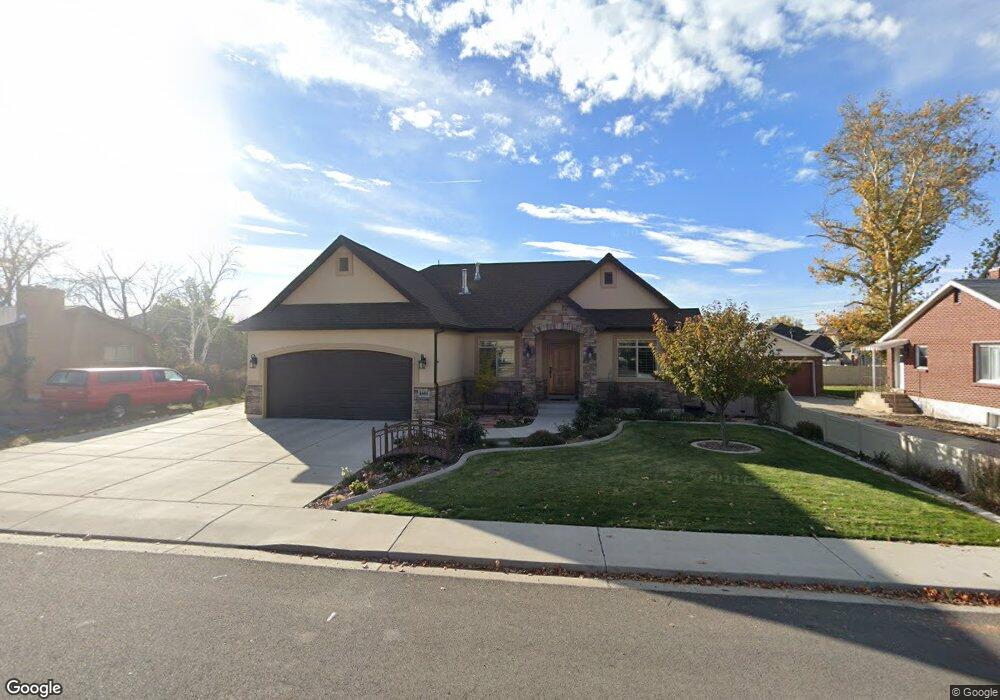
1865 N 400 W Unit 8 Orem, UT 84057
Northridge NeighborhoodEstimated Value: $553,000 - $641,000
2
Beds
3
Baths
1,610
Sq Ft
$375/Sq Ft
Est. Value
About This Home
This home is located at 1865 N 400 W Unit 8, Orem, UT 84057 and is currently estimated at $603,815, approximately $375 per square foot. 1865 N 400 W Unit 8 is a home located in Utah County with nearby schools including Northridge Elementary School, Oak Canyon Junior High School, and Timpanogos High School.
Ownership History
Date
Name
Owned For
Owner Type
Purchase Details
Closed on
Jan 29, 2013
Sold by
Millhaven Construction Llc
Bought by
Hyer Troy R and Hyer Pamela A
Current Estimated Value
Home Financials for this Owner
Home Financials are based on the most recent Mortgage that was taken out on this home.
Original Mortgage
$188,000
Outstanding Balance
$130,935
Interest Rate
3.33%
Mortgage Type
New Conventional
Estimated Equity
$472,880
Create a Home Valuation Report for This Property
The Home Valuation Report is an in-depth analysis detailing your home's value as well as a comparison with similar homes in the area
Home Values in the Area
Average Home Value in this Area
Purchase History
| Date | Buyer | Sale Price | Title Company |
|---|---|---|---|
| Hyer Troy R | -- | Union Title |
Source: Public Records
Mortgage History
| Date | Status | Borrower | Loan Amount |
|---|---|---|---|
| Open | Hyer Troy R | $188,000 |
Source: Public Records
Tax History Compared to Growth
Tax History
| Year | Tax Paid | Tax Assessment Tax Assessment Total Assessment is a certain percentage of the fair market value that is determined by local assessors to be the total taxable value of land and additions on the property. | Land | Improvement |
|---|---|---|---|---|
| 2025 | $2,427 | $321,365 | -- | -- |
| 2024 | $2,427 | $296,780 | $0 | $0 |
| 2023 | $2,262 | $297,330 | $0 | $0 |
| 2022 | $2,608 | $332,090 | $0 | $0 |
| 2021 | $2,374 | $457,900 | $147,800 | $310,100 |
| 2020 | $2,236 | $423,800 | $128,500 | $295,300 |
| 2019 | $1,955 | $385,300 | $128,500 | $256,800 |
| 2018 | $2,046 | $385,300 | $128,500 | $256,800 |
| 2017 | $1,927 | $194,370 | $0 | $0 |
| 2016 | $2,005 | $186,505 | $0 | $0 |
| 2015 | $2,209 | $194,315 | $0 | $0 |
| 2014 | $2,001 | $175,230 | $0 | $0 |
Source: Public Records
Map
Nearby Homes