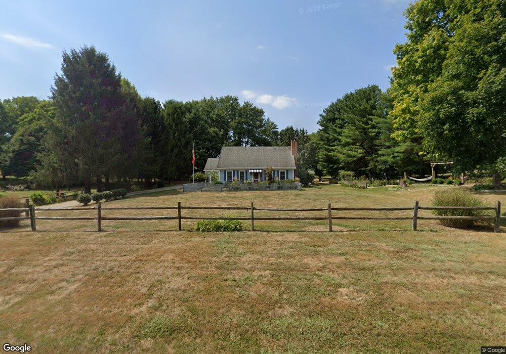
1865 Stringtown Rd NE Lancaster, OH 43130
Estimated Value: $389,203 - $407,000
5
Beds
2
Baths
2,074
Sq Ft
$191/Sq Ft
Est. Value
About This Home
This home is located at 1865 Stringtown Rd NE, Lancaster, OH 43130 and is currently estimated at $396,051, approximately $190 per square foot. 1865 Stringtown Rd NE is a home located in Fairfield County with nearby schools including Medill Elementary School, Thomas Ewing Junior High School, and Lancaster High School.
Ownership History
Date
Name
Owned For
Owner Type
Purchase Details
Closed on
Sep 2, 2016
Sold by
Blackburn Sandra and Rice Susan J
Bought by
Constantinidis Theodore and Blackburn Sandra
Current Estimated Value
Purchase Details
Closed on
Jun 14, 2010
Sold by
Osgood Judith M and Osgood Ronald
Bought by
Blackburn Sandra and Rice Susan J
Purchase Details
Closed on
Jun 5, 2007
Sold by
Boyer James P and Boyer Nancy A
Bought by
Blackburn Sandra and Rice Susan J
Purchase Details
Closed on
Oct 1, 1986
Create a Home Valuation Report for This Property
The Home Valuation Report is an in-depth analysis detailing your home's value as well as a comparison with similar homes in the area
Home Values in the Area
Average Home Value in this Area
Purchase History
| Date | Buyer | Sale Price | Title Company |
|---|---|---|---|
| Constantinidis Theodore | -- | None Available | |
| Blackburn Sandra | -- | Attorney | |
| Blackburn Sandra | $207,000 | Attorney | |
| -- | $73,500 | -- |
Source: Public Records
Tax History Compared to Growth
Tax History
| Year | Tax Paid | Tax Assessment Tax Assessment Total Assessment is a certain percentage of the fair market value that is determined by local assessors to be the total taxable value of land and additions on the property. | Land | Improvement |
|---|---|---|---|---|
| 2024 | $8,389 | $86,400 | $16,690 | $69,710 |
| 2023 | $3,474 | $86,400 | $16,690 | $69,710 |
| 2022 | $3,517 | $86,400 | $16,690 | $69,710 |
| 2021 | $2,812 | $67,190 | $15,170 | $52,020 |
| 2020 | $897 | $67,190 | $15,170 | $52,020 |
| 2019 | $2,579 | $67,190 | $15,170 | $52,020 |
| 2018 | $984 | $60,630 | $15,170 | $45,460 |
| 2017 | $2,464 | $60,630 | $15,170 | $45,460 |
| 2016 | $2,284 | $60,630 | $15,170 | $45,460 |
| 2015 | $2,279 | $58,650 | $15,170 | $43,480 |
| 2014 | $2,174 | $58,650 | $15,170 | $43,480 |
| 2013 | $2,174 | $58,650 | $15,170 | $43,480 |
Source: Public Records
Map
Nearby Homes
- 715 Sherman Bluff Way Unit 14715
- 173 Lakeview Dr NE
- 1916 Country Place
- 1801 Pleasantview Dr NE
- 2149 Pleasantview Dr NE
- 1700 Rosewood Dr NE
- 2865 Stringtown Rd NW
- 626 Rainbow Dr NW
- 0 Coonpath Rd NW Unit Tract 7 224028097
- 0 Coonpath Rd NW Unit Tract 4 224028093
- 1189 Ridge Rd NE
- 0 Tschopp Rd NE Unit Lot 33 225027324
- 0 Tschopp Rd NE Unit Lot 17 225027320
- 0 Old Millersport Rd NE Unit Lot 10 225033491
- 0 Old Millersport Rd NE Unit 225010386
- 0 Old Millersport Rd NE Unit Tract 8 224028101
- 980 Coonpath Rd NE
- 2444 Sheridan Dr
- 1760 Rainbow Dr NE
- 319 Greenfield Ave
- 1845 Stringtown Rd NE
- 1935 Stringtown Rd NE
- 1920 Stringtown Rd NE
- 437 Rainbow Dr NE
- 1850 Stringtown Rd NE
- 1800 Stringtown Rd NE
- 1825 Stringtown Rd NE
- 1795 Stringtown Rd NE
- 1995 Stringtown Rd NE
- 1770 Stringtown Rd NE
- 575 Rainbow Dr NE
- 333 Rainbow Dr NE
- 2040 Stringtown Rd NE
- 1874 Sunset Strip St NE
- 2065 Stringtown Rd NE
- 605 Rainbow Dr NE
- 1735 Stringtown Rd NE
- 1900 Sunset Strip St NE
- 1720 Stringtown Rd NE
- 1720 Stringtown Rd NE