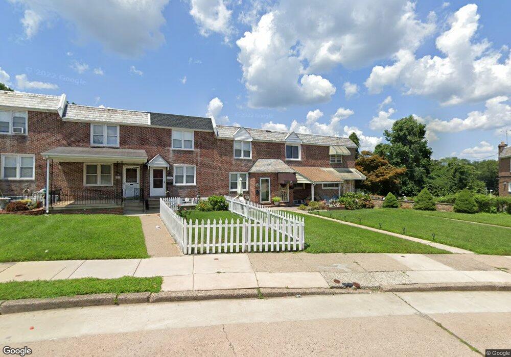
1866 Ashurst Rd Philadelphia, PA 19151
Overbrook NeighborhoodEstimated Value: $230,000 - $276,000
3
Beds
1
Bath
1,120
Sq Ft
$218/Sq Ft
Est. Value
About This Home
This home is located at 1866 Ashurst Rd, Philadelphia, PA 19151 and is currently estimated at $244,126, approximately $217 per square foot. 1866 Ashurst Rd is a home located in Philadelphia County with nearby schools including Lamberton Robert E School, Overbrook High School, and West Philadelphia Achievement Charter Elementary School.
Ownership History
Date
Name
Owned For
Owner Type
Purchase Details
Closed on
Aug 15, 2013
Sold by
Young Charles D and Young Carmella I
Bought by
Young Charles D
Current Estimated Value
Home Financials for this Owner
Home Financials are based on the most recent Mortgage that was taken out on this home.
Original Mortgage
$210,000
Outstanding Balance
$143,190
Interest Rate
2.43%
Mortgage Type
Reverse Mortgage Home Equity Conversion Mortgage
Estimated Equity
$100,936
Purchase Details
Closed on
Jul 21, 2000
Sold by
Levin Barbara H
Bought by
Young Charles D and Young Carmella I
Home Financials for this Owner
Home Financials are based on the most recent Mortgage that was taken out on this home.
Original Mortgage
$84,150
Interest Rate
8.18%
Mortgage Type
VA
Purchase Details
Closed on
Apr 8, 1996
Sold by
Hulford Bruce D and Hulford Barbara H
Bought by
Hulford Barbara H
Create a Home Valuation Report for This Property
The Home Valuation Report is an in-depth analysis detailing your home's value as well as a comparison with similar homes in the area
Home Values in the Area
Average Home Value in this Area
Purchase History
| Date | Buyer | Sale Price | Title Company |
|---|---|---|---|
| Young Charles D | -- | None Available | |
| Young Charles D | $81,900 | -- | |
| Hulford Barbara H | -- | -- |
Source: Public Records
Mortgage History
| Date | Status | Borrower | Loan Amount |
|---|---|---|---|
| Open | Young Charles D | $210,000 | |
| Previous Owner | Young Charles D | $84,150 |
Source: Public Records
Tax History Compared to Growth
Tax History
| Year | Tax Paid | Tax Assessment Tax Assessment Total Assessment is a certain percentage of the fair market value that is determined by local assessors to be the total taxable value of land and additions on the property. | Land | Improvement |
|---|---|---|---|---|
| 2025 | $2,706 | $230,400 | $46,080 | $184,320 |
| 2024 | $2,706 | $230,400 | $46,080 | $184,320 |
| 2023 | $2,706 | $193,300 | $38,660 | $154,640 |
| 2022 | $2,076 | $148,300 | $38,660 | $109,640 |
| 2021 | $1,888 | $0 | $0 | $0 |
| 2020 | $1,888 | $0 | $0 | $0 |
| 2019 | $1,818 | $0 | $0 | $0 |
| 2018 | $1,907 | $0 | $0 | $0 |
| 2017 | $1,907 | $0 | $0 | $0 |
| 2016 | $1,465 | $0 | $0 | $0 |
| 2015 | $13,308 | $0 | $0 | $0 |
| 2014 | -- | $136,200 | $31,856 | $104,344 |
| 2012 | -- | $15,808 | $2,272 | $13,536 |
Source: Public Records
Map
Nearby Homes
- 1818 N 77th St
- 7661 Overbrook Ave
- 1504 Sheffield Ln
- 7650 Sherwood Rd
- 7641 Brentwood Rd
- 1848 N 76th St
- 26 Henley Rd
- 7546 Overbrook Ave
- 978 Township Line Rd
- 7520 Overbrook Ave
- 7519 Brookhaven Rd
- 7517 Brookhaven Rd
- 1406 Greywall Ln
- 7603 Woodcrest Ave
- 109 Overbrook Pkwy
- 7326 Brookhaven Rd
- 212 Henley Rd
- 1351 Kimberly Dr
- 7755 Parkview Rd
- 1455 Braddock Ln
- 1868 Ashurst Rd
- 1864 Ashurst Rd
- 1862 Ashurst Rd
- 1860 Ashurst Rd
- 7747 Overbrook Ave
- 1858 Ashurst Rd
- 1856 Ashurst Rd
- 7745 Overbrook Ave
- 1854 Ashurst Rd
- 7743 Overbrook Ave
- 1852 Ashurst Rd
- 1850 Ashurst Rd
- 7741 Overbrook Ave
- 1851 Ashurst Rd
- 7739 Overbrook Ave
- 1848 Ashurst Rd
- 1849 Ashurst Rd
- 7737 Overbrook Ave
- 1847 Ashurst Rd
- 1846 Ashurst Rd