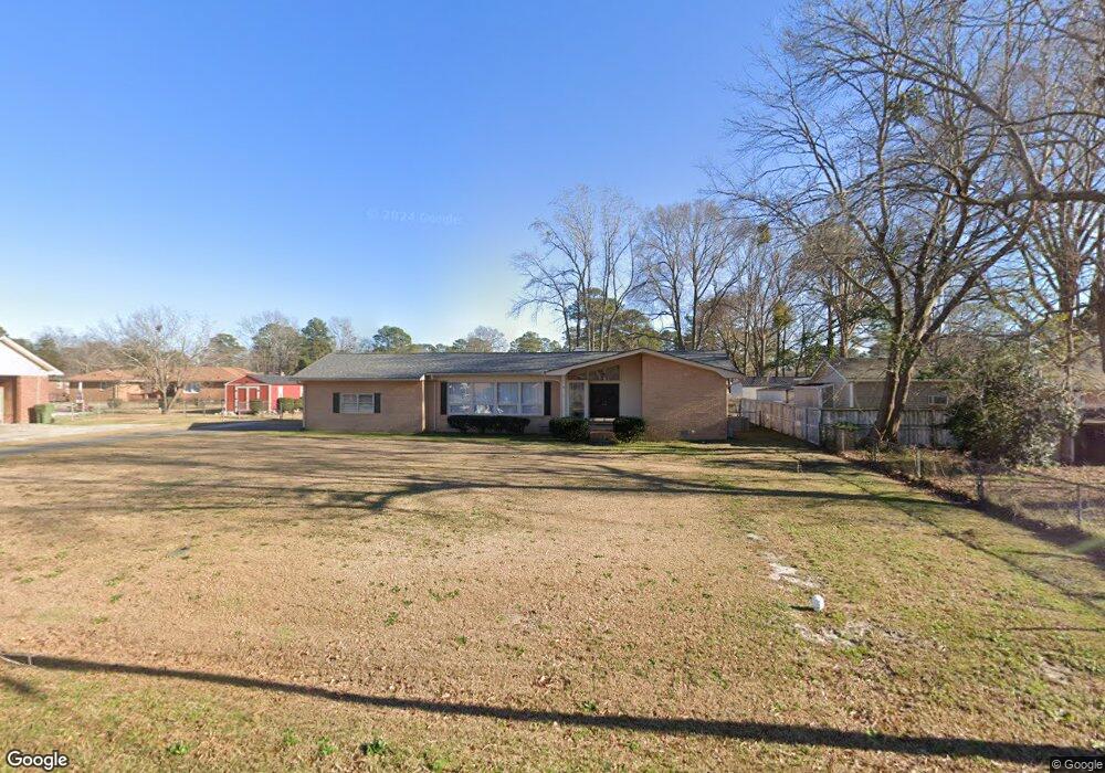
1866 Devonshire Dr Florence, SC 29505
Estimated Value: $230,020 - $264,000
3
Beds
2
Baths
1,820
Sq Ft
$132/Sq Ft
Est. Value
About This Home
This home is located at 1866 Devonshire Dr, Florence, SC 29505 and is currently estimated at $241,005, approximately $132 per square foot. 1866 Devonshire Dr is a home located in Florence County with nearby schools including McLaurin Elementary School, Southside Middle School, and South Florence High School.
Ownership History
Date
Name
Owned For
Owner Type
Purchase Details
Closed on
Nov 11, 2005
Sold by
Elko Sean M and Elko Erin M
Bought by
Adams Mitzi S and Schrijn Juinette
Current Estimated Value
Home Financials for this Owner
Home Financials are based on the most recent Mortgage that was taken out on this home.
Original Mortgage
$110,000
Interest Rate
5.39%
Mortgage Type
New Conventional
Purchase Details
Closed on
Jul 28, 2004
Sold by
Obrien Harry D and Obrien Nettie Jean Z
Bought by
Elko Sean M and Elko Erin M
Purchase Details
Closed on
Mar 5, 2003
Sold by
Hammers Todd Lee and Hammers Loris Ann
Bought by
Obrien Harry D and Obrien Jean Z
Create a Home Valuation Report for This Property
The Home Valuation Report is an in-depth analysis detailing your home's value as well as a comparison with similar homes in the area
Purchase History
| Date | Buyer | Sale Price | Title Company |
|---|---|---|---|
| Adams Mitzi S | $139,000 | -- | |
| Elko Sean M | $127,500 | -- | |
| Obrien Harry D | $36,000 | -- |
Source: Public Records
Mortgage History
| Date | Status | Borrower | Loan Amount |
|---|---|---|---|
| Closed | Adams Mitzi S | $110,000 |
Source: Public Records
Tax History
| Year | Tax Paid | Tax Assessment Tax Assessment Total Assessment is a certain percentage of the fair market value that is determined by local assessors to be the total taxable value of land and additions on the property. | Land | Improvement |
|---|---|---|---|---|
| 2024 | $479 | $7,952 | $1,000 | $6,952 |
| 2023 | $405 | $5,799 | $1,000 | $4,799 |
| 2022 | $479 | $5,799 | $1,000 | $4,799 |
| 2021 | $759 | $5,800 | $0 | $0 |
| 2020 | $688 | $5,800 | $0 | $0 |
| 2019 | $642 | $5,799 | $1,000 | $4,799 |
| 2018 | $565 | $5,400 | $0 | $0 |
| 2017 | $535 | $5,400 | $0 | $0 |
| 2016 | $492 | $5,400 | $0 | $0 |
| 2015 | $514 | $5,400 | $0 | $0 |
| 2014 | $444 | $5,398 | $1,000 | $4,398 |
Source: Public Records
Map
Nearby Homes
- 1905 Marsh Ave
- 1830 Marsh Ave
- 1807 Nottingham Dr
- 1804 Woods Dr
- 2141 Elderberry Dr
- 2113 Sanderling Dr
- 1768 Marsh Ave
- 1770 Woods Dr
- 1914 Brigadoone Ln
- 1815 Hampton Dr
- 1193 Waxwing Dr
- 1779 S Saint Anthony Ave
- 1110 3rd Loop Rd
- 1126 3rd Loop Rd
- 1162 Pinckney Ave
- 1880 S Walter Dr
- 1062 Clarendon Ave
- 1811 Meadow Green Place
- 2943 Wild Turkey Dr
- 1510 Rosedale St
- 1862 Devonshire Dr
- 1917 Marsh Ave
- 1906 Westmoreland Ave
- 1910 Westmoreland Ave
- 1900 Westmoreland Ave
- 1900 Westmoreland Ave
- 1921 Marsh Ave
- 1913 Marsh Ave
- 1867 Devonshire Dr
- 1858 Devonshire Dr
- 1863 Devonshire Dr
- 1925 Marsh Ave
- 1909 Marsh Ave
- 1890 Westmoreland Ave
- 1859 Devonshire Dr
- 1854 Devonshire Dr
- 1886 Westmoreland Ave
- 1909 Westmoreland Ave
- 1916 Marsh Ave
- 1913 Westmoreland Ave
Your Personal Tour Guide
Ask me questions while you tour the home.