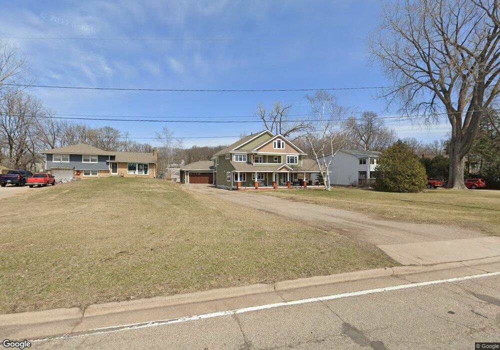
1866 E Shore Dr Saint Paul, MN 55109
Gladstone NeighborhoodEstimated Value: $580,000 - $725,000
4
Beds
4
Baths
2,940
Sq Ft
$220/Sq Ft
Est. Value
About This Home
This home is located at 1866 E Shore Dr, Saint Paul, MN 55109 and is currently estimated at $647,681, approximately $220 per square foot. 1866 E Shore Dr is a home located in Ramsey County with nearby schools including Weaver Elementary School, John Glenn Middle School, and Face to Face Academy Online.
Ownership History
Date
Name
Owned For
Owner Type
Purchase Details
Closed on
Apr 11, 2002
Sold by
Kareen Paul S and Kareen Mary Rea
Bought by
Zemas Erika R and Zemas Jason
Current Estimated Value
Purchase Details
Closed on
May 5, 1999
Sold by
Koreen Paul S and Koreen Mary R
Bought by
Zerwas Jason J and Zerwas Erika R
Create a Home Valuation Report for This Property
The Home Valuation Report is an in-depth analysis detailing your home's value as well as a comparison with similar homes in the area
Home Values in the Area
Average Home Value in this Area
Purchase History
| Date | Buyer | Sale Price | Title Company |
|---|---|---|---|
| Zemas Erika R | $155,000 | -- | |
| Zerwas Jason J | $155,000 | -- |
Source: Public Records
Mortgage History
| Date | Status | Borrower | Loan Amount |
|---|---|---|---|
| Closed | Zemas Erika R | -- |
Source: Public Records
Tax History
| Year | Tax Paid | Tax Assessment Tax Assessment Total Assessment is a certain percentage of the fair market value that is determined by local assessors to be the total taxable value of land and additions on the property. | Land | Improvement |
|---|---|---|---|---|
| 2025 | $8,528 | $618,000 | $145,200 | $472,800 |
| 2023 | $8,528 | $579,500 | $145,200 | $434,300 |
| 2022 | $8,876 | $463,500 | $145,200 | $318,300 |
| 2021 | $7,966 | $573,200 | $145,200 | $428,000 |
| 2020 | $7,672 | $533,600 | $145,200 | $388,400 |
| 2019 | $6,048 | $485,100 | $145,200 | $339,900 |
| 2018 | $5,614 | $390,200 | $145,200 | $245,000 |
| 2017 | $6,062 | $354,700 | $145,200 | $209,500 |
| 2016 | $6,084 | $0 | $0 | $0 |
| 2015 | $5,730 | $364,700 | $133,300 | $231,400 |
| 2014 | $5,502 | $0 | $0 | $0 |
Source: Public Records
Map
Nearby Homes
- 1800 Edward St
- 1745 Duluth St
- 760 Larpenteur Ave E
- 2180 N English St
- 1563 Arcade St
- 2022 English St
- 1544 Duluth St
- 1290 Belmont Ln E
- 1855 Birmingham St
- 695 Idaho Ave E
- 1200 Leland Rd E
- 1592 Greenbrier St
- 1633 Etna St
- 1563 Clarence St
- 1561 Clarence St
- 742 Nebraska Ave E
- TBD Jessie St
- 761 Sherwood Ave
- 733 Sherwood Ave
- 1364 Arcade St
- 1858 E Shore Dr
- 1848 E Shore Dr
- 1844 E Shore Dr
- 1840 E Shore Dr
- 1833 Adele St
- 1841 Adele St
- 1832 E Shore Dr
- 1849 Adele St
- 1061 Gordon Ave
- 1066 Gordon Ave
- 1069 Gordon Ave
- 1857 Adele St
- 1828 E Shore Dr
- 1844 Adele St
- 1072 Gordon Ave
- 1875 E Shore Dr Unit 402
- 1875 E Shore Dr Unit 103
- 1875 E Shore Dr Unit 118
- 1875 E Shore Dr Unit 101
- 1875 E Shore Dr Unit 116
Your Personal Tour Guide
Ask me questions while you tour the home.