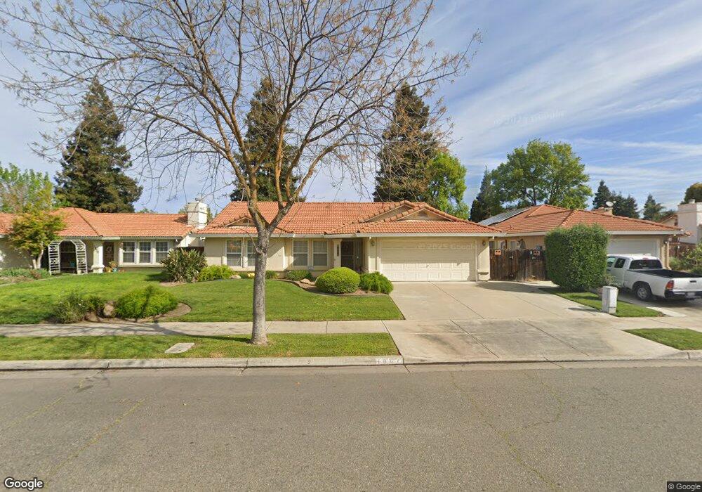
1867 Brookside Dr Merced, CA 95348
Estimated Value: $300,000 - $346,000
3
Beds
2
Baths
1,281
Sq Ft
$251/Sq Ft
Est. Value
About This Home
This home is located at 1867 Brookside Dr, Merced, CA 95348 and is currently estimated at $322,138, approximately $251 per square foot. 1867 Brookside Dr is a home located in Merced County with nearby schools including Luther Burbank Elementary School, Tenaya Middle School, and Merced High School.
Ownership History
Date
Name
Owned For
Owner Type
Purchase Details
Closed on
Jan 30, 2012
Sold by
Lourenco Frank R and Lourenco Maria I
Bought by
Lourenco Frank R and Lourenco Maria I
Current Estimated Value
Purchase Details
Closed on
Mar 9, 2011
Sold by
Hsbc Bank Usa National Association
Bought by
Lourenco Frank R and Lourenco Maria I
Purchase Details
Closed on
Nov 29, 2010
Sold by
Minor Kristine R and Minor Michael B
Bought by
Hsbc Bank Usa National Association
Purchase Details
Closed on
Feb 25, 2002
Sold by
Minor Kristine R and Kelley Kristine R
Bought by
Minor Michael B and Minor Kristine R
Home Financials for this Owner
Home Financials are based on the most recent Mortgage that was taken out on this home.
Original Mortgage
$94,900
Interest Rate
6.8%
Create a Home Valuation Report for This Property
The Home Valuation Report is an in-depth analysis detailing your home's value as well as a comparison with similar homes in the area
Purchase History
| Date | Buyer | Sale Price | Title Company |
|---|---|---|---|
| Lourenco Frank R | -- | None Available | |
| Lourenco Frank R | $94,000 | First American Title Company | |
| Hsbc Bank Usa National Association | $95,200 | Accommodation | |
| Minor Michael B | -- | Fidelity National Title |
Source: Public Records
Mortgage History
| Date | Status | Borrower | Loan Amount |
|---|---|---|---|
| Previous Owner | Minor Michael B | $94,900 |
Source: Public Records
Tax History
| Year | Tax Paid | Tax Assessment Tax Assessment Total Assessment is a certain percentage of the fair market value that is determined by local assessors to be the total taxable value of land and additions on the property. | Land | Improvement |
|---|---|---|---|---|
| 2025 | $1,352 | $120,418 | $14,085 | $106,333 |
| 2024 | $1,352 | $118,058 | $13,809 | $104,249 |
| 2023 | $1,335 | $115,744 | $13,539 | $102,205 |
| 2022 | $1,386 | $113,475 | $13,274 | $100,201 |
| 2021 | $1,374 | $111,251 | $13,014 | $98,237 |
| 2020 | $1,313 | $110,111 | $12,881 | $97,230 |
| 2019 | $1,298 | $107,953 | $12,629 | $95,324 |
| 2018 | $1,185 | $105,837 | $12,382 | $93,455 |
| 2017 | $1,219 | $103,763 | $12,140 | $91,623 |
| 2016 | $1,200 | $101,729 | $11,902 | $89,827 |
| 2015 | $1,175 | $100,202 | $11,724 | $88,478 |
| 2014 | $1,148 | $98,240 | $11,495 | $86,745 |
Source: Public Records
Map
Nearby Homes
- 1844 Springfield Ct
- 2440 Crystal Springs Ave
- 1541 W North Bear Creek Dr
- 1648 W North Bear Creek Dr
- 2500 N State Highway 59 Unit 36
- 2500 N State Highway 59 Unit 239
- 2500 N State Highway 59 Unit 18
- 2500 N State Highway 59
- 1963 Shadowbrook Dr
- 1646 W North Bear Creek Dr
- 1973 Shadowbrook Dr
- 1437 W North Bear Creek Dr
- 1664 W North Bear Creek Dr Unit 5
- 1441 W 20th St
- 1438 W 19th St
- 2790 N State Highway 59
- 1482 Autry Way
- 1463 W 25th St
- 1312 W 24th St
- 1127 W 19th St
- 1879 Brookside Dr
- 1855 Brookside Dr
- 1880 Springfield Ct
- 1843 Brookside Dr
- 1856 Springfield Ct
- 1891 Brookside Dr
- 1892 Springfield Ct
- 1866 Brookside Dr
- 1878 Brookside Dr
- 1854 Brookside Dr
- 1831 Brookside Dr
- 1890 Brookside Dr
- 1840 Brookside Dr
- 1819 Brookside Dr
- 1830 Brookside Dr
- 1832 Springfield Ct
- 1869 Springfield Ct
- 1857 Springfield Ct
- 1892 Brookside Dr
- 2564 Stonybrook Ave
Your Personal Tour Guide
Ask me questions while you tour the home.