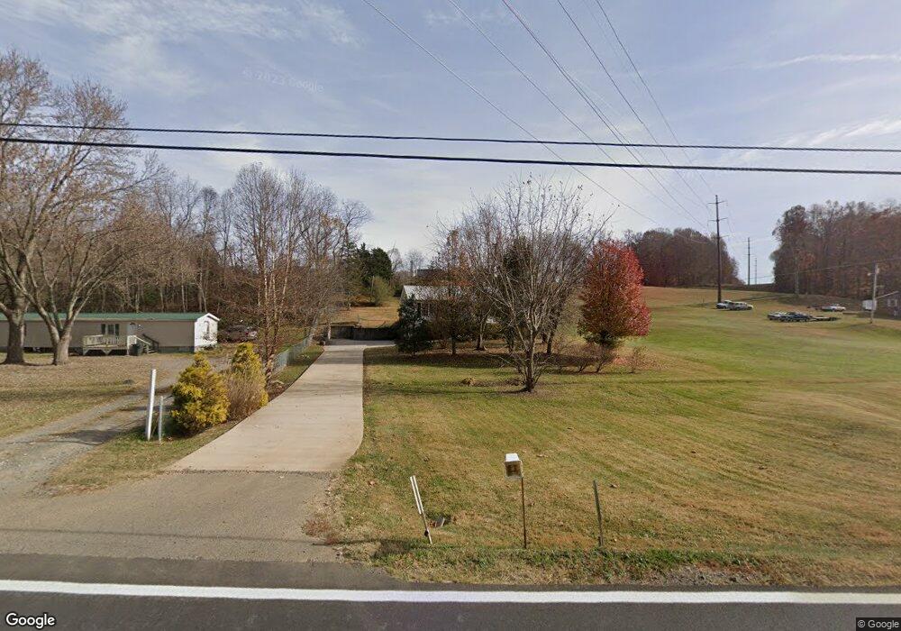
1867 Highway 81 S Jonesborough, TN 37659
Estimated Value: $264,000 - $335,000
3
Beds
2
Baths
1,530
Sq Ft
$195/Sq Ft
Est. Value
About This Home
This home is located at 1867 Highway 81 S, Jonesborough, TN 37659 and is currently estimated at $297,996, approximately $194 per square foot. 1867 Highway 81 S is a home located in Washington County with nearby schools including Jonesborough Elementary School, Jonesborough Middle School, and David Crockett High School.
Ownership History
Date
Name
Owned For
Owner Type
Purchase Details
Closed on
Apr 8, 2019
Sold by
Burns Susan M
Bought by
Burns Susan M and Susan M Burns Revocable Living
Current Estimated Value
Purchase Details
Closed on
Jul 30, 2008
Sold by
Hubbard Jonathan
Bought by
Burn Susan M
Home Financials for this Owner
Home Financials are based on the most recent Mortgage that was taken out on this home.
Original Mortgage
$131,600
Outstanding Balance
$86,288
Interest Rate
6.31%
Estimated Equity
$211,708
Purchase Details
Closed on
Jun 16, 2003
Sold by
White Roger and White Janie
Bought by
Hubbard Jonathan
Home Financials for this Owner
Home Financials are based on the most recent Mortgage that was taken out on this home.
Original Mortgage
$84,800
Interest Rate
5.25%
Purchase Details
Closed on
Mar 5, 1996
Sold by
White Roger M
Bought by
White Roger M
Purchase Details
Closed on
Mar 1, 1996
Bought by
White Roger M
Purchase Details
Closed on
Jan 1, 1983
Create a Home Valuation Report for This Property
The Home Valuation Report is an in-depth analysis detailing your home's value as well as a comparison with similar homes in the area
Home Values in the Area
Average Home Value in this Area
Purchase History
| Date | Buyer | Sale Price | Title Company |
|---|---|---|---|
| Burns Susan M | -- | None Available | |
| Burn Susan M | $133,000 | -- | |
| Hubbard Jonathan | $15,000 | -- | |
| White Roger M | $24,000 | -- | |
| White Roger M | $24,000 | -- | |
| -- | $3,800 | -- |
Source: Public Records
Mortgage History
| Date | Status | Borrower | Loan Amount |
|---|---|---|---|
| Open | -- | $131,600 | |
| Previous Owner | -- | $84,800 |
Source: Public Records
Tax History Compared to Growth
Tax History
| Year | Tax Paid | Tax Assessment Tax Assessment Total Assessment is a certain percentage of the fair market value that is determined by local assessors to be the total taxable value of land and additions on the property. | Land | Improvement |
|---|---|---|---|---|
| 2024 | $1,056 | $61,725 | $10,250 | $51,475 |
| 2022 | $726 | $33,750 | $6,150 | $27,600 |
| 2021 | $726 | $33,750 | $6,150 | $27,600 |
| 2020 | $726 | $33,750 | $6,150 | $27,600 |
| 2019 | $791 | $33,750 | $6,150 | $27,600 |
| 2018 | $791 | $33,225 | $5,725 | $27,500 |
| 2017 | $791 | $33,225 | $5,725 | $27,500 |
| 2016 | $791 | $33,225 | $5,725 | $27,500 |
| 2015 | $658 | $33,225 | $5,725 | $27,500 |
| 2014 | $658 | $33,225 | $5,725 | $27,500 |
Source: Public Records
Map
Nearby Homes
- 229 Ridgecrest Rd
- 397 Ridgecrest Rd
- 123 Hallborough Dr
- 507 Emma Grace Dr
- 146 Mulberry Bend
- 144 Forestview Dr
- 205 Reece Ct N
- 191 Hall Rd
- 168 County Farm Rd
- Lot 7 Markwood Cir
- 450 Mount Zion Church Rd
- 522 Old State Route 34
- 2351 Highway 81 S
- 2365 Highway 81 S
- 24 Vesta Sue Ct
- 2376 Highway 81 S
- 206 Persimmon Ln
- 126 Charlem Hills Rd
- 639 Old State Route 34
- 315 Old Franklin Place
- 1859 Highway 81 S
- 1866 Highway 81 S
- 1857 Highway 81 S
- 1869 Highway 81 S
- 1864 Highway 81 S
- 1840 Highway 81 S
- 1832 Highway 81 S
- 1831 Highway 81 S
- 129 Frank Lowe Rd
- 1834 Highway 81 S
- 1878 Highway 81 S
- 1 Highway 81 S
- 1881 Highway 81 S
- 167 Frank Lowe Rd
- 127 Baines Ln
- 1882 Highway 81 S
- 1870 Highway 81 S
- 1825 Highway 81 S
- 1824 Highway 81 S
- 174 Frank Lowe Rd