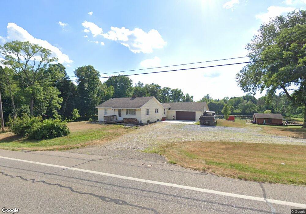
1867 State Route 43 Mogadore, OH 44260
Estimated Value: $212,000 - $215,330
2
Beds
1
Bath
972
Sq Ft
$220/Sq Ft
Est. Value
About This Home
This home is located at 1867 State Route 43, Mogadore, OH 44260 and is currently estimated at $213,443, approximately $219 per square foot. 1867 State Route 43 is a home located in Portage County with nearby schools including Suffield Elementary School, Field Middle School, and Field High School.
Ownership History
Date
Name
Owned For
Owner Type
Purchase Details
Closed on
Aug 14, 2023
Sold by
Kunkle Kyle
Bought by
Kunkle William Edward
Current Estimated Value
Home Financials for this Owner
Home Financials are based on the most recent Mortgage that was taken out on this home.
Original Mortgage
$145,500
Outstanding Balance
$142,097
Interest Rate
6.67%
Mortgage Type
Construction
Estimated Equity
$71,346
Purchase Details
Closed on
Jul 28, 2023
Sold by
William Edward Kunkle Revocable Trust
Bought by
Kunkle Kyle
Home Financials for this Owner
Home Financials are based on the most recent Mortgage that was taken out on this home.
Original Mortgage
$145,500
Outstanding Balance
$142,097
Interest Rate
6.67%
Mortgage Type
Construction
Estimated Equity
$71,346
Purchase Details
Closed on
Nov 25, 2014
Sold by
Kunkle William E
Bought by
Kunkle William Edward
Purchase Details
Closed on
Oct 18, 2013
Sold by
Kunkle Carol J
Bought by
Kunkle William E
Home Financials for this Owner
Home Financials are based on the most recent Mortgage that was taken out on this home.
Original Mortgage
$40,000
Interest Rate
3.26%
Mortgage Type
New Conventional
Create a Home Valuation Report for This Property
The Home Valuation Report is an in-depth analysis detailing your home's value as well as a comparison with similar homes in the area
Home Values in the Area
Average Home Value in this Area
Purchase History
| Date | Buyer | Sale Price | Title Company |
|---|---|---|---|
| Kunkle William Edward | $250 | None Listed On Document | |
| Kunkle Kyle | -- | None Listed On Document | |
| Kunkle William Edward | -- | None Available | |
| Kunkle William E | -- | Bennett Land Title Agency |
Source: Public Records
Mortgage History
| Date | Status | Borrower | Loan Amount |
|---|---|---|---|
| Open | Kunkle Kyle | $145,500 | |
| Previous Owner | Kunkle William E | $40,000 |
Source: Public Records
Tax History Compared to Growth
Tax History
| Year | Tax Paid | Tax Assessment Tax Assessment Total Assessment is a certain percentage of the fair market value that is determined by local assessors to be the total taxable value of land and additions on the property. | Land | Improvement |
|---|---|---|---|---|
| 2024 | $2,258 | $65,590 | $23,660 | $41,930 |
| 2023 | $2,024 | $49,880 | $16,420 | $33,460 |
| 2022 | $2,043 | $49,880 | $16,420 | $33,460 |
| 2021 | $2,009 | $49,880 | $16,420 | $33,460 |
| 2020 | $1,908 | $44,070 | $16,420 | $27,650 |
| 2019 | $1,918 | $44,070 | $16,420 | $27,650 |
| 2018 | $1,496 | $40,990 | $18,030 | $22,960 |
| 2017 | $1,464 | $40,990 | $18,030 | $22,960 |
| 2016 | $1,449 | $40,990 | $18,030 | $22,960 |
| 2015 | $1,450 | $40,990 | $18,030 | $22,960 |
| 2014 | $1,412 | $40,990 | $18,030 | $22,960 |
| 2013 | $1,400 | $40,990 | $18,030 | $22,960 |
Source: Public Records
Map
Nearby Homes
- 1324 Trares Rd
- 1470 Congress Lake Rd
- 1811 Randolph Rd
- 1791 Winterhaven Dr
- S/L 38 1150 Lakeview Dr
- S/L 11 959 Sunrise Dr
- S/L 37 1140 Lakeview Dr
- VL 863 State Route 43
- 2355 Martin Rd
- 375 Grant Ave
- 406 S Cleveland Ave
- 2700 Martin Rd
- 3985 Warner St
- 2100 Steffy Rd
- 2671 Spring Valley Blvd
- 252 Saxe Rd
- 38 Walnut Ct
- 2751 Highline Dr
- 3539 Carper Ave
- 489 Howard Ave
- 1847 State Route 43
- 1900 State Route 43
- 1829 State Route 43
- 1807 State Route 43
- 1914 State Route 43
- 1930 State Route 43
- 1944 State Route 43
- 1775 State Route 43
- 1972 State Route 43
- 1218 Randolph Rd
- 1836 State Route 43
- 1980 State Route 43
- 1308 Trares Rd
- 1725 State Route 43
- 1340 Trares Rd Unit 1342
- 1732 State Route 43
- 1802 State Route 43 V L
- 1258 Randolph Rd
- 1352 Trares Rd
- 0 Randolph Rd Unit 5112744