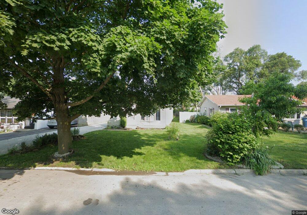
1867 Sunnyside Ave Kankakee, IL 60901
Estimated Value: $108,000 - $134,000
--
Bed
--
Bath
--
Sq Ft
5,924
Sq Ft Lot
About This Home
This home is located at 1867 Sunnyside Ave, Kankakee, IL 60901 and is currently estimated at $121,707. 1867 Sunnyside Ave is a home located in Kankakee County with nearby schools including Edison Primary School, King Middle Grade School, and Kankakee Junior High School.
Ownership History
Date
Name
Owned For
Owner Type
Purchase Details
Closed on
May 24, 2005
Sold by
Morris Robert G and Morris Pauline
Bought by
Camargo Juan and Camargo Sofia Alvarado
Current Estimated Value
Home Financials for this Owner
Home Financials are based on the most recent Mortgage that was taken out on this home.
Original Mortgage
$67,890
Outstanding Balance
$35,920
Interest Rate
6.07%
Mortgage Type
New Conventional
Estimated Equity
$85,787
Create a Home Valuation Report for This Property
The Home Valuation Report is an in-depth analysis detailing your home's value as well as a comparison with similar homes in the area
Home Values in the Area
Average Home Value in this Area
Purchase History
| Date | Buyer | Sale Price | Title Company |
|---|---|---|---|
| Camargo Juan | $73,000 | Kankakee Cnty Title & Tr |
Source: Public Records
Mortgage History
| Date | Status | Borrower | Loan Amount |
|---|---|---|---|
| Open | Camargo Juan | $67,890 |
Source: Public Records
Tax History Compared to Growth
Tax History
| Year | Tax Paid | Tax Assessment Tax Assessment Total Assessment is a certain percentage of the fair market value that is determined by local assessors to be the total taxable value of land and additions on the property. | Land | Improvement |
|---|---|---|---|---|
| 2024 | $3,591 | $36,373 | $2,924 | $33,449 |
| 2023 | $3,376 | $32,404 | $2,605 | $29,799 |
| 2022 | $3,039 | $28,362 | $2,280 | $26,082 |
| 2021 | $2,787 | $25,667 | $2,063 | $23,604 |
| 2020 | $2,497 | $23,071 | $1,854 | $21,217 |
| 2019 | $2,317 | $21,462 | $1,725 | $19,737 |
| 2018 | $2,162 | $19,872 | $1,597 | $18,275 |
| 2017 | $2,397 | $19,435 | $1,562 | $17,873 |
| 2016 | $2,227 | $19,054 | $1,531 | $17,523 |
| 2015 | $1,856 | $17,493 | $1,562 | $15,931 |
| 2014 | $2,091 | $19,443 | $1,562 | $17,881 |
| 2013 | -- | $20,253 | $1,627 | $18,626 |
Source: Public Records
Map
Nearby Homes
- 1847 Sunnyside Ave
- 1869 Summit Ave
- 2345 E Maple St Unit 67
- 1686 E Bourbonnais St
- 459 S Nelson Ave
- 540 S Osborn Ave
- 601 S Osborn Ave
- 326 S Gordon Ave
- 370 Albert Blvd
- 550 S Poplar Ave
- 744 S Elm Ave
- 643 S Elm Ave
- 2642 E Melbrook Dr
- 417 S Elm Ave
- 956 S Elm Ave
- 257 Orchard Ave
- 382 S Elm Ave
- 352 S Elm Ave
- 201 N Cottage Ave
- 435 S Myrtle Ave
- 1855 Sunnyside Ave
- 1851 Sunnyside Ave
- 1879 Sunnyside Ave
- 715 S Prospect Ave
- 735 S Prospect Ave
- 1848 Sunnyside Ave
- 1843 Sunnyside Ave
- 1885 Sunnyside Ave
- 1846 Sunnyside Ave
- 1841 Sunnyside Ave
- 1842 Sunnyside Ave
- 755 S Prospect Ave
- 2121 E Maple St
- 1858 E Eagle St
- 1835 Sunnyside Ave
- 1836 Sunnyside Ave
- 1870 E Eagle St Unit 80
- 2125 E Maple St
- 752 S Prospect Ave
- 767 S Prospect Ave