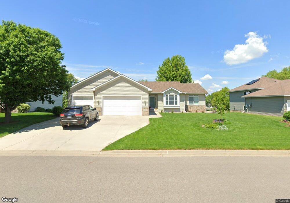
1868 14th St W Hastings, MN 55033
Hastings-Marshan Township NeighborhoodEstimated Value: $498,817 - $565,000
4
Beds
3
Baths
1,744
Sq Ft
$299/Sq Ft
Est. Value
About This Home
This home is located at 1868 14th St W, Hastings, MN 55033 and is currently estimated at $521,454, approximately $298 per square foot. 1868 14th St W is a home located in Dakota County with nearby schools including Christa Mcauliffe Elementary School, Hastings Middle School, and Hastings High School.
Ownership History
Date
Name
Owned For
Owner Type
Purchase Details
Closed on
Aug 5, 2004
Sold by
Lawrence Builders Inc
Bought by
Schuster Richard L and Schuster Heidi A
Current Estimated Value
Purchase Details
Closed on
Jan 2, 2004
Sold by
Lawrence Delores L and Lawrence Paul W
Bought by
Lawrence Builders Inc
Create a Home Valuation Report for This Property
The Home Valuation Report is an in-depth analysis detailing your home's value as well as a comparison with similar homes in the area
Home Values in the Area
Average Home Value in this Area
Purchase History
| Date | Buyer | Sale Price | Title Company |
|---|---|---|---|
| Schuster Richard L | $329,500 | -- | |
| Lawrence Builders Inc | $171,000 | -- |
Source: Public Records
Tax History Compared to Growth
Tax History
| Year | Tax Paid | Tax Assessment Tax Assessment Total Assessment is a certain percentage of the fair market value that is determined by local assessors to be the total taxable value of land and additions on the property. | Land | Improvement |
|---|---|---|---|---|
| 2024 | $5,568 | $485,000 | $92,500 | $392,500 |
| 2023 | $5,250 | $482,000 | $92,600 | $389,400 |
| 2022 | $4,624 | $467,800 | $92,400 | $375,400 |
| 2021 | $4,544 | $378,100 | $80,300 | $297,800 |
| 2020 | $4,734 | $369,600 | $72,400 | $297,200 |
| 2019 | $4,703 | $372,000 | $69,000 | $303,000 |
| 2018 | $4,624 | $352,200 | $65,700 | $286,500 |
| 2017 | $4,333 | $335,900 | $62,600 | $273,300 |
| 2016 | $4,409 | $315,200 | $58,500 | $256,700 |
| 2015 | $4,332 | $303,603 | $55,148 | $248,455 |
| 2014 | -- | $300,006 | $53,039 | $246,967 |
| 2013 | -- | $263,491 | $47,274 | $216,217 |
Source: Public Records
Map
Nearby Homes
- 1882 13th St W Unit 802
- 1960 Rose Way
- 1967 Sierra Dr Unit 303
- 1478 Pringle Ct
- 2725 General Sieben Dr
- 1767 Carleton Place
- 1500 Brittany Rd
- 2109 Westpointe Dr
- 2117 Westpointe Dr
- 1832 Ridgepointe N
- 2120 Ridge Pointe Dr
- 1817 Ridgepointe Ct
- 2157 Westpointe Dr
- 2160 Ridge Pointe Dr
- 2173 Westpointe Dr
- 2189 Westpointe Dr
- 1451 17th St W
- 1824 Fallbrooke Dr
- 1811 Fallbrooke Dr
- Alley Plan at Heritage Ridge
- 1856 14th St W
- 1882 14th St W
- 1881 13th St W
- 1877 13th St W
- 1885 13th St W
- 1893 13th St W Unit 1204
- 1844 14th St W
- 1888 Tierney Dr
- 1877 1877 13th-Street-w
- 1857 14th St W
- 1865 13th St W
- 1845 14th St W
- 1914 14th St W
- 1857 13th St W
- 1832 14th St W
- 1874 Tierney Dr
- 1853 13th St W
- 1909 Sierra Dr
- 1888 13th St W
- 1888 13th St W Unit 805