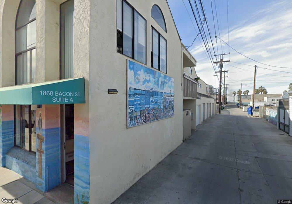
1868 Bacon St San Diego, CA 92107
Ocean Beach NeighborhoodEstimated Value: $1,780,633
1
Bed
1
Bath
600
Sq Ft
$2,968/Sq Ft
Est. Value
About This Home
This home is located at 1868 Bacon St, San Diego, CA 92107 and is currently estimated at $1,780,633, approximately $2,967 per square foot. 1868 Bacon St is a home located in San Diego County with nearby schools including Ocean Beach Elementary School, Richard Henry Dana Middle School, and Correia Middle School.
Ownership History
Date
Name
Owned For
Owner Type
Purchase Details
Closed on
Jun 4, 2020
Sold by
Davis Dion
Bought by
Hirmez Saad and Hirmez Zeena
Current Estimated Value
Purchase Details
Closed on
Feb 12, 2016
Sold by
Hayes Kathleen M
Bought by
Hayes Kathleen M
Purchase Details
Closed on
Nov 4, 1997
Sold by
Vonder Mehden Anne G
Bought by
Vondermehden Anneg
Create a Home Valuation Report for This Property
The Home Valuation Report is an in-depth analysis detailing your home's value as well as a comparison with similar homes in the area
Home Values in the Area
Average Home Value in this Area
Purchase History
| Date | Buyer | Sale Price | Title Company |
|---|---|---|---|
| Hirmez Saad | $1,200,000 | Western Resources Title | |
| Hayes Kathleen M | -- | None Available | |
| Vondermehden Anneg | -- | -- |
Source: Public Records
Tax History Compared to Growth
Tax History
| Year | Tax Paid | Tax Assessment Tax Assessment Total Assessment is a certain percentage of the fair market value that is determined by local assessors to be the total taxable value of land and additions on the property. | Land | Improvement |
|---|---|---|---|---|
| 2025 | $15,668 | $1,298,917 | $1,028,309 | $270,608 |
| 2024 | $15,668 | $1,273,449 | $1,008,147 | $265,302 |
| 2023 | $15,324 | $1,248,480 | $988,380 | $260,100 |
| 2022 | $14,917 | $1,224,000 | $969,000 | $255,000 |
| 2021 | $14,815 | $1,200,000 | $950,000 | $250,000 |
| 2020 | $13,557 | $1,100,000 | $850,000 | $250,000 |
| 2019 | $4,153 | $334,733 | $102,666 | $232,067 |
| 2018 | $3,883 | $328,170 | $100,653 | $227,517 |
| 2017 | $3,791 | $321,736 | $98,680 | $223,056 |
| 2016 | $3,731 | $315,429 | $96,746 | $218,683 |
| 2015 | $3,676 | $310,692 | $95,293 | $215,399 |
| 2014 | $3,619 | $304,607 | $93,427 | $211,180 |
Source: Public Records
Map
Nearby Homes
- 4985 Narragansett Ave Unit 87
- 5035 Saratoga Ave
- 1817-19 Sunset Cliffs Blvd
- 4867 Santa Cruz Ave
- 4985 Coronado Ave Unit 2
- 4961-67 Coronado Ave
- 4804 Cape May Ave
- 5152 Brighton Ave
- 4725 Saratoga Ave
- 4768 72 Coronado Ave Ave
- 4922 Muir Ave
- 4674 Saratoga Ave Unit 2
- 5155 W Point Loma Blvd Unit 9
- 5123 Lotus St
- 4617 Del Monte Ave
- 4878 Pescadero Ave Unit 403
- 4685 Long Branch Ave
- 4611 Santa Cruz Ave
- 1558 Ebers St
- 4545 Newport Ave
- 5001 Newport Ave
- 5050 Niagara Ave
- 5050 Niagara Ave
- 5047 Newport Ave
- 4978 Niagara Ave
- 5009 Niagara Ave Unit 15
- 5049 Newport Ave
- 4967 Newport Ave
- 5054 Niagara Ave Unit 56
- 5025 Niagara Ave
- 5058 Niagara Ave Unit 60
- 5033 Niagara Ave
- 4994 Newport Ave
- 5064-66 Niagara Ave
- 4973 Niagara Ave Unit 75
- 5019 Niagara Ave Unit 21
- 5041 Niagara Ave
- 5035 Niagara Ave
- 5037 Niagara Ave Unit 3
- 5039 Niagara Ave Unit LU39