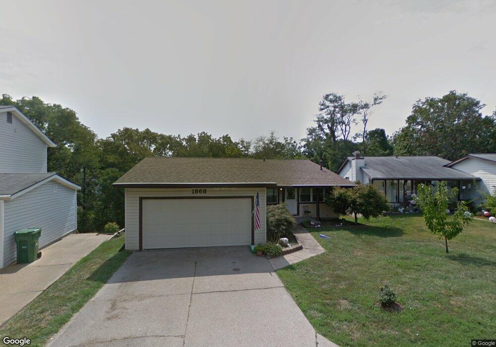
1868 Hanover Ln Barnhart, MO 63012
Estimated Value: $216,036 - $274,000
Studio
--
Bath
1,440
Sq Ft
$169/Sq Ft
Est. Value
About This Home
This home is located at 1868 Hanover Ln, Barnhart, MO 63012 and is currently estimated at $243,509, approximately $169 per square foot. 1868 Hanover Ln is a home located in Jefferson County with nearby schools including Windsor High School and St. Joseph Catholic School.
Ownership History
Date
Name
Owned For
Owner Type
Purchase Details
Closed on
Jun 3, 2013
Sold by
Crane Michael S
Bought by
Janes Matthew G
Current Estimated Value
Purchase Details
Closed on
Jun 19, 2009
Sold by
Janes Matthew G
Bought by
Janes Matthew G and Crane Michael S
Home Financials for this Owner
Home Financials are based on the most recent Mortgage that was taken out on this home.
Original Mortgage
$143,223
Interest Rate
4.84%
Mortgage Type
FHA
Purchase Details
Closed on
Dec 28, 2007
Sold by
The Maxine Guin Family Trust
Bought by
Janes Matthew G and Crane Michael S
Home Financials for this Owner
Home Financials are based on the most recent Mortgage that was taken out on this home.
Original Mortgage
$141,500
Interest Rate
6.23%
Mortgage Type
Purchase Money Mortgage
Create a Home Valuation Report for This Property
The Home Valuation Report is an in-depth analysis detailing your home's value as well as a comparison with similar homes in the area
Home Values in the Area
Average Home Value in this Area
Purchase History
| Date | Buyer | Sale Price | Title Company |
|---|---|---|---|
| Janes Matthew G | -- | None Available | |
| Janes Matthew G | -- | Investors Title Co | |
| Janes Matthew G | -- | Investors Title Co | |
| Janes Matthew G | -- | Ust |
Source: Public Records
Mortgage History
| Date | Status | Borrower | Loan Amount |
|---|---|---|---|
| Previous Owner | Janes Matthew G | $143,223 | |
| Previous Owner | Janes Matthew G | $141,500 |
Source: Public Records
Tax History
| Year | Tax Paid | Tax Assessment Tax Assessment Total Assessment is a certain percentage of the fair market value that is determined by local assessors to be the total taxable value of land and additions on the property. | Land | Improvement |
|---|---|---|---|---|
| 2025 | $1,561 | $24,200 | $5,000 | $19,200 |
| 2024 | $1,561 | $21,300 | $4,000 | $17,300 |
| 2023 | $1,561 | $21,300 | $4,000 | $17,300 |
| 2022 | $1,404 | $19,200 | $1,900 | $17,300 |
| 2021 | $1,405 | $19,200 | $1,900 | $17,300 |
| 2020 | $1,320 | $17,500 | $1,600 | $15,900 |
| 2019 | $1,318 | $17,500 | $1,600 | $15,900 |
| 2018 | $1,300 | $17,500 | $1,600 | $15,900 |
| 2017 | $1,251 | $17,500 | $1,600 | $15,900 |
| 2016 | $1,134 | $15,800 | $1,700 | $14,100 |
Source: Public Records
Map
Nearby Homes
- 2149 Meadow Dr
- 7406 Avondale Park
- 7255 Meriwether Ct
- 7511 Hillcress Ct
- 1702 Springbrook Dr
- 0 Hwy Mm Unit MAR24032005
- 0 New Highway M Unit MAR25024234
- 1660 Old State Road M
- 1433 Hoover Dr
- 1675 Old State Road M
- 1884 Morgan Rd
- 6759 Sycamore Landing
- 36 Huntleigh Woods
- 8147 Murphy Ln
- 8018 Fox Hollow
- 2110 Devonshire Dr
- 3037 Upper Moss Hollow Rd
- 2712 Kings Crossing Dr
- 2338 Windsor Castle Dr
- 1299 Riesling Ln
- 1872 Hanover Ln
- 1862 Hanover Ln
- 1858 Hanover Ln
- 1876 Hanover Ln
- 1852 Hanover Ln
- 1859 Hanover Ln
- 1865 Hanover Ln
- 1875 Hanover Ln
- 1882 Hanover Ln
- 1851 Hanover Ln
- 1844 Hanover Ln
- 1886 Hanover Ln
- 1843 Hanover Ln
- 1836 Hanover Ln
- 1837 Hanover Ln
- 1878 Fairfax Dr
- 1880 Fairfax Dr
- 1890 Hanover Ln
- 1870 Fairfax Dr
- 1884 Fairfax Dr
Your Personal Tour Guide
Ask me questions while you tour the home.