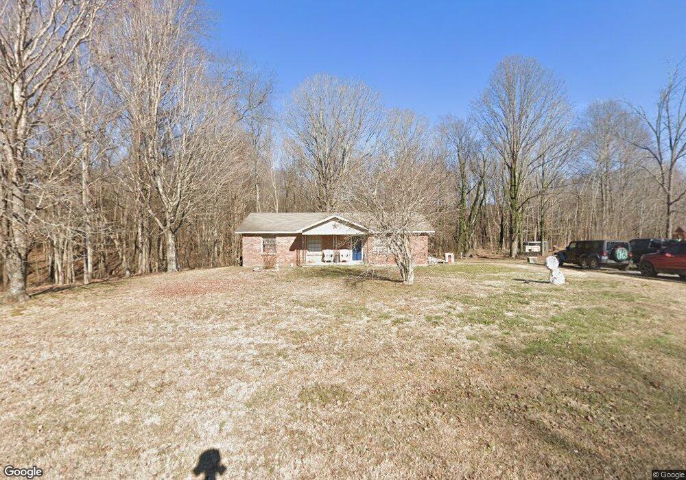
1868 W Stinson Rd Westmoreland, TN 37186
Estimated Value: $155,000 - $278,000
--
Bed
1
Bath
1,344
Sq Ft
$152/Sq Ft
Est. Value
About This Home
This home is located at 1868 W Stinson Rd, Westmoreland, TN 37186 and is currently estimated at $204,926, approximately $152 per square foot. 1868 W Stinson Rd is a home located in Macon County.
Ownership History
Date
Name
Owned For
Owner Type
Purchase Details
Closed on
Jun 3, 2017
Sold by
Smith Christopher D and Smith Angela M
Bought by
Smith Christopher Shadow and Smith Cassandra
Current Estimated Value
Purchase Details
Closed on
Nov 14, 2006
Sold by
Humphreys Laura A
Bought by
Smith Christopher D
Purchase Details
Closed on
Jul 5, 2006
Sold by
Hugh Bartley Charles
Bought by
Humphreys Laura A
Purchase Details
Closed on
Dec 15, 1998
Bought by
Bartley Charles Hugh and Bartley Sendy
Create a Home Valuation Report for This Property
The Home Valuation Report is an in-depth analysis detailing your home's value as well as a comparison with similar homes in the area
Home Values in the Area
Average Home Value in this Area
Purchase History
| Date | Buyer | Sale Price | Title Company |
|---|---|---|---|
| Smith Christopher Shadow | $6,600 | Benchmark Title Company | |
| Smith Christopher D | $44,532 | -- | |
| Humphreys Laura A | $54,000 | -- | |
| Bartley Charles Hugh | $56,300 | -- |
Source: Public Records
Tax History Compared to Growth
Tax History
| Year | Tax Paid | Tax Assessment Tax Assessment Total Assessment is a certain percentage of the fair market value that is determined by local assessors to be the total taxable value of land and additions on the property. | Land | Improvement |
|---|---|---|---|---|
| 2024 | $535 | $39,350 | $3,500 | $35,850 |
| 2023 | $535 | $37,850 | $0 | $0 |
| 2022 | $443 | $18,475 | $3,125 | $15,350 |
| 2021 | $443 | $18,475 | $3,125 | $15,350 |
| 2020 | $443 | $18,475 | $3,125 | $15,350 |
| 2019 | $443 | $18,475 | $3,125 | $15,350 |
| 2018 | $409 | $18,475 | $3,125 | $15,350 |
| 2017 | $415 | $16,475 | $3,125 | $13,350 |
| 2016 | $395 | $16,475 | $3,125 | $13,350 |
| 2015 | $395 | $16,475 | $3,125 | $13,350 |
| 2014 | $395 | $16,467 | $0 | $0 |
Source: Public Records
Map
Nearby Homes
- 234 Haven Way
- 295 Akins Heights Ln
- 10029 Old Highway 52
- 11076 Highway 52 W
- 6221 Austin Peay Hwy
- 670 Howell Rd
- 0 Trammel Creek Rd
- 401 Robins Trail
- 401 Robin's Trail
- 458 Robins Trail
- 219 Wagoners Way
- 2131 Lambert Dr
- 5270 New Highway 31e
- 1112 New Highway 52 E
- 4169 Bledsoe St
- 397 Lauren Ln
- 1123 New Hwy 52
- 1131 New Hwy 52
- 177 Lauren Ln
- 393 Leaths Branch Rd
- 1814 W Stinson Rd
- 1811 W Stinson Rd
- 1889 W Stinson Rd
- 304 Haven Way
- 306 Haven Way
- 1747 W Stinson Rd
- 300 Haven Way
- 1740 W Stinson Rd
- 283 Haven Way
- 298 Haven Way
- 1690 W Stinson Rd
- 2023 W Stinson Rd
- 255 Haven Way
- 284 Haven Way
- 1982 W Stinson Rd
- 256 Haven Way
- 233 Haven Way
- 2060 W Stinson Rd
- 266 Curtis Ln
- 2059 W Stinson Rd