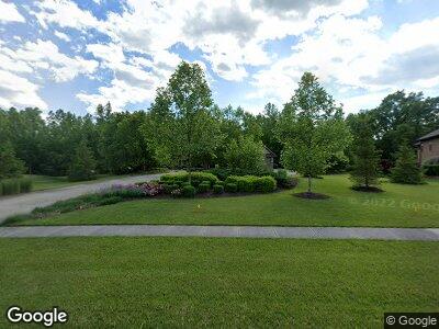
1869 Amys Ridge Ct Beavercreek, OH 45434
Estimated Value: $1,017,000 - $1,179,427
4
Beds
5
Baths
5,698
Sq Ft
$196/Sq Ft
Est. Value
About This Home
This home is located at 1869 Amys Ridge Ct, Beavercreek, OH 45434 and is currently estimated at $1,114,476, approximately $195 per square foot. 1869 Amys Ridge Ct is a home with nearby schools including Main Elementary School, Jacob Coy Middle School, and Beavercreek High School.
Ownership History
Date
Name
Owned For
Owner Type
Purchase Details
Closed on
Oct 14, 2019
Sold by
Koncal Scott and Koncal Megan
Bought by
Koncal Scott D and Koncal Megan Dines
Current Estimated Value
Purchase Details
Closed on
Oct 4, 2011
Sold by
Oberer Land Developers Ltd
Bought by
Koncal Scott and Koncal Megan
Home Financials for this Owner
Home Financials are based on the most recent Mortgage that was taken out on this home.
Original Mortgage
$619,233
Outstanding Balance
$439,423
Interest Rate
4.5%
Mortgage Type
Construction
Estimated Equity
$669,147
Purchase Details
Closed on
Oct 4, 2005
Sold by
The Siebenthaler Co
Bought by
Fox Ridge Developers Ltd
Home Financials for this Owner
Home Financials are based on the most recent Mortgage that was taken out on this home.
Original Mortgage
$2,264,000
Interest Rate
6.2%
Mortgage Type
Unknown
Create a Home Valuation Report for This Property
The Home Valuation Report is an in-depth analysis detailing your home's value as well as a comparison with similar homes in the area
Home Values in the Area
Average Home Value in this Area
Purchase History
| Date | Buyer | Sale Price | Title Company |
|---|---|---|---|
| Koncal Scott D | -- | None Available | |
| Koncal Scott | $159,900 | Triad Title Agency Inc | |
| Fox Ridge Developers Ltd | $1,490,700 | -- |
Source: Public Records
Mortgage History
| Date | Status | Borrower | Loan Amount |
|---|---|---|---|
| Open | Koncal Scott D | $619,233 | |
| Closed | Koncal Scott | $176,924 | |
| Previous Owner | Fox Ridge Developers Ltd | $2,264,000 | |
| Previous Owner | Fox Ridge Developers Ltd | $2,264,000 |
Source: Public Records
Tax History Compared to Growth
Tax History
| Year | Tax Paid | Tax Assessment Tax Assessment Total Assessment is a certain percentage of the fair market value that is determined by local assessors to be the total taxable value of land and additions on the property. | Land | Improvement |
|---|---|---|---|---|
| 2024 | $21,634 | $329,460 | $53,590 | $275,870 |
| 2023 | $21,634 | $329,460 | $53,590 | $275,870 |
| 2022 | $21,483 | $288,800 | $53,590 | $235,210 |
| 2021 | $21,466 | $288,800 | $53,590 | $235,210 |
| 2020 | $21,627 | $288,800 | $53,590 | $235,210 |
| 2019 | $19,291 | $239,720 | $53,590 | $186,130 |
| 2018 | $17,040 | $239,720 | $53,590 | $186,130 |
| 2017 | $15,989 | $239,720 | $53,590 | $186,130 |
| 2016 | $15,990 | $216,760 | $53,590 | $163,170 |
| 2015 | $15,887 | $216,760 | $53,590 | $163,170 |
| 2014 | $15,650 | $216,760 | $53,590 | $163,170 |
Source: Public Records
Map
Nearby Homes
- 2709 Majestic Oaks Ct
- 2240 Pacer Ct
- 2040 Rustling Oak Ct
- 2495 Kewanna Ln
- 2544 Kewanna Ln
- 2337 Eastwind Dr
- 2331 Eastwind Dr
- 2725 Terraceview Cir
- 2085 Codaz Way
- 2040 Codaz Way
- 1401 Meadow Moor Dr
- 2003 E Schmidt Dr
- 2099 van Oss Dr
- 00 van Oss Dr
- 1401 Edenwood Dr
- 2170 David Grey Cir
- 1361 Obetz Dr Unit B
- 2555 Valdina Dr
- 1941 Schmidt Dr E
- 2989 Mckay Rd
- 1869 Amys Ridge Ct
- 1857 Amys Ridge Ct
- 1881 Amys Ridge Ct
- 1845 Amys Ridge Ct
- 1874 Amys Ridge Ct
- 1896 Amys Ridge Ct
- 1905 Amys Ridge Ct
- 1850 Amys Ridge Ct
- 1833 Amys Ridge Ct
- 1908 Amys Ridge Ct
- 0 Amys Ridge Ct E Unit 621588
- 1917 Amys Ridge Ct
- 2035 Amys Ridge East Ct
- 1914 Amys Ridge Ct
- 2025 Amys Ridge East Ct
- 1818 Amys Ridge East Ct
- 2045 Amys Ridge East Ct
- 2010 Amys Ridge East Ct
- 2045 Amys Ridge East Ct
- 2576 Whisper Way
