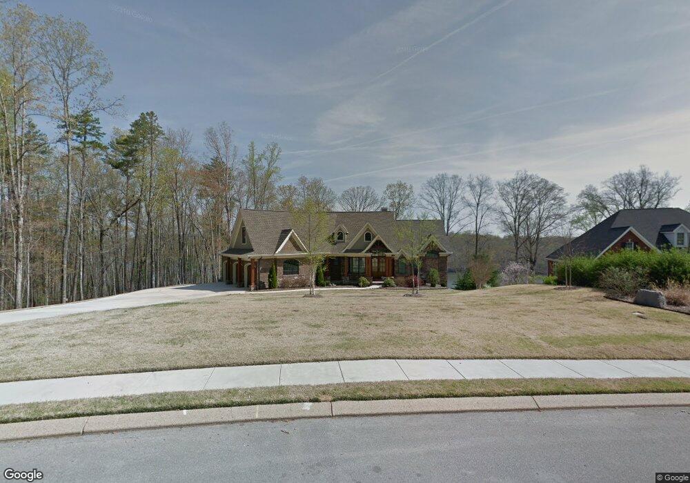
1869 Emerald Pointe Dr Soddy Daisy, TN 37379
Bakewell-Sale Creek NeighborhoodEstimated Value: $741,000 - $1,113,789
--
Bed
--
Bath
3,371
Sq Ft
$276/Sq Ft
Est. Value
About This Home
This home is located at 1869 Emerald Pointe Dr, Soddy Daisy, TN 37379 and is currently estimated at $931,697, approximately $276 per square foot. 1869 Emerald Pointe Dr is a home located in Hamilton County with nearby schools including North Hamilton Elementary School.
Ownership History
Date
Name
Owned For
Owner Type
Purchase Details
Closed on
Jan 26, 2009
Sold by
Weaver Brian T
Bought by
Mead Mitchell A and Mead Tina M
Current Estimated Value
Home Financials for this Owner
Home Financials are based on the most recent Mortgage that was taken out on this home.
Original Mortgage
$161,415
Outstanding Balance
$102,796
Interest Rate
5.24%
Mortgage Type
Seller Take Back
Estimated Equity
$828,901
Purchase Details
Closed on
Jul 20, 2003
Sold by
Weaver Lisa L
Bought by
Weaver Brian T
Purchase Details
Closed on
Sep 26, 2002
Sold by
Thunder Investments Llc
Bought by
Weaver Brian T and Weaver Lisa L
Purchase Details
Closed on
May 10, 2000
Sold by
Joe Speicher Ronald and Lynn Cheryl Lynn
Bought by
Thunder Investments Llc
Create a Home Valuation Report for This Property
The Home Valuation Report is an in-depth analysis detailing your home's value as well as a comparison with similar homes in the area
Home Values in the Area
Average Home Value in this Area
Purchase History
| Date | Buyer | Sale Price | Title Company |
|---|---|---|---|
| Mead Mitchell A | $189,900 | None Available | |
| Weaver Brian T | -- | -- | |
| Weaver Brian T | $89,000 | -- | |
| Thunder Investments Llc | $125,000 | -- |
Source: Public Records
Mortgage History
| Date | Status | Borrower | Loan Amount |
|---|---|---|---|
| Open | Mead Mitchell A | $161,415 |
Source: Public Records
Tax History Compared to Growth
Tax History
| Year | Tax Paid | Tax Assessment Tax Assessment Total Assessment is a certain percentage of the fair market value that is determined by local assessors to be the total taxable value of land and additions on the property. | Land | Improvement |
|---|---|---|---|---|
| 2024 | $4,751 | $212,375 | $0 | $0 |
| 2023 | $4,689 | $209,175 | $0 | $0 |
| 2022 | $4,689 | $209,175 | $0 | $0 |
| 2021 | $4,689 | $209,175 | $0 | $0 |
| 2020 | $4,746 | $171,300 | $0 | $0 |
| 2019 | $4,746 | $171,300 | $0 | $0 |
| 2018 | $4,746 | $171,300 | $0 | $0 |
| 2017 | $4,746 | $171,300 | $0 | $0 |
| 2016 | $4,154 | $0 | $0 | $0 |
| 2015 | $4,154 | $149,900 | $0 | $0 |
| 2014 | $4,154 | $0 | $0 | $0 |
Source: Public Records
Map
Nearby Homes
- 1646 Ritz Way
- 1549 Leighton Dr
- 12800 Blakeslee Dr
- 1444 Leighton Dr
- 12733 Blakeslee Dr
- 1650 Criswell Ct
- 12951 Blakeslee Dr
- 13309 Blakeslee Dr
- 13114 Blakeslee Dr
- 13316 Bellacoola Rd
- 13300 Bellacoola Rd
- 13670 Tonja Ln S
- 13652 Tonja Ln S
- 1344 Spitzy Ln
- 1053 Jonas Dr
- 13777 Tonja Ln S
- 1009 Longo Dr
- 13747 Lillard Rd
- 12612 Emerald Bay Dr
- 126 Nature Trail
- 1881 Emerald Pointe Dr
- 1893 Emerald Pointe Dr
- 1864 Emerald Pointe Dr
- 1829 Emerald Pointe Dr
- 1855 Emerald Pointe Dr
- 1912 Emerald Pointe Dr
- 1919 Emerald Pointe Dr
- 1803 Emerald Pointe Dr
- 1934 Emerald Pointe Dr
- 1943 Emerald Pointe Dr
- 1943 Emerald Pointe Dr Unit LT 48
- 1782 Emerald Pointe Dr
- 1775 Emerald Pointe Dr
- 1965 Emerald Pointe Dr
- 1980 Emerald Pointe Dr
- 1753 Emerald Pointe Dr
- 1979 Emerald Pointe Dr
- 1979 Emerald Pointe Dr Unit LT 50
- 945 Brooke Stone Dr
- 1731 Emerald Pointe Dr