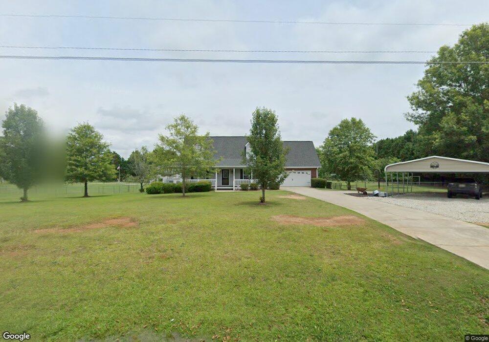
1869 Mt Vernon Rd NW Monroe, GA 30656
Estimated Value: $325,000 - $413,000
3
Beds
3
Baths
1,559
Sq Ft
$232/Sq Ft
Est. Value
About This Home
This home is located at 1869 Mt Vernon Rd NW, Monroe, GA 30656 and is currently estimated at $362,179, approximately $232 per square foot. 1869 Mt Vernon Rd NW is a home located in Walton County with nearby schools including Monroe Elementary School, Carver Middle School, and Monroe Area High School.
Ownership History
Date
Name
Owned For
Owner Type
Purchase Details
Closed on
Dec 14, 2011
Sold by
Camp James Roy
Bought by
Glass Samuel Chadwick and Glass Kimberly A
Current Estimated Value
Home Financials for this Owner
Home Financials are based on the most recent Mortgage that was taken out on this home.
Original Mortgage
$109,183
Outstanding Balance
$74,868
Interest Rate
4.06%
Mortgage Type
New Conventional
Estimated Equity
$287,311
Purchase Details
Closed on
Feb 11, 2011
Sold by
Camp James R
Bought by
Camp James R and Camp Katie M
Home Financials for this Owner
Home Financials are based on the most recent Mortgage that was taken out on this home.
Original Mortgage
$102,400
Interest Rate
4.76%
Mortgage Type
New Conventional
Purchase Details
Closed on
May 14, 2004
Sold by
Mcclellan Carol B
Bought by
Camp James R
Home Financials for this Owner
Home Financials are based on the most recent Mortgage that was taken out on this home.
Original Mortgage
$107,500
Interest Rate
5.77%
Mortgage Type
New Conventional
Create a Home Valuation Report for This Property
The Home Valuation Report is an in-depth analysis detailing your home's value as well as a comparison with similar homes in the area
Home Values in the Area
Average Home Value in this Area
Purchase History
| Date | Buyer | Sale Price | Title Company |
|---|---|---|---|
| Glass Samuel Chadwick | $107,000 | -- | |
| Camp James R | -- | -- | |
| Camp James R | $143,500 | -- |
Source: Public Records
Mortgage History
| Date | Status | Borrower | Loan Amount |
|---|---|---|---|
| Open | Glass Samuel Chadwick | $109,183 | |
| Previous Owner | Camp James R | $102,400 | |
| Previous Owner | Camp James R | $107,500 |
Source: Public Records
Tax History Compared to Growth
Tax History
| Year | Tax Paid | Tax Assessment Tax Assessment Total Assessment is a certain percentage of the fair market value that is determined by local assessors to be the total taxable value of land and additions on the property. | Land | Improvement |
|---|---|---|---|---|
| 2024 | $2,340 | $113,360 | $18,800 | $94,560 |
| 2023 | $1,798 | $103,960 | $15,520 | $88,440 |
| 2022 | $2,239 | $93,240 | $13,880 | $79,360 |
| 2021 | $1,898 | $72,680 | $10,200 | $62,480 |
| 2020 | $1,856 | $68,360 | $8,160 | $60,200 |
| 2019 | $1,755 | $60,680 | $6,520 | $54,160 |
| 2018 | $1,688 | $60,680 | $6,520 | $54,160 |
| 2017 | $1,969 | $57,160 | $4,520 | $52,640 |
| 2016 | $1,465 | $48,760 | $4,480 | $44,280 |
| 2015 | $1,444 | $46,680 | $4,480 | $42,200 |
| 2014 | $1,321 | $39,840 | $4,080 | $35,760 |
Source: Public Records
Map
Nearby Homes
- 1811 Michael Rd
- 2955 Hearn Rd NW
- 0 Hearn Rd NW Unit 10647785
- 729 Belle Vista St
- (GA)The Ellen | Front Entry Plan at Belle Woode Estates
- (GA)The Carson | Front Entry Plan at Belle Woode Estates
- (GA)The Everett | Front Entry Plan at Belle Woode Estates
- 500 Belle Woode St
- (GA)The Avondale | Front Entry Plan at Belle Woode Estates
- (GA)The Ava | Front Entry Plan at Belle Woode Estates
- (GA)The Emerson Ranch | Front Entry Plan at Belle Woode Estates
- 733 Belle Vista St
- TRACT 8 Bradley Gin Rd
- TRACT 4 Bradley Gin Rd
- TRACT 2 Bradley Gin Rd
- TRACT 6 Bradley Gin Rd
- TRACT 5 Bradley Gin Rd
- TRACT 7 Bradley Gin Rd
- TRACT 3 Bradley Gin Rd
- 736 Belle Vista St
- 1869 Mount Vernon Rd NW
- 1930 Michael Rd
- 1910 Michael Rd
- 1845 Mount Vernon Rd NW
- 1850 Michael Rd
- 1929 Mount Vernon Rd NW
- 1910 Mount Vernon Rd NW
- 1799 Mount Vernon Rd NW
- 1840 Mount Vernon Rd NW
- 1810 Michael Rd NW
- 1810 Mount Vernon Rd NW
- 1810 Mt Vernon Rd NW
- 1862 Michael Rd NW
- 1945 Mount Vernon Rd NW
- 1779 Mount Vernon Rd NW
- 1950 Mount Vernon Rd NW
- 1729 Michael Rd
- 1711 Michael Rd
- 1701 Michael Rd
- 1761 Mount Vernon Rd NW