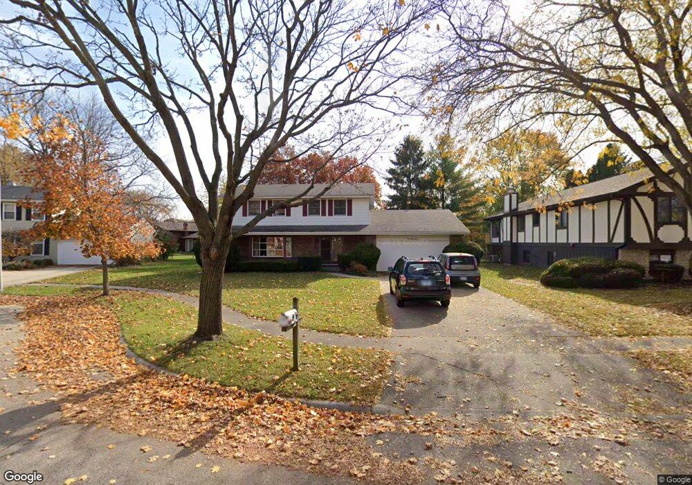
187 Brookside Dr Elgin, IL 60123
North Country Knolls NeighborhoodEstimated Value: $400,682 - $429,000
4
Beds
3
Baths
2,107
Sq Ft
$197/Sq Ft
Est. Value
About This Home
This home is located at 187 Brookside Dr, Elgin, IL 60123 and is currently estimated at $415,421, approximately $197 per square foot. 187 Brookside Dr is a home located in Kane County with nearby schools including Hillcrest Elementary School, Kimball Middle School, and Larkin High School.
Ownership History
Date
Name
Owned For
Owner Type
Purchase Details
Closed on
Apr 16, 2001
Sold by
Hoffmann Gerald Lawrence and Hoffman Mary Kae
Bought by
Clough Thomas G and Macior Clough Mary A
Current Estimated Value
Home Financials for this Owner
Home Financials are based on the most recent Mortgage that was taken out on this home.
Original Mortgage
$109,900
Interest Rate
7.11%
Create a Home Valuation Report for This Property
The Home Valuation Report is an in-depth analysis detailing your home's value as well as a comparison with similar homes in the area
Home Values in the Area
Average Home Value in this Area
Purchase History
| Date | Buyer | Sale Price | Title Company |
|---|---|---|---|
| Clough Thomas G | $220,000 | Chicago Title Insurance Co |
Source: Public Records
Mortgage History
| Date | Status | Borrower | Loan Amount |
|---|---|---|---|
| Previous Owner | Clough Thomas G | $109,900 |
Source: Public Records
Tax History Compared to Growth
Tax History
| Year | Tax Paid | Tax Assessment Tax Assessment Total Assessment is a certain percentage of the fair market value that is determined by local assessors to be the total taxable value of land and additions on the property. | Land | Improvement |
|---|---|---|---|---|
| 2024 | $7,961 | $115,483 | $32,892 | $82,591 |
| 2023 | $7,530 | $104,330 | $29,715 | $74,615 |
| 2022 | $7,295 | $95,131 | $27,095 | $68,036 |
| 2021 | $6,954 | $88,941 | $25,332 | $63,609 |
| 2020 | $6,741 | $84,908 | $24,183 | $60,725 |
| 2019 | $6,527 | $80,880 | $23,036 | $57,844 |
| 2018 | $5,924 | $70,921 | $21,701 | $49,220 |
| 2017 | $5,765 | $67,046 | $20,515 | $46,531 |
| 2016 | $5,461 | $62,200 | $19,032 | $43,168 |
| 2015 | -- | $57,012 | $17,445 | $39,567 |
| 2014 | -- | $56,309 | $17,230 | $39,079 |
| 2013 | -- | $57,794 | $17,684 | $40,110 |
Source: Public Records
Map
Nearby Homes
- 40 Acres Randall Rd
- 92 N Airlite St
- 2705 Colonial Dr
- 1995 Salem Rd
- Geneva Plan at The Villas at Madison Lane
- Lot 1 Highland Springs Dr
- 640 Highland Springs Dr
- 519 Shagbark Dr
- 660 Robin Ridge
- 2214 Colorado Ave Unit 4
- 1755 Country Knoll Ln Unit 11
- 270 Nautical Way
- 609 N Lyle Ave
- 691 Canyon Ln
- 11N060 Johnstown Rd
- 215 2nd St
- 900 Glenmore Ln
- 949 Millcreek Cir
- 391 Cornell Ln
- 908 Glenmore Ln
- 183 Brookside Dr
- 191 Brookside Dr
- 167 Brookside Dr
- 163 Brookside Dr
- 171 Brookside Dr
- 195 Brookside Dr
- 179 Brookside Dr
- 207 Brookside Dr
- 211 Brookside Dr
- 175 Brookside Dr
- 199 Brookside Dr Unit 18
- 159 Brookside Dr Unit 18
- 203 Brookside Dr
- 147 Brookside Dr
- 227 Brookside Dr
- 155 Brookside Dr Unit 18
- 143 Brookside Dr Unit 18
- 231 Brookside Dr
- 196 Westgate Dr
- 176 Westgate Dr