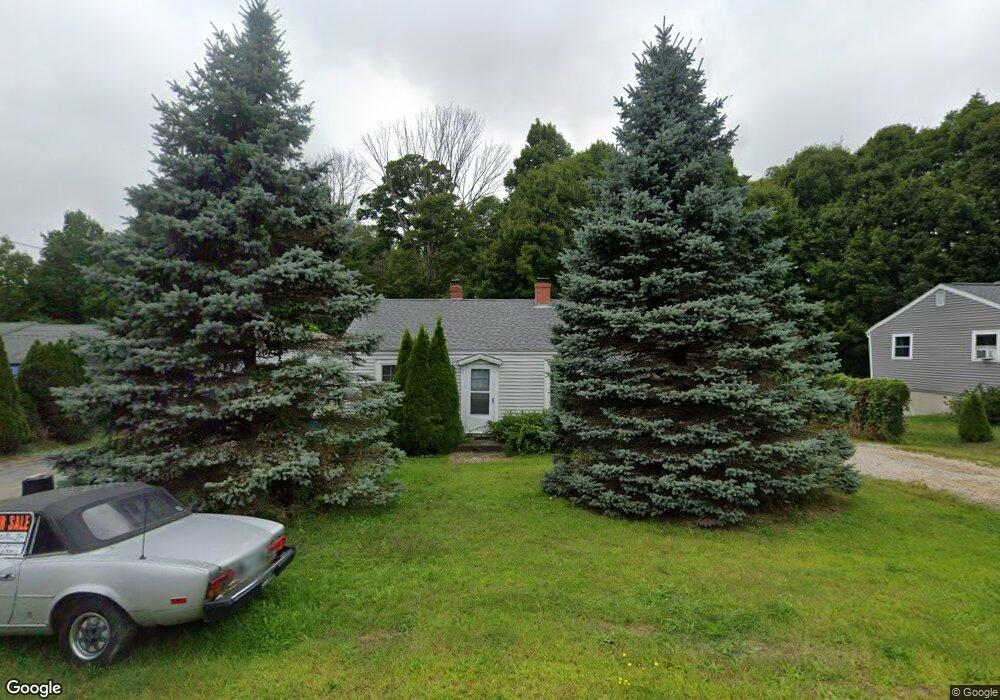
187 Edmond Ave Portsmouth, NH 03801
Woodbury-Maplewood NeighborhoodEstimated Value: $622,000 - $705,000
3
Beds
1
Bath
1,090
Sq Ft
$603/Sq Ft
Est. Value
About This Home
This home is located at 187 Edmond Ave, Portsmouth, NH 03801 and is currently estimated at $657,315, approximately $603 per square foot. 187 Edmond Ave is a home located in Rockingham County with nearby schools including New Franklin School, Portsmouth Middle School, and Portsmouth High School.
Ownership History
Date
Name
Owned For
Owner Type
Purchase Details
Closed on
Feb 11, 2019
Sold by
Khalil Rafic Y
Bought by
Khalil Rafic Y and Viel Robert
Current Estimated Value
Purchase Details
Closed on
Jan 6, 2005
Sold by
Hersh Leo J
Bought by
Khalil Rafie Y
Home Financials for this Owner
Home Financials are based on the most recent Mortgage that was taken out on this home.
Original Mortgage
$213,122
Interest Rate
5.75%
Mortgage Type
Purchase Money Mortgage
Purchase Details
Closed on
Apr 30, 1998
Sold by
Pechner Allan I
Bought by
Hersh Leo J
Home Financials for this Owner
Home Financials are based on the most recent Mortgage that was taken out on this home.
Original Mortgage
$82,600
Interest Rate
7.04%
Mortgage Type
Purchase Money Mortgage
Create a Home Valuation Report for This Property
The Home Valuation Report is an in-depth analysis detailing your home's value as well as a comparison with similar homes in the area
Home Values in the Area
Average Home Value in this Area
Purchase History
| Date | Buyer | Sale Price | Title Company |
|---|---|---|---|
| Khalil Rafic Y | -- | -- | |
| Khalil Rafie Y | $215,000 | -- | |
| Hersh Leo J | $115,000 | -- |
Source: Public Records
Mortgage History
| Date | Status | Borrower | Loan Amount |
|---|---|---|---|
| Previous Owner | Hersh Leo J | $208,000 | |
| Previous Owner | Hersh Leo J | $197,000 | |
| Previous Owner | Hersh Leo J | $213,122 | |
| Previous Owner | Hersh Leo J | $82,600 |
Source: Public Records
Tax History Compared to Growth
Tax History
| Year | Tax Paid | Tax Assessment Tax Assessment Total Assessment is a certain percentage of the fair market value that is determined by local assessors to be the total taxable value of land and additions on the property. | Land | Improvement |
|---|---|---|---|---|
| 2024 | $6,092 | $544,900 | $292,400 | $252,500 |
| 2023 | $5,365 | $332,600 | $195,000 | $137,600 |
| 2022 | $5,056 | $332,600 | $195,000 | $137,600 |
| 2021 | $4,999 | $332,600 | $195,000 | $137,600 |
| 2020 | $0 | $331,000 | $193,400 | $137,600 |
| 2019 | $4,919 | $331,000 | $193,400 | $137,600 |
| 2018 | $4,845 | $305,900 | $182,800 | $123,100 |
| 2017 | $0 | $291,900 | $168,800 | $123,100 |
| 2016 | $4,270 | $250,600 | $146,700 | $103,900 |
| 2015 | $4,208 | $250,600 | $146,700 | $103,900 |
| 2014 | $4,244 | $234,500 | $135,700 | $98,800 |
| 2013 | $4,200 | $234,500 | $135,700 | $98,800 |
| 2012 | $4,114 | $234,400 | $135,700 | $98,700 |
Source: Public Records
Map
Nearby Homes
- 31 Eden Ln Unit 5
- 27 Eden Ln Unit 4
- 15 Eden Ln Unit 1
- 19 Eden Ln Unit 2
- 281 Dennett St
- 14 Birch St
- 25 Mangrove St
- 201 Kearsarge Way
- 9 Prospect St Unit 1
- 12 Ruth St
- 255 Thornton St
- 88 Farm Ln
- 3 Shearwater Dr Unit 1900
- 216 Woodbury Ave
- 19 Shearwater Dr Unit 1903
- 15 Shearwater Dr Unit 1902
- 37 Shearwater Dr Unit 1906
- 6 Boyd Rd
- #3 Woodbury Reserve Rd Unit 3
- #5 Woodbury Reserve Unit 5