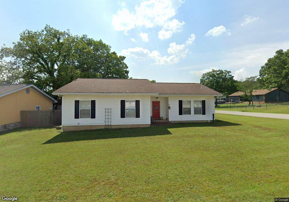
187 Enterprise Ln Branson, MO 65616
Table Rock NeighborhoodEstimated Value: $213,467 - $235,000
Studio
--
Bath
1,592
Sq Ft
$143/Sq Ft
Est. Value
About This Home
This home is located at 187 Enterprise Ln, Branson, MO 65616 and is currently estimated at $227,117, approximately $142 per square foot. 187 Enterprise Ln is a home located in Taney County with nearby schools including Cedar Ridge Primary, Cedar Ridge Intermediate School, and Cedar Ridge Elementary School.
Ownership History
Date
Name
Owned For
Owner Type
Purchase Details
Closed on
Aug 22, 2024
Sold by
Davis Gabina Dominguez and Davis Terrence
Bought by
Wiley Guadalupe
Current Estimated Value
Purchase Details
Closed on
Mar 6, 2019
Sold by
Torres Macaela and Ascension Rico Gutierrez J
Bought by
Wiley Guadalupe
Home Financials for this Owner
Home Financials are based on the most recent Mortgage that was taken out on this home.
Original Mortgage
$98,188
Interest Rate
4.5%
Mortgage Type
FHA
Purchase Details
Closed on
Jun 7, 2017
Sold by
Anglen Randy S
Bought by
Torres Macaela
Purchase Details
Closed on
Nov 16, 2016
Sold by
The Southpaw Enigma Llc
Bought by
Anglen Randy S
Create a Home Valuation Report for This Property
The Home Valuation Report is an in-depth analysis detailing your home's value as well as a comparison with similar homes in the area
Home Values in the Area
Average Home Value in this Area
Purchase History
| Date | Buyer | Sale Price | Title Company |
|---|---|---|---|
| Wiley Guadalupe | -- | None Listed On Document | |
| Wiley Guadalupe | -- | Waco Title Company Branson | |
| Torres Macaela | -- | None Available | |
| Anglen Randy S | -- | None Available |
Source: Public Records
Mortgage History
| Date | Status | Borrower | Loan Amount |
|---|---|---|---|
| Previous Owner | Wiley Guadalupe | $98,188 |
Source: Public Records
Tax History
| Year | Tax Paid | Tax Assessment Tax Assessment Total Assessment is a certain percentage of the fair market value that is determined by local assessors to be the total taxable value of land and additions on the property. | Land | Improvement |
|---|---|---|---|---|
| 2025 | $783 | $13,210 | -- | -- |
| 2023 | $783 | $14,640 | $0 | $0 |
| 2022 | $761 | $14,640 | $0 | $0 |
| 2021 | $756 | $14,640 | $0 | $0 |
| 2019 | $704 | $13,060 | $0 | $0 |
| 2018 | $704 | $13,060 | $0 | $0 |
| 2017 | $693 | $12,970 | $0 | $0 |
| 2016 | $691 | $12,970 | $0 | $0 |
| 2015 | $685 | $12,970 | $0 | $0 |
| 2014 | $625 | $12,410 | $0 | $0 |
Source: Public Records
Map
Nearby Homes
- 145 Grand Ave
- 175 Avondale Dr Unit 15
- 175 Avondale Dr Unit 11
- 175 Avondale Dr Unit 5
- 161 Avondale Dr Unit 12
- 189 Avondale Dr Unit 3
- 189 Avondale Dr Unit 5
- 189 Avondale Dr Unit 6
- 193 Avondale Dr Unit 10
- 000 Skyview Dr
- 000 Terrace
- 444 Elizabeth Dr
- 439 Grand Ave
- 1690 Skyview Dr
- 130 Trafalgar Dr
- 329 Lancashire Dr
- 1125 Skyview Dr
- 175 Meadow Brook Ln Unit 2-2
- 200 Meadow Ridge Ln Unit 6-4
- 195 Meadow Brook Ln Unit 4
- 187 Enterprise Ln
- 137 Plaza Dr
- 217 Enterprise Ln
- 140 Plaza Dr
- 2400 State Highway 165
- 0 Irish Ln Unit 60090832
- 0 Irish Ln Unit 60090833
- 186 Plaza
- 225 Enterprise Ln
- 180 Plaza Dr
- 133 Elizabeth Dr
- 2400 Missouri 165
- 2400 Missouri 165
- 190 Plaza Dr
- 2456 Historic Highway 165
- 2456 State Highway 165
- 2456 State Highway 165
- 206 Plaza Dr
- 207 Elizabeth Dr
- 215 Elizabeth Dr
Your Personal Tour Guide
Ask me questions while you tour the home.