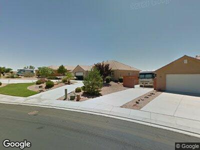
187 N 2650 W Hurricane, UT 84737
Estimated Value: $490,051 - $566,000
3
Beds
2
Baths
1,909
Sq Ft
$274/Sq Ft
Est. Value
About This Home
This home is located at 187 N 2650 W, Hurricane, UT 84737 and is currently estimated at $522,263, approximately $273 per square foot. 187 N 2650 W is a home located in Washington County with nearby schools including Hurricane Elementary School, Hurricane High School, and Hurricane Middle School.
Ownership History
Date
Name
Owned For
Owner Type
Purchase Details
Closed on
Jul 21, 2011
Sold by
Schreiber Lloyd J and Schreiber Kristine S
Bought by
Schreiber Lloyd J and Schreiber Kristine S
Current Estimated Value
Home Financials for this Owner
Home Financials are based on the most recent Mortgage that was taken out on this home.
Original Mortgage
$322,500
Interest Rate
4.46%
Mortgage Type
Reverse Mortgage Home Equity Conversion Mortgage
Purchase Details
Closed on
Sep 20, 2006
Sold by
Schreiber Lloyd J and Schreiber Kristine S
Bought by
Schreiber Lloyd J and Schreiber Kristine S
Create a Home Valuation Report for This Property
The Home Valuation Report is an in-depth analysis detailing your home's value as well as a comparison with similar homes in the area
Home Values in the Area
Average Home Value in this Area
Purchase History
| Date | Buyer | Sale Price | Title Company |
|---|---|---|---|
| Schreiber Lloyd J | -- | Provo Land Title Co | |
| Schreiber Lloyd J | -- | None Available |
Source: Public Records
Mortgage History
| Date | Status | Borrower | Loan Amount |
|---|---|---|---|
| Closed | Schreiber Lloyd J | $322,500 |
Source: Public Records
Tax History Compared to Growth
Tax History
| Year | Tax Paid | Tax Assessment Tax Assessment Total Assessment is a certain percentage of the fair market value that is determined by local assessors to be the total taxable value of land and additions on the property. | Land | Improvement |
|---|---|---|---|---|
| 2023 | $1,985 | $266,255 | $57,750 | $208,505 |
| 2022 | $2,025 | $254,650 | $55,000 | $199,650 |
| 2021 | $1,955 | $359,600 | $70,000 | $289,600 |
| 2020 | $1,757 | $305,300 | $55,000 | $250,300 |
| 2019 | $1,687 | $284,300 | $50,000 | $234,300 |
| 2018 | $1,671 | $144,870 | $0 | $0 |
| 2017 | $1,631 | $136,015 | $0 | $0 |
| 2016 | $1,603 | $129,470 | $0 | $0 |
| 2015 | $1,534 | $119,295 | $0 | $0 |
| 2014 | $1,448 | $117,150 | $0 | $0 |
Source: Public Records
Map
Nearby Homes
- 68 Cinder St
- 138 Ash St Unit 138
- 0 Approx 2700 W State St
- 108 Blackrock Rd
- 2711 W 270 N
- 107 Black Rock Rd
- 105 Black Rock Rd
- 2578 W 225 N
- 105 S Black Rock
- 2738 W 270 N
- 2583 W 260 N
- 2241 W 320 N
- 2129 W 320 N
- 2242 W 320 N Unit 16
- 2242 W 320 N
- 2227 W 320 N
- 2078 W 320 N Unit 44
- 2092 W 320 N Unit 46
- 2086 W 320 N Unit 45
- 2054 W 320 N
- 187 N 2650 W
- 185 N 2650 W
- 189 N 2650 W
- 183 N 2650 W Unit 18
- 183 N 2650 W
- Lot #18 Rio Del Sol
- 183 N 2650 Unit 18
- 2649 W 190 N
- 191 N 2650 W
- 191 N 2650 W Unit 19
- 2648 W 175 N
- 2639 W 190 N
- 2642 W 175 N
- 177 N 2650 W Unit 17
- 195 N 2650 W
- 2657 W 175 N
- 2657 W 175 N Unit 16
- 8.16 Acres Approx 2700 W
- 2649 W 200 N
- 2635 W 190 N