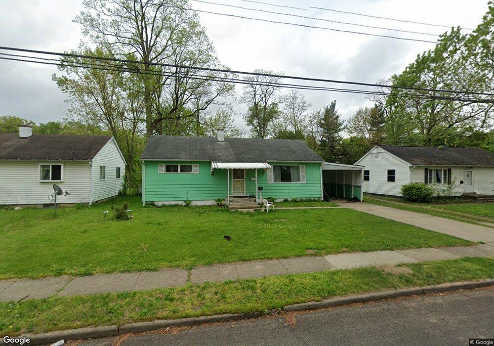
187 Spaulding Ave W Battle Creek, MI 49037
Urbandale NeighborhoodEstimated Value: $138,000 - $159,000
3
Beds
1
Bath
1,025
Sq Ft
$141/Sq Ft
Est. Value
About This Home
This home is located at 187 Spaulding Ave W, Battle Creek, MI 49037 and is currently estimated at $144,588, approximately $141 per square foot. 187 Spaulding Ave W is a home located in Calhoun County with nearby schools including LaMora Park School, Northwestern Middle School, and Battle Creek Central High School.
Ownership History
Date
Name
Owned For
Owner Type
Purchase Details
Closed on
Apr 14, 2022
Sold by
Campbell Julie A
Bought by
New Day Homes Llc
Current Estimated Value
Home Financials for this Owner
Home Financials are based on the most recent Mortgage that was taken out on this home.
Original Mortgage
$65,000
Outstanding Balance
$58,542
Interest Rate
1%
Mortgage Type
New Conventional
Estimated Equity
$86,046
Purchase Details
Closed on
May 8, 2019
Sold by
Hardin Denise H
Bought by
Campbell Julie A and Flook Julie A
Purchase Details
Closed on
Jan 20, 2012
Sold by
Jung Ila M
Bought by
Jung Ila M and Flook Julie A
Create a Home Valuation Report for This Property
The Home Valuation Report is an in-depth analysis detailing your home's value as well as a comparison with similar homes in the area
Home Values in the Area
Average Home Value in this Area
Purchase History
| Date | Buyer | Sale Price | Title Company |
|---|---|---|---|
| New Day Homes Llc | $74,500 | None Listed On Document | |
| Campbell Julie A | -- | None Available | |
| Jung Ila M | -- | None Available |
Source: Public Records
Mortgage History
| Date | Status | Borrower | Loan Amount |
|---|---|---|---|
| Open | New Day Homes Llc | $65,000 |
Source: Public Records
Tax History Compared to Growth
Tax History
| Year | Tax Paid | Tax Assessment Tax Assessment Total Assessment is a certain percentage of the fair market value that is determined by local assessors to be the total taxable value of land and additions on the property. | Land | Improvement |
|---|---|---|---|---|
| 2025 | -- | $66,700 | $0 | $0 |
| 2024 | $2,535 | $62,488 | $0 | $0 |
| 2023 | $2,390 | $51,224 | $0 | $0 |
| 2022 | $1,698 | $45,824 | $0 | $0 |
| 2021 | $2,271 | $43,710 | $0 | $0 |
| 2020 | $2,246 | $40,634 | $0 | $0 |
| 2019 | $1,213 | $37,884 | $0 | $0 |
| 2018 | $1,213 | $32,696 | $1,033 | $31,663 |
| 2017 | $1,176 | $27,067 | $0 | $0 |
| 2016 | $1,174 | $26,355 | $0 | $0 |
| 2015 | $1,150 | $25,742 | $2,948 | $22,794 |
| 2014 | $1,150 | $24,958 | $2,948 | $22,010 |
Source: Public Records
Map
Nearby Homes
- 163 Spaulding Ave W
- 116 Geneva Ave
- 35 Avery Ave
- 1823 Michigan Ave W
- 180 Woodlawn Ave N
- 1528 Michigan Ave W
- 33 Shellenberger Ave
- 213 Broadway Blvd
- 53 Lamora Ave
- 84 Lamora Ave
- 81 Taylor Ave
- 232 Woodlawn Ave N
- 244 Woodlawn Ave N
- 40 Kellogg St
- 133 Mosher Ave
- 217 Creekview Dr
- 430 Presidential Dr
- 420 Presidential Dr
- 134 Creekview Dr
- 137 Dunning Ave
- 191 Spaulding Ave W
- 183 Spaulding Ave W
- 195 Spaulding Ave W
- 179 Spaulding Ave W
- 27 Ashland Ave
- 35 Ashland Ave
- 23 Ashland Ave
- 199 Spaulding Ave W
- 39 Ashland Ave
- 184 Spaulding Ave W
- 175 Spaulding Ave W
- 19 Ashland Ave
- 200 B__2f Spaulding
- 192 Spaulding Ave W
- 43 Ashland Ave
- 176 Spaulding Ave W
- 205 Spaulding Ave W
- 171 Spaulding Ave W
- 200 Spaulding Ave W
- 47 Ashland Ave