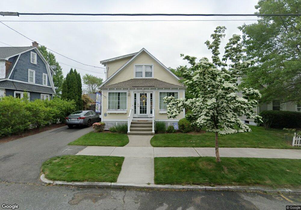
187 Winton St Springfield, MA 01118
East Forest Park NeighborhoodEstimated Value: $327,905 - $365,000
4
Beds
2
Baths
1,464
Sq Ft
$234/Sq Ft
Est. Value
About This Home
This home is located at 187 Winton St, Springfield, MA 01118 and is currently estimated at $343,226, approximately $234 per square foot. 187 Winton St is a home located in Hampden County with nearby schools including Mary A. Dryden Veterans Memorial School, M Marcus Kiley Middle, and Springfield High School of Science and Technology.
Ownership History
Date
Name
Owned For
Owner Type
Purchase Details
Closed on
Nov 15, 2000
Sold by
Brock Robert S and Brock Mary G
Bought by
Kuczarsk Christopher
Current Estimated Value
Home Financials for this Owner
Home Financials are based on the most recent Mortgage that was taken out on this home.
Original Mortgage
$111,150
Outstanding Balance
$40,664
Interest Rate
7.78%
Mortgage Type
Purchase Money Mortgage
Estimated Equity
$302,562
Purchase Details
Closed on
Feb 26, 1997
Sold by
Hurley Brian C and Hurley Nancy A
Bought by
Brock Robert S and Brock Mary G
Purchase Details
Closed on
Nov 4, 1988
Sold by
Kidd Raysa R
Bought by
Hurley Brian R
Create a Home Valuation Report for This Property
The Home Valuation Report is an in-depth analysis detailing your home's value as well as a comparison with similar homes in the area
Home Values in the Area
Average Home Value in this Area
Purchase History
| Date | Buyer | Sale Price | Title Company |
|---|---|---|---|
| Kuczarsk Christopher | $117,000 | -- | |
| Brock Robert S | $104,500 | -- | |
| Hurley Brian R | $93,000 | -- |
Source: Public Records
Mortgage History
| Date | Status | Borrower | Loan Amount |
|---|---|---|---|
| Open | Hurley Brian R | $16,000 | |
| Closed | Hurley Brian R | $10,800 | |
| Open | Hurley Brian R | $111,150 |
Source: Public Records
Tax History
| Year | Tax Paid | Tax Assessment Tax Assessment Total Assessment is a certain percentage of the fair market value that is determined by local assessors to be the total taxable value of land and additions on the property. | Land | Improvement |
|---|---|---|---|---|
| 2025 | $4,594 | $293,000 | $46,800 | $246,200 |
| 2024 | $3,914 | $243,700 | $46,800 | $196,900 |
| 2023 | $3,756 | $220,300 | $44,600 | $175,700 |
| 2022 | $3,604 | $191,500 | $44,600 | $146,900 |
| 2021 | $3,262 | $172,600 | $40,500 | $132,100 |
| 2020 | $3,318 | $169,900 | $40,500 | $129,400 |
| 2019 | $3,342 | $169,800 | $40,500 | $129,300 |
| 2018 | $3,109 | $158,000 | $40,500 | $117,500 |
| 2017 | $3,079 | $156,600 | $40,500 | $116,100 |
| 2016 | $2,986 | $151,900 | $40,500 | $111,400 |
| 2015 | $2,982 | $151,600 | $40,500 | $111,100 |
Source: Public Records
Map
Nearby Homes
Your Personal Tour Guide
Ask me questions while you tour the home.