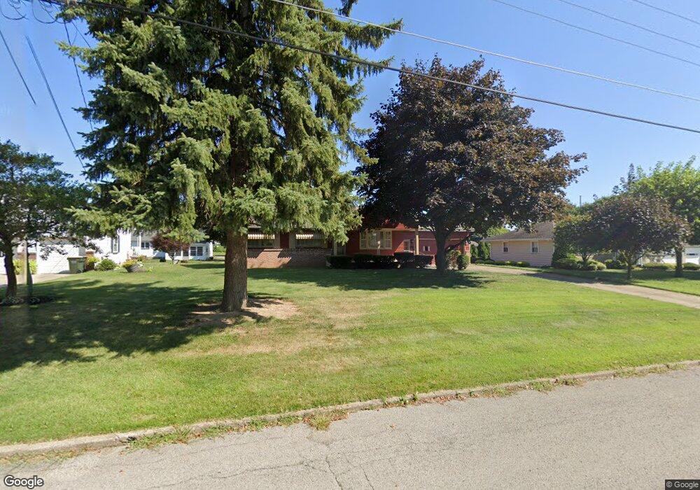
1870 Palo Verde Dr Youngstown, OH 44514
Estimated Value: $135,000 - $159,000
3
Beds
1
Bath
1,080
Sq Ft
$137/Sq Ft
Est. Value
About This Home
This home is located at 1870 Palo Verde Dr, Youngstown, OH 44514 and is currently estimated at $148,356, approximately $137 per square foot. 1870 Palo Verde Dr is a home located in Mahoning County with nearby schools including Paul C. Bunn Elementary School, Clear Horizons Early College High School, and Chaney High School.
Ownership History
Date
Name
Owned For
Owner Type
Purchase Details
Closed on
Jan 27, 2024
Sold by
Palotsee Michael J and Palotsee Patrizia
Bought by
Palotsee Michael J and Palotsee Landon R
Current Estimated Value
Home Financials for this Owner
Home Financials are based on the most recent Mortgage that was taken out on this home.
Original Mortgage
$40,105
Interest Rate
6.99%
Mortgage Type
New Conventional
Purchase Details
Closed on
Sep 19, 2023
Sold by
Bakos Cynthia J
Bought by
Palotsee Michael J
Purchase Details
Closed on
Mar 28, 2014
Sold by
Palotsee Michael J and Palotsee Paticia A
Bought by
Palotsee Robert R and Palotsee Janet Ann
Purchase Details
Closed on
Apr 26, 2012
Sold by
Palotsee Robert R and Palotsee Janet Ann
Bought by
Palotsee Michael J and Bakos Cynthia J
Purchase Details
Closed on
Feb 9, 1962
Bought by
Palotsee Robert R
Create a Home Valuation Report for This Property
The Home Valuation Report is an in-depth analysis detailing your home's value as well as a comparison with similar homes in the area
Home Values in the Area
Average Home Value in this Area
Purchase History
| Date | Buyer | Sale Price | Title Company |
|---|---|---|---|
| Palotsee Michael J | -- | Visionet Services | |
| Palotsee Michael J | -- | None Listed On Document | |
| Palotsee Michael J | -- | None Listed On Document | |
| Palotsee Robert R | -- | Attorney | |
| Palotsee Michael J | -- | Attorney | |
| Palotsee Robert R | -- | -- |
Source: Public Records
Mortgage History
| Date | Status | Borrower | Loan Amount |
|---|---|---|---|
| Previous Owner | Palotsee Michael J | $40,105 |
Source: Public Records
Tax History Compared to Growth
Tax History
| Year | Tax Paid | Tax Assessment Tax Assessment Total Assessment is a certain percentage of the fair market value that is determined by local assessors to be the total taxable value of land and additions on the property. | Land | Improvement |
|---|---|---|---|---|
| 2024 | $2,240 | $38,670 | $6,400 | $32,270 |
| 2023 | $1,100 | $22,460 | $5,740 | $16,720 |
| 2022 | $1,047 | $22,460 | $5,740 | $16,720 |
| 2021 | $1,047 | $22,460 | $5,740 | $16,720 |
| 2020 | $1,052 | $22,460 | $5,740 | $16,720 |
| 2019 | $974 | $19,360 | $4,950 | $14,410 |
| 2018 | $886 | $19,360 | $4,950 | $14,410 |
| 2017 | $868 | $19,360 | $4,950 | $14,410 |
| 2016 | $1,058 | $22,550 | $6,050 | $16,500 |
| 2015 | $1,040 | $22,550 | $6,050 | $16,500 |
| 2014 | $1,033 | $22,550 | $6,050 | $16,500 |
| 2013 | $1,021 | $22,550 | $6,050 | $16,500 |
Source: Public Records
Map
Nearby Homes
- 1913 Country Club Ave
- 1720 Sequoya Dr
- 0 Lemoyne Ave
- 1645 Chattanooga Ave
- 2021 Country Club Ave
- 1933 Brandon Ave
- 1828 Basil Ave
- 1543 Lynn Ave
- 1514 Thalia Ave
- 1830 Halbert Dr
- 1661 Wakefield Ave
- 1553 Bancroft Ave
- 1633 Wakefield Ave
- 1919 Wingate Rd
- 2002 Bancroft Ave
- 1579 Wakefield Ave
- 1841 Wingate Rd
- 0 Woodlawn Ave
- 1513 Wakefield Ave
- 2001 Brownlee Ave
- 1880 Palo Verde Dr
- 1860 Palo Verde Dr
- 1865 Country Club Ave
- 1850 Palo Verde Dr
- 1875 Palo Verde Dr
- 5020 Sheridan Rd
- 1865 Palo Verde Dr
- 1885 Palo Verde Dr
- 5016 Sheridan Rd
- 1855 Country Club Ave
- 5010 Sheridan Rd
- 1855 Palo Verde Dr
- 5030 Sheridan Rd
- 1840 Palo Verde Dr
- 1845 Country Club Ave
- 1870 Sequoya Dr
- 1676 Country Club Ave
- 1860 Sequoya Dr
- 1845 Palo Verde Dr
- 1880 Sequoya Dr