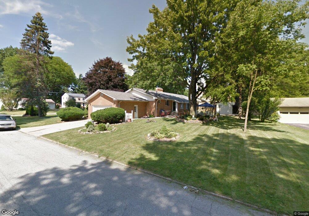
1871 Cover Dr Youngstown, OH 44514
Estimated Value: $237,000 - $290,371
3
Beds
2
Baths
1,984
Sq Ft
$133/Sq Ft
Est. Value
About This Home
This home is located at 1871 Cover Dr, Youngstown, OH 44514 and is currently estimated at $264,093, approximately $133 per square foot. 1871 Cover Dr is a home located in Mahoning County with nearby schools including Poland Union Elementary School, Poland Middle School, and Poland Seminary High School.
Ownership History
Date
Name
Owned For
Owner Type
Purchase Details
Closed on
Apr 3, 2002
Sold by
Bobeck Joseph S
Bought by
Elchammas Nicolas and Alisse Mireille A
Current Estimated Value
Home Financials for this Owner
Home Financials are based on the most recent Mortgage that was taken out on this home.
Original Mortgage
$101,150
Outstanding Balance
$41,961
Interest Rate
6.82%
Estimated Equity
$222,132
Purchase Details
Closed on
Dec 5, 2001
Sold by
Estate Of Joseph Stanley Bobeck
Bought by
Bobeck Joseph A
Purchase Details
Closed on
Oct 19, 2000
Sold by
Estate Of Margaret M Bobeck
Bought by
Bobeck Joseph S
Create a Home Valuation Report for This Property
The Home Valuation Report is an in-depth analysis detailing your home's value as well as a comparison with similar homes in the area
Home Values in the Area
Average Home Value in this Area
Purchase History
| Date | Buyer | Sale Price | Title Company |
|---|---|---|---|
| Elchammas Nicolas | $119,000 | -- | |
| Bobeck Joseph A | -- | -- | |
| Bobeck Joseph S | -- | -- |
Source: Public Records
Mortgage History
| Date | Status | Borrower | Loan Amount |
|---|---|---|---|
| Open | Elchammas Nicolas | $101,150 |
Source: Public Records
Tax History Compared to Growth
Tax History
| Year | Tax Paid | Tax Assessment Tax Assessment Total Assessment is a certain percentage of the fair market value that is determined by local assessors to be the total taxable value of land and additions on the property. | Land | Improvement |
|---|---|---|---|---|
| 2024 | $4,708 | $91,300 | $10,010 | $81,290 |
| 2023 | $4,652 | $91,300 | $10,010 | $81,290 |
| 2022 | $3,436 | $55,840 | $10,220 | $45,620 |
| 2021 | $3,441 | $55,840 | $10,220 | $45,620 |
| 2020 | $3,455 | $55,840 | $10,220 | $45,620 |
| 2019 | $3,161 | $46,160 | $8,450 | $37,710 |
| 2018 | $2,902 | $46,160 | $8,450 | $37,710 |
| 2017 | $2,899 | $46,160 | $8,450 | $37,710 |
| 2016 | $2,654 | $40,470 | $8,450 | $32,020 |
| 2015 | $2,603 | $40,470 | $8,450 | $32,020 |
| 2014 | $2,612 | $40,470 | $8,450 | $32,020 |
| 2013 | $2,581 | $40,470 | $8,450 | $32,020 |
Source: Public Records
Map
Nearby Homes
- 1827 Alverne Dr
- 1804 Alverne Dr
- 1738 Island Dr
- 1 Michigan Ave
- 43 Venloe Dr
- 8360 South Ave
- 34 Venloe Dr
- 2035 Woodward Ave
- 1894 Lealand Ave
- 1859 Mathews Rd
- 2295 Bel Aire Ln
- 1890 Mathews Rd
- 2379 Clyde St
- 0 Mathews Rd Unit 5149232
- 0 Mathews Rd Unit 5143059
- 829 Pearson Cir
- 2153 Lyon Blvd
- 2307 Hamilton Ave
- 2128 Lyon Blvd
- 816 Pearson Un#1