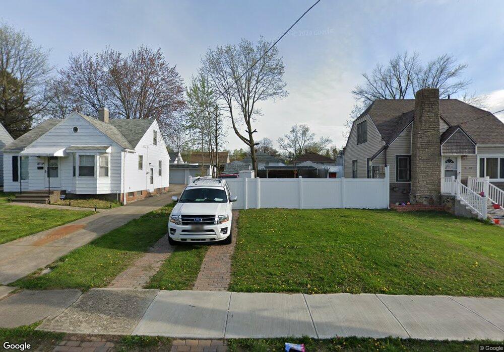
18721 Raymond St Maple Heights, OH 44137
Estimated Value: $59,000 - $186,048
3
Beds
1
Bath
1,020
Sq Ft
$136/Sq Ft
Est. Value
About This Home
This home is located at 18721 Raymond St, Maple Heights, OH 44137 and is currently estimated at $138,262, approximately $135 per square foot. 18721 Raymond St is a home located in Cuyahoga County with nearby schools including Abraham Lincoln Elementary School, Rockside/ J.F. Kennedy School, and Italy High School.
Ownership History
Date
Name
Owned For
Owner Type
Purchase Details
Closed on
Jun 5, 2020
Sold by
Cuyahoga County Land Reutilization Corp
Bought by
Pedraza Jorge
Current Estimated Value
Purchase Details
Closed on
Aug 24, 2016
Sold by
Lathon Sancho
Bought by
Cuyahoga County Land Reutilization Corp
Purchase Details
Closed on
Feb 4, 2007
Sold by
Lembo David F and Lembo Leslie
Bought by
Lathon Sancho
Home Financials for this Owner
Home Financials are based on the most recent Mortgage that was taken out on this home.
Original Mortgage
$94,500
Interest Rate
6.31%
Mortgage Type
Stand Alone First
Purchase Details
Closed on
Feb 23, 2004
Sold by
Northcoast Real Estate Mgt Ltd
Bought by
Lembo David F
Purchase Details
Closed on
Dec 27, 2002
Sold by
Bank One National Assn
Bought by
North Coast Real Estate Management Ltd
Purchase Details
Closed on
Mar 19, 2002
Sold by
White Sheldon
Bought by
Bank One Na
Purchase Details
Closed on
Oct 28, 1999
Sold by
Parrilla John A and Parrilla Dawn M
Bought by
White Sheldon
Home Financials for this Owner
Home Financials are based on the most recent Mortgage that was taken out on this home.
Original Mortgage
$77,350
Interest Rate
10.85%
Mortgage Type
Purchase Money Mortgage
Purchase Details
Closed on
Nov 23, 1998
Sold by
Parrilla John A
Bought by
Parrilla John A and Parrilla Dawn M
Home Financials for this Owner
Home Financials are based on the most recent Mortgage that was taken out on this home.
Original Mortgage
$65,250
Interest Rate
7.01%
Mortgage Type
Balloon
Purchase Details
Closed on
Oct 29, 1993
Sold by
Parrilla Jose A
Bought by
Parrilla John A
Purchase Details
Closed on
Jul 30, 1991
Bought by
Parrilla Jose A
Purchase Details
Closed on
Sep 14, 1990
Sold by
Luiz Robert A
Bought by
Sec. Of Veterans Affairs
Purchase Details
Closed on
Nov 21, 1984
Sold by
Viskocil Anna C
Bought by
Ochwat Alice J
Purchase Details
Closed on
Jan 1, 1975
Bought by
Viskocil Anna C
Create a Home Valuation Report for This Property
The Home Valuation Report is an in-depth analysis detailing your home's value as well as a comparison with similar homes in the area
Home Values in the Area
Average Home Value in this Area
Purchase History
| Date | Buyer | Sale Price | Title Company |
|---|---|---|---|
| Pedraza Jorge | -- | None Available | |
| Cuyahoga County Land Reutilization Corp | $39,875 | None Available | |
| Lathon Sancho | $105,000 | Stewart Title Agency | |
| Lembo David F | -- | -- | |
| North Coast Real Estate Management Ltd | $45,000 | Resource Title Agency Inc | |
| Bank One Na | $60,000 | -- | |
| White Sheldon | $73,500 | First Service Title Agency I | |
| Parrilla John A | -- | Trident Title Agency | |
| Parrilla John A | $52,000 | -- | |
| Parrilla Jose A | -- | -- | |
| Sec. Of Veterans Affairs | -- | -- | |
| Ochwat Alice J | -- | -- | |
| Viskocil Anna C | -- | -- |
Source: Public Records
Mortgage History
| Date | Status | Borrower | Loan Amount |
|---|---|---|---|
| Previous Owner | Lathon Sancho | $94,500 | |
| Previous Owner | White Sheldon | $77,350 | |
| Previous Owner | Parrilla John A | $65,250 |
Source: Public Records
Tax History Compared to Growth
Tax History
| Year | Tax Paid | Tax Assessment Tax Assessment Total Assessment is a certain percentage of the fair market value that is determined by local assessors to be the total taxable value of land and additions on the property. | Land | Improvement |
|---|---|---|---|---|
| 2024 | $230 | $1,050 | $1,050 | -- |
| 2023 | $229 | $1,050 | $1,050 | $0 |
| 2022 | $229 | $1,050 | $1,050 | $0 |
| 2021 | $236 | $1,050 | $1,050 | $0 |
| 2020 | $132 | $2,700 | $2,700 | $0 |
| 2019 | $122 | $0 | $0 | $0 |
| 2018 | $122 | $2,700 | $2,700 | $0 |
| 2017 | $349 | $0 | $0 | $0 |
| 2016 | $1,570 | $11,770 | $2,700 | $9,070 |
| 2015 | $27,720 | $11,770 | $2,700 | $9,070 |
| 2014 | $27,720 | $12,920 | $2,980 | $9,940 |
Source: Public Records
Map
Nearby Homes
- 19309 Nitra Ave
- 5165 Camden Rd
- 5234 Erwin St
- 5031 Cato St
- 5199 Arch St
- 5265 Bellview St
- 5239 Arch St
- 19520 Maple Heights Blvd
- 5061 Philip Ave
- 19807 Gardenview Dr
- 5082 Philip Ave
- 5110 Philip Ave
- 18909 Maple Heights Blvd
- 19221 Stafford Ave
- 5357 Beechwood Ave
- 20120 Mccracken Rd
- 5231 Philip Ave
- 19806 Mountville Dr
- 5257 Philip Ave
- 19289 Stafford Ave
- 18741 Raymond St
- 18711 Raymond St
- 18761 Raymond St
- 18661 Raymond St
- 18807 Raymond St
- 18641 Raymond St
- 18806 Longview Ave
- 18810 Longview Ave
- 18802 Longview Ave
- 18814 Longview Ave
- 18714 Longview Ave
- 18621 Raymond St
- 18821 Raymond St
- 18720 Raymond St
- 18818 Longview Ave
- 18710 Longview Ave
- 18700 Raymond St
- 18760 Raymond St
- 18680 Raymond St
- 18706 Longview Ave