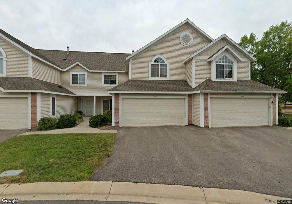
1873 Topaz Point Ln SW Rochester, MN 55902
Estimated Value: $309,000 - $324,913
2
Beds
2
Baths
1,565
Sq Ft
$202/Sq Ft
Est. Value
About This Home
This home is located at 1873 Topaz Point Ln SW, Rochester, MN 55902 and is currently estimated at $316,728, approximately $202 per square foot. 1873 Topaz Point Ln SW is a home located in Olmsted County with nearby schools including Bamber Valley Elementary School, John Adams Middle School, and Mayo Senior High School.
Ownership History
Date
Name
Owned For
Owner Type
Purchase Details
Closed on
Apr 16, 2024
Sold by
Low Philip and Vogel Elizabeth R
Bought by
Rea Morgan
Current Estimated Value
Home Financials for this Owner
Home Financials are based on the most recent Mortgage that was taken out on this home.
Original Mortgage
$248,000
Outstanding Balance
$244,294
Interest Rate
6.88%
Mortgage Type
New Conventional
Estimated Equity
$72,434
Purchase Details
Closed on
Jun 1, 2011
Sold by
Larusso Nicholas F and Larusso Revocable T Nicholas F
Bought by
Vogel Elizabeth R
Home Financials for this Owner
Home Financials are based on the most recent Mortgage that was taken out on this home.
Original Mortgage
$180,000
Interest Rate
4.81%
Mortgage Type
New Conventional
Purchase Details
Closed on
Jun 20, 2005
Sold by
Larusso Nicholas F and Larusso Roberta W
Bought by
Larusso Nicholas F and Larusso Revocable T Nicholas F
Create a Home Valuation Report for This Property
The Home Valuation Report is an in-depth analysis detailing your home's value as well as a comparison with similar homes in the area
Home Values in the Area
Average Home Value in this Area
Purchase History
| Date | Buyer | Sale Price | Title Company |
|---|---|---|---|
| Rea Morgan | $310,000 | Rochester Title | |
| Vogel Elizabeth R | $180,000 | Rochester Title | |
| Larusso Nicholas F | -- | None Available |
Source: Public Records
Mortgage History
| Date | Status | Borrower | Loan Amount |
|---|---|---|---|
| Open | Rea Morgan | $248,000 | |
| Previous Owner | Vogel Elizabeth R | $180,000 |
Source: Public Records
Tax History Compared to Growth
Tax History
| Year | Tax Paid | Tax Assessment Tax Assessment Total Assessment is a certain percentage of the fair market value that is determined by local assessors to be the total taxable value of land and additions on the property. | Land | Improvement |
|---|---|---|---|---|
| 2024 | $3,714 | $280,600 | $40,000 | $240,600 |
| 2023 | $3,380 | $278,700 | $40,000 | $238,700 |
| 2022 | $3,180 | $262,300 | $40,000 | $222,300 |
| 2021 | $2,700 | $233,400 | $40,000 | $193,400 |
| 2020 | $2,606 | $211,500 | $30,000 | $181,500 |
| 2019 | $2,552 | $198,100 | $30,000 | $168,100 |
| 2018 | $2,332 | $195,200 | $30,000 | $165,200 |
| 2017 | $2,234 | $186,200 | $23,600 | $162,600 |
| 2016 | $1,902 | $149,600 | $20,600 | $129,000 |
| 2015 | $898 | $124,100 | $19,800 | $104,300 |
| 2014 | $1,716 | $125,500 | $19,800 | $105,700 |
| 2012 | -- | $123,200 | $19,752 | $103,448 |
Source: Public Records
Map
Nearby Homes
- 1941 Waterford Place SW
- 3125 Glenwood Rd SW
- 2961 Glenwood Rd SW
- 3177 Glenwood Rd SW
- 1814 Mayowood Rd SW
- 1810 Mayowood Rd SW
- 1568 Salem Ct SW
- 1911 Greenfield Ln SW Unit E
- 2449 Salem Heights Ln SW
- 1747 Mayowood Rd SW
- 1704 Lakeview Dr SW
- 2114 Ponderosa Dr SW
- 2229 Ponderosa Dr SW
- 2236 Ponderosa Dr SW
- 3018 Mayowood Common Cir SW
- 2308 Baihly Hills Dr SW
- 1726 Mayowood Rd SW
- 1758 Mayowood Rd SW
- 1750 Mayowood Rd SW
- 1710 Mayowood Ct SW
- 1873 Topaz Pointe Ln SW
- 1875 Topaz Point Ln SW
- 1875 Topaz Pointe Ln SW
- 1871 Topaz Point Ln SW
- 1877 Topaz Point Ln SW
- 1877 Topaz Pointe Ln SW
- 1872 Topaz Point Ln SW
- 1872 Topaz Pointe Ln SW
- 1905 Topaz Point Ln SW
- 1905 Topaz Pointe Ln SW
- 1874 Topaz Point Ln SW
- 1874 Topaz Pointe Ln SW
- 1907 Topaz Point Ln SW
- 1880 Waterford Place SW
- 1876 Waterford Place SW
- 1907 Topaz Pointe Ln SW
- 1876 Topaz Point Ln SW
- 1876 Topaz Pointe Ln SW
- 1896 Waterford Place SW
- 1909 Topaz Point Ln SW