Estimated Value: $982,662
--
Bed
2
Baths
6,000
Sq Ft
$164/Sq Ft
Est. Value
About This Home
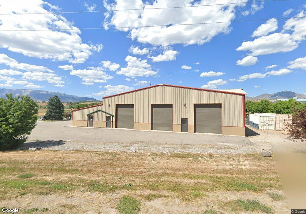
This home is located at 1874 Enterprise Ct, Rifle, CO 81650 and is currently estimated at $982,662, approximately $163 per square foot. 1874 Enterprise Ct is a home located in Garfield County with nearby schools including Highland Elementary School, Rifle Middle School, and Rifle High School.
Ownership History
Date
Name
Owned For
Owner Type
Purchase Details
Closed on
Sep 24, 2024
Sold by
Robinson Scott and Robinson Debra S
Bought by
Una Development Llc
Current Estimated Value
Purchase Details
Closed on
Dec 20, 2023
Sold by
Robinson Scott and Robinson Debra S
Bought by
Reeves Andrew and Reeves Kamehl
Purchase Details
Closed on
Feb 5, 2008
Sold by
Ball Allen
Bought by
Robinson Scott and Robinson Debra S
Home Financials for this Owner
Home Financials are based on the most recent Mortgage that was taken out on this home.
Original Mortgage
$682,414
Interest Rate
6.15%
Mortgage Type
Commercial
Purchase Details
Closed on
May 2, 2001
Sold by
B To B Development Company
Bought by
H R A Llc
Purchase Details
Closed on
Apr 6, 2000
Sold by
Rifle Colorado City Of
Bought by
Fox Run Meadows Lllp
Create a Home Valuation Report for This Property
The Home Valuation Report is an in-depth analysis detailing your home's value as well as a comparison with similar homes in the area
Home Values in the Area
Average Home Value in this Area
Purchase History
| Date | Buyer | Sale Price | Title Company |
|---|---|---|---|
| Una Development Llc | $900,000 | None Listed On Document | |
| Reeves Andrew | $1,450,000 | Title Company Of The Rockies | |
| Robinson Scott | $750,000 | Cwt | |
| H R A Llc | $50,500 | -- | |
| Fox Run Meadows Lllp | $459,000 | -- |
Source: Public Records
Mortgage History
| Date | Status | Borrower | Loan Amount |
|---|---|---|---|
| Previous Owner | Robinson Scott | $682,414 |
Source: Public Records
Tax History Compared to Growth
Tax History
| Year | Tax Paid | Tax Assessment Tax Assessment Total Assessment is a certain percentage of the fair market value that is determined by local assessors to be the total taxable value of land and additions on the property. | Land | Improvement |
|---|---|---|---|---|
| 2024 | $8,265 | $109,540 | $28,330 | $81,210 |
| 2023 | $8,265 | $109,540 | $28,330 | $81,210 |
| 2022 | $7,229 | $102,110 | $19,630 | $82,480 |
| 2021 | $8,082 | $102,110 | $19,630 | $82,480 |
| 2020 | $7,007 | $96,850 | $19,630 | $77,220 |
| 2019 | $6,627 | $96,850 | $19,630 | $77,220 |
| 2018 | $7,357 | $105,080 | $19,630 | $85,450 |
| 2017 | $6,640 | $105,080 | $19,630 | $85,450 |
| 2016 | $7,346 | $131,870 | $45,810 | $86,060 |
| 2015 | $6,783 | $131,870 | $45,810 | $86,060 |
| 2014 | $6,543 | $126,440 | $39,260 | $87,180 |
Source: Public Records
Map
Nearby Homes
- 756 Airport Rd
- 756 Airport Rd Unit 9 AC
- Tbd Blacktail Dr
- 2135 Airport Rd
- 1797 County Road 346
- 27653 Highway 6 Unit 310
- 515 Last Chance Dr
- 275 County Road 332
- 530 Birch Ct
- 235 Ash Ave
- 742 E 3rd St
- TBD Cty Rd 319 ''Cmc West Parcel''
- 1626 Dogwood Dr
- 712 E 3rd St
- 520 Aspen Ave
- 1553 E 12th St
- 325 7th St S
- 1433 Jays Ave
- 1874 Enterprise Ct Unit A
- 1862 Enterprise Ct
- 1862 Enterprise Ct Unit C
- 1900 Airport Rd
- 1850 Enterprise Ct Unit A
- 1850 Enterprise Ct Unit B
- 1850 Enterprise Ct Unit B
- 1850 Enterprise Ct Unit A&E
- 1850 Enterprise Ct
- TBD Airport Rd Unit Lot 33B
- TBD Airport Rd
- TBD Airport Rd Unit 1
- TBD Airport Rd Unit 2
- 1900 Airport Rd
- 1900 Airport Rd
- 1867 Enterprise Court Lot 25
- 1867 Enterprise Ct
- 1867 Enterprise Ct Unit Lot 25
- 1910 Airport Rd
- 1842 Enterprise Ct