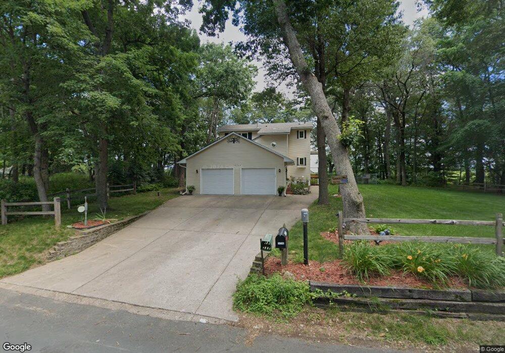
18745 Breezy Point Dr NE Wyoming, MN 55092
Estimated Value: $460,000 - $602,000
3
Beds
2
Baths
1,752
Sq Ft
$304/Sq Ft
Est. Value
About This Home
This home is located at 18745 Breezy Point Dr NE, Wyoming, MN 55092 and is currently estimated at $532,810, approximately $304 per square foot. 18745 Breezy Point Dr NE is a home located in Anoka County with nearby schools including Cedar Creek Community School, St. Francis Middle School, and St. Francis High School.
Ownership History
Date
Name
Owned For
Owner Type
Purchase Details
Closed on
Jun 24, 2016
Sold by
Piersak Mark Mark
Bought by
Komomua Arthur Arthur
Current Estimated Value
Home Financials for this Owner
Home Financials are based on the most recent Mortgage that was taken out on this home.
Original Mortgage
$291,622
Outstanding Balance
$232,023
Interest Rate
3.56%
Estimated Equity
$300,787
Purchase Details
Closed on
Apr 30, 2008
Sold by
Federal Home Loan Mortgage Corporation
Bought by
Piersak Mark and Piersak Amanda J
Home Financials for this Owner
Home Financials are based on the most recent Mortgage that was taken out on this home.
Original Mortgage
$271,350
Interest Rate
5.93%
Mortgage Type
VA
Purchase Details
Closed on
Apr 25, 2001
Sold by
Snyder Freeman D and Synder Barbara L
Bought by
Tangren Lonnie L and Tangren Ann
Create a Home Valuation Report for This Property
The Home Valuation Report is an in-depth analysis detailing your home's value as well as a comparison with similar homes in the area
Home Values in the Area
Average Home Value in this Area
Purchase History
| Date | Buyer | Sale Price | Title Company |
|---|---|---|---|
| Komomua Arthur Arthur | $331,600 | -- | |
| Piersak Mark | $265,000 | -- | |
| Tangren Lonnie L | $265,000 | -- |
Source: Public Records
Mortgage History
| Date | Status | Borrower | Loan Amount |
|---|---|---|---|
| Open | Komomua Arthur Arthur | $291,622 | |
| Previous Owner | Piersak Mark | $271,350 |
Source: Public Records
Tax History Compared to Growth
Tax History
| Year | Tax Paid | Tax Assessment Tax Assessment Total Assessment is a certain percentage of the fair market value that is determined by local assessors to be the total taxable value of land and additions on the property. | Land | Improvement |
|---|---|---|---|---|
| 2025 | $2,948 | $536,500 | $256,000 | $280,500 |
| 2024 | $2,948 | $476,900 | $205,600 | $271,300 |
| 2023 | $2,429 | $489,200 | $205,600 | $283,600 |
| 2022 | $1,777 | $435,000 | $163,600 | $271,400 |
| 2021 | $1,986 | $330,300 | $137,000 | $193,300 |
| 2020 | $1,901 | $336,200 | $153,100 | $183,100 |
| 2019 | $2,390 | $318,300 | $129,800 | $188,500 |
| 2018 | $1,979 | $342,300 | $0 | $0 |
| 2017 | $1,922 | $308,800 | $0 | $0 |
| 2016 | $3,980 | $299,300 | $0 | $0 |
| 2015 | $3,373 | $299,300 | $150,300 | $149,000 |
| 2014 | -- | $225,100 | $95,100 | $130,000 |
Source: Public Records
Map
Nearby Homes
- 4310 Channel Ln NE
- xxx Birch Rd
- 426 Birch Rd
- 19479 Leyte St NE
- 3841 Interlachen Dr NE
- 3837 Interlachen Dr NE
- 3461 Interlachen Dr NE
- 3524 Interlachen Dr NE
- 3413 Interlachen Dr NE
- 17742 Oakland Dr NE
- TBD S 179th Ave NE
- 17307 Hiawatha Beach Dr NE
- 17327 Hiawatha Beach Dr NE
- 18216 Yancy St NE
- 20136 Erskine St NE
- xxxx Alamo St
- 2475 179th Ave NE
- 18019 Urbank St NE
- 3464 172nd Ln NE
- 18022 Urbank St NE
- 18731 Breezy Point Dr NE
- 18801 Breezy Point Dr NE
- 18748 Breezy Point Dr NE
- 18740 Breezy Point Dr NE
- 18732 Breezy Point Dr NE
- 18809 Breezy Point Dr NE
- 18743 Breezy Point Dr NE
- 3925 Breezy Point Dr NE
- 18719 Breezy Point Dr NE
- 18829 Breezy Point Dr NE
- 18818 Breezy Point Dr NE
- 3915 Breezy Point Dr NE
- 18742 Breezy Point Dr NE
- 3940 Breezy Point Dr NE
- 3908 Edmar Ln NE
- 18734 Breezy Point Dr NE
- 3920 Edmar Ln NE
- 3930 Breezy Point Dr NE
- 18841 Breezy Point Dr NE
- 3918 Breezy Point Dr NE