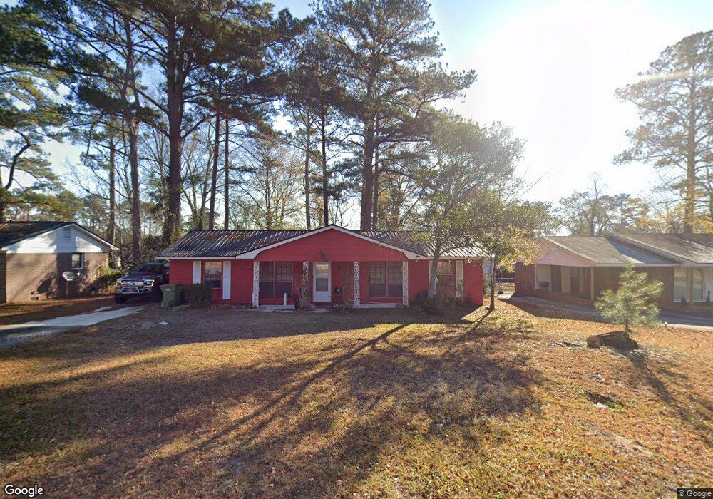
1875 Bunker Hill Rd Columbus, GA 31907
Eastern Columbus NeighborhoodEstimated Value: $176,000 - $211,131
4
Beds
3
Baths
2,000
Sq Ft
$93/Sq Ft
Est. Value
About This Home
This home is located at 1875 Bunker Hill Rd, Columbus, GA 31907 and is currently estimated at $186,533, approximately $93 per square foot. 1875 Bunker Hill Rd is a home located in Muscogee County with nearby schools including Dawson Elementary School, East Columbus Magnet Academy, and Spencer High School.
Ownership History
Date
Name
Owned For
Owner Type
Purchase Details
Closed on
Sep 9, 2024
Sold by
Latham Charles and Latham Darrell
Bought by
Latham Darrell
Current Estimated Value
Home Financials for this Owner
Home Financials are based on the most recent Mortgage that was taken out on this home.
Original Mortgage
$175,050
Outstanding Balance
$173,177
Interest Rate
6.73%
Mortgage Type
VA
Estimated Equity
$13,356
Purchase Details
Closed on
Oct 1, 2021
Sold by
Latham Tony
Bought by
Latham Darrell
Purchase Details
Closed on
Sep 29, 2021
Sold by
Latham Eddie Bell Estate
Bought by
Latham Darrell and Latham Tony
Purchase Details
Closed on
Apr 30, 2005
Sold by
Southtrust Bank
Bought by
Tiger Creek Development Inc
Create a Home Valuation Report for This Property
The Home Valuation Report is an in-depth analysis detailing your home's value as well as a comparison with similar homes in the area
Home Values in the Area
Average Home Value in this Area
Purchase History
| Date | Buyer | Sale Price | Title Company |
|---|---|---|---|
| Latham Darrell | -- | Vantage Point Title | |
| Latham Darrell | -- | -- | |
| Latham Darrell | -- | -- | |
| Tiger Creek Development Inc | -- | None Available |
Source: Public Records
Mortgage History
| Date | Status | Borrower | Loan Amount |
|---|---|---|---|
| Open | Latham Darrell | $175,050 |
Source: Public Records
Tax History Compared to Growth
Tax History
| Year | Tax Paid | Tax Assessment Tax Assessment Total Assessment is a certain percentage of the fair market value that is determined by local assessors to be the total taxable value of land and additions on the property. | Land | Improvement |
|---|---|---|---|---|
| 2025 | -- | $52,632 | $12,920 | $39,712 |
| 2024 | -- | $52,632 | $12,920 | $39,712 |
| 2023 | $0 | $52,632 | $12,920 | $39,712 |
| 2022 | $172 | $43,980 | $12,920 | $31,060 |
| 2021 | $278 | $43,000 | $12,920 | $30,080 |
| 2020 | $278 | $43,000 | $12,920 | $30,080 |
| 2019 | $281 | $43,000 | $12,920 | $30,080 |
| 2018 | $281 | $43,000 | $12,920 | $30,080 |
| 2017 | $283 | $43,000 | $12,920 | $30,080 |
| 2016 | $286 | $32,824 | $5,922 | $26,902 |
| 2015 | $287 | $32,824 | $5,922 | $26,902 |
| 2014 | $289 | $32,824 | $5,922 | $26,902 |
| 2013 | -- | $32,824 | $5,922 | $26,902 |
Source: Public Records
Map
Nearby Homes
- 5664 St Marys Rd
- 5613 Quebec Dr
- 5644 Quebec Dr
- 5310 Stoney Point Rd
- 5728 Lexington Dr
- 1513 Alamo Dr
- 4462 Walking Stick Way
- 1238 Brandywine Dr
- 5336 Gettysburg Way
- 1340 Bunker Ridge Ln
- 1210 Bunker Hill Rd
- 5219 Argonne Dr
- 4408 Walking Stick Way
- 5109 Lexington Ln
- 5090 Lexington Ln
- 5116 Magazine Ln
- 849 Bunker Hill Rd
- 780 Honey Do Ct
- 4939 Aaron Dr
- 1025 Belmar St
- 1881 Bunker Hill Rd
- 1869 Bunker Hill Rd
- 1863 Bunker Hill Rd
- 1301 Trenton Ct
- 1300 Trenton Ct
- 5602 Monmouth Dr
- 5608 Monmouth Dr
- 1857 Bunker Hill Rd
- 1865 Bunker Hill Rd
- 5624 Monmouth Dr
- 1303 Trenton Ct
- 1304 Trenton Ct
- 5634 Monmouth Dr
- 1851 Bunker Hill Rd
- 1307 Kings Mountain Rd
- 5642 Monmouth Dr
- 1307 Kings Mountain Rd
- 5601 Monmouth Dr
- 1309 Trenton Ct
- 5609 Monmouth Dr