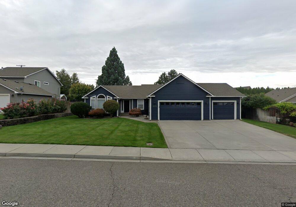
1875 Kapalua Ave Richland, WA 99352
Estimated Value: $455,000 - $505,000
4
Beds
2
Baths
1,755
Sq Ft
$268/Sq Ft
Est. Value
About This Home
This home is located at 1875 Kapalua Ave, Richland, WA 99352 and is currently estimated at $469,646, approximately $267 per square foot. 1875 Kapalua Ave is a home located in Benton County with nearby schools including Orchard Elementary School, Enterprise Middle School, and Richland High School.
Ownership History
Date
Name
Owned For
Owner Type
Purchase Details
Closed on
Apr 23, 2018
Sold by
Rhonda Jones Alana and Rhonda Pemreite
Bought by
Jones Adam M
Current Estimated Value
Home Financials for this Owner
Home Financials are based on the most recent Mortgage that was taken out on this home.
Original Mortgage
$245,000
Outstanding Balance
$210,696
Interest Rate
4.44%
Mortgage Type
New Conventional
Estimated Equity
$258,950
Create a Home Valuation Report for This Property
The Home Valuation Report is an in-depth analysis detailing your home's value as well as a comparison with similar homes in the area
Home Values in the Area
Average Home Value in this Area
Purchase History
| Date | Buyer | Sale Price | Title Company |
|---|---|---|---|
| Jones Adam M | $275,000 | First American Title |
Source: Public Records
Mortgage History
| Date | Status | Borrower | Loan Amount |
|---|---|---|---|
| Open | Jones Adam M | $245,000 |
Source: Public Records
Tax History Compared to Growth
Tax History
| Year | Tax Paid | Tax Assessment Tax Assessment Total Assessment is a certain percentage of the fair market value that is determined by local assessors to be the total taxable value of land and additions on the property. | Land | Improvement |
|---|---|---|---|---|
| 2024 | $3,447 | $384,860 | $85,000 | $299,860 |
| 2023 | $3,447 | $367,730 | $85,000 | $282,730 |
| 2022 | $3,131 | $307,760 | $85,000 | $222,760 |
| 2021 | $3,066 | $282,050 | $85,000 | $197,050 |
| 2020 | $2,943 | $264,920 | $85,000 | $179,920 |
| 2019 | $2,491 | $240,400 | $44,000 | $196,400 |
| 2018 | $2,581 | $218,580 | $44,000 | $174,580 |
| 2017 | $2,272 | $189,480 | $44,000 | $145,480 |
| 2016 | $307 | $189,480 | $44,000 | $145,480 |
| 2015 | $2,583 | $189,480 | $44,000 | $145,480 |
| 2014 | -- | $189,480 | $44,000 | $145,480 |
| 2013 | -- | $189,480 | $44,000 | $145,480 |
Source: Public Records
Map
Nearby Homes
- 1942 Sky Meadow Ave
- 2172 Newhaven Loop
- 309 Falconridge St
- 316 Soaring Hawk St
- 1924 Mint Loop
- 483 Aimee Dr
- 3 Keene Rd Unit Lot 3
- 2 Keene Rd Unit Lot 2
- 1 Keene Rd Unit Lot 1
- 1640 Palermo Ave
- 183 Mcintosh Ct
- 2042 Morency Dr
- 481 Clermont Dr
- 2258 Morency Dr
- 1606 Elementary St
- 464 Agier Dr
- 1557 Livorno Ave
- 204 Brookwood Loop
- 1641 Brantingham Rd
- 2349 Morency Dr
- 1889 Kapalua Ave
- 329 Kona Ct
- 341 Kona Ct
- 353 Kona Ct
- 1872 Kapalua Ave
- 1886 Kapalua Ave
- 1858 Kapalua Ave
- 1902 Sky Meadow Ave
- 326 Kona Ct
- 338 Kona Ct
- 1903 Sky Meadow Ave
- 365 Kona Ct
- 1844 Kapalua Ave
- 350 Kona Ct
- 1910 Sky Meadow Ave
- 362 Kona Ct
- 1830 Kapalua Ave
- 1865 Maui Dr
- 1853 Maui Dr
- 1922 Sky Meadow Ave