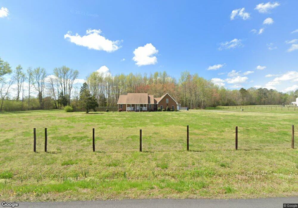
1875 Manning Rd Suffolk, VA 23434
Holy Neck NeighborhoodEstimated Value: $545,000 - $564,000
4
Beds
3
Baths
2,756
Sq Ft
$203/Sq Ft
Est. Value
About This Home
This home is located at 1875 Manning Rd, Suffolk, VA 23434 and is currently estimated at $558,334, approximately $202 per square foot. 1875 Manning Rd is a home located in Suffolk City with nearby schools including Southwestern Elementary School, Forest Glen Middle School, and Lakeland High School.
Ownership History
Date
Name
Owned For
Owner Type
Purchase Details
Closed on
Oct 22, 2018
Sold by
Cole Martin A
Bought by
Cole Kelli Jo Laker
Current Estimated Value
Home Financials for this Owner
Home Financials are based on the most recent Mortgage that was taken out on this home.
Original Mortgage
$338,000
Outstanding Balance
$295,383
Interest Rate
4.6%
Mortgage Type
Adjustable Rate Mortgage/ARM
Estimated Equity
$262,951
Purchase Details
Closed on
Jul 29, 2013
Sold by
Myers Lisa M
Bought by
Cole Martin A
Home Financials for this Owner
Home Financials are based on the most recent Mortgage that was taken out on this home.
Original Mortgage
$351,116
Interest Rate
3.97%
Mortgage Type
VA
Create a Home Valuation Report for This Property
The Home Valuation Report is an in-depth analysis detailing your home's value as well as a comparison with similar homes in the area
Home Values in the Area
Average Home Value in this Area
Purchase History
| Date | Buyer | Sale Price | Title Company |
|---|---|---|---|
| Cole Kelli Jo Laker | $338,000 | Multiple | |
| Cole Martin A | $339,900 | -- |
Source: Public Records
Mortgage History
| Date | Status | Borrower | Loan Amount |
|---|---|---|---|
| Open | Cole Kelli Jo Laker | $338,000 | |
| Previous Owner | Cole Martin A | $351,116 |
Source: Public Records
Tax History Compared to Growth
Tax History
| Year | Tax Paid | Tax Assessment Tax Assessment Total Assessment is a certain percentage of the fair market value that is determined by local assessors to be the total taxable value of land and additions on the property. | Land | Improvement |
|---|---|---|---|---|
| 2024 | $6,039 | $480,400 | $99,900 | $380,500 |
| 2023 | $5,533 | $452,400 | $99,900 | $352,500 |
| 2022 | $4,331 | $397,300 | $99,900 | $297,400 |
| 2021 | $4,036 | $363,600 | $99,900 | $263,700 |
| 2020 | $3,835 | $345,500 | $99,900 | $245,600 |
| 2019 | $3,835 | $345,500 | $99,900 | $245,600 |
| 2018 | $3,821 | $347,800 | $83,200 | $264,600 |
| 2017 | $3,616 | $337,900 | $83,200 | $254,700 |
| 2016 | $3,512 | $328,200 | $83,200 | $245,000 |
| 2015 | $1,774 | $328,200 | $83,200 | $245,000 |
| 2014 | $1,774 | $328,200 | $83,200 | $245,000 |
Source: Public Records
Map
Nearby Homes
- 2101 Manning Rd
- 2313 Manning Rd
- 3999 Jackson Rd
- .51ac Holland Rd
- 138 Beechwood Dr
- 3240 Holland Rd
- 3316 Holland Rd
- 3320 Holland Rd
- 1925 Copeland Rd
- 216 Tracy Dr
- 212 Tracy Dr
- 2028 Holland Rd
- 105 Fairfield Ave
- 2022 Holland Rd
- 300 Lummis Rd
- 300 Lummis Rd Unit D
- 113 Fairfield Ave
- 104 Springfield Terrace
- 404 Great Oak Ct
- .26+AC Lummis Rd
- 1871 Manning Rd
- 1878 Manning Rd
- 1565 Manning Rd
- 1872 Manning Rd
- 1556 Manning Rd
- 1936 Manning Rd
- 1940 Manning Rd
- 1552 Manning Rd
- 1868 Manning Rd
- 1944 Manning Rd
- 1900 Manning Rd
- 1563 Manning Rd
- 1965 Manning Rd
- 1548 Manning Rd
- 1543 Manning Rd
- 1942 Manning Rd
- 1544 Manning Rd
- 1971 Manning Rd
- 789 Manning Bridge Rd
- 791 Manning Bridge Rd