Estimated Value: $299,000 - $303,000
3
Beds
3
Baths
2,144
Sq Ft
$141/Sq Ft
Est. Value
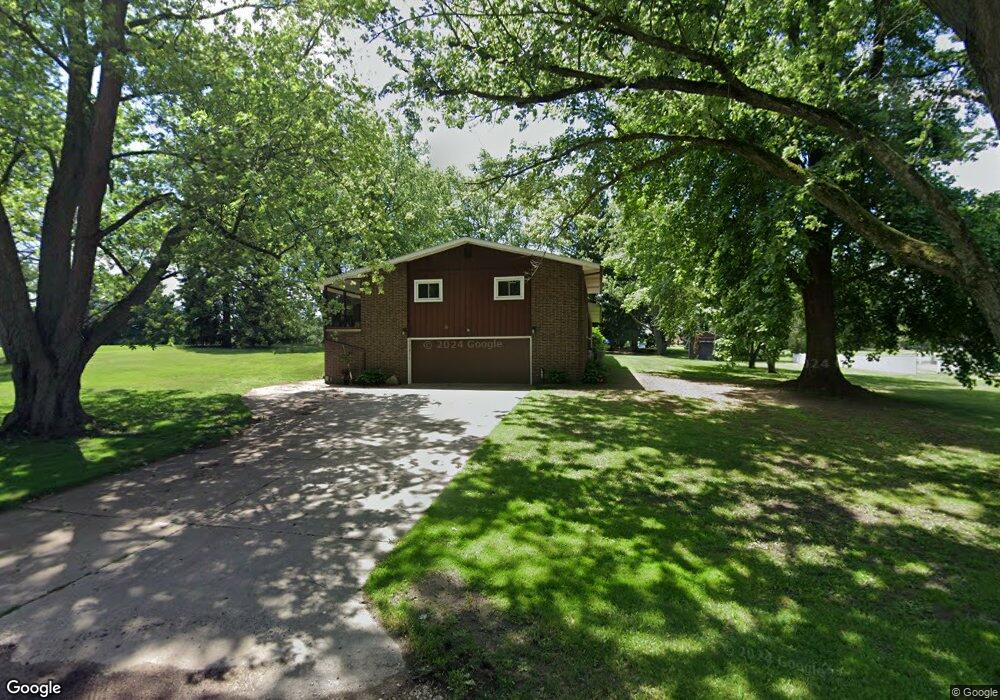
About This Home
This home is located at 1875 S Main St, Clyde, OH 43410 and is currently estimated at $301,485, approximately $140 per square foot. 1875 S Main St is a home located in Sandusky County with nearby schools including Clyde High School, Harvest Temple Christian Academy, and St Mary's Catholic School.
Ownership History
Date
Name
Owned For
Owner Type
Purchase Details
Closed on
Oct 2, 2025
Sold by
Roth David A and Roth Nancy A
Bought by
Brown Darrell J and Brown Dana L
Current Estimated Value
Home Financials for this Owner
Home Financials are based on the most recent Mortgage that was taken out on this home.
Original Mortgage
$75,000
Outstanding Balance
$75,000
Interest Rate
6.56%
Mortgage Type
New Conventional
Estimated Equity
$226,485
Purchase Details
Closed on
Apr 20, 2016
Sold by
Crockett Golf Estates Llc
Bought by
Roth David A and Roth Nancy A
Home Financials for this Owner
Home Financials are based on the most recent Mortgage that was taken out on this home.
Original Mortgage
$146,000
Interest Rate
3.68%
Mortgage Type
New Conventional
Purchase Details
Closed on
Jul 8, 2003
Sold by
Stiger Judith Anne
Bought by
Crockett Golf Estates Llc
Create a Home Valuation Report for This Property
The Home Valuation Report is an in-depth analysis detailing your home's value as well as a comparison with similar homes in the area
Purchase History
| Date | Buyer | Sale Price | Title Company |
|---|---|---|---|
| Brown Darrell J | $305,000 | Portage Valley Title | |
| Roth David A | $182,500 | First American Title | |
| Crockett Golf Estates Llc | $120,000 | -- |
Source: Public Records
Mortgage History
| Date | Status | Borrower | Loan Amount |
|---|---|---|---|
| Open | Brown Darrell J | $75,000 | |
| Previous Owner | Roth David A | $146,000 |
Source: Public Records
Tax History
| Year | Tax Paid | Tax Assessment Tax Assessment Total Assessment is a certain percentage of the fair market value that is determined by local assessors to be the total taxable value of land and additions on the property. | Land | Improvement |
|---|---|---|---|---|
| 2025 | $3,618 | $263,700 | $49,100 | $214,600 |
| 2024 | $3,618 | $92,300 | $17,190 | $75,110 |
| 2023 | $3,543 | $65,000 | $12,110 | $52,890 |
| 2022 | $2,727 | $65,000 | $12,110 | $52,890 |
| 2021 | $2,757 | $65,000 | $12,110 | $52,890 |
| 2020 | $2,624 | $59,750 | $12,110 | $47,640 |
| 2019 | $2,593 | $59,750 | $12,110 | $47,640 |
| 2018 | $2,593 | $59,750 | $12,110 | $47,640 |
| 2017 | $2,470 | $55,440 | $12,110 | $43,330 |
| 2016 | $2,434 | $55,440 | $12,110 | $43,330 |
| 2015 | $2,407 | $55,440 | $12,110 | $43,330 |
| 2014 | $2,479 | $54,330 | $12,220 | $42,110 |
| 2013 | $2,425 | $54,330 | $12,220 | $42,110 |
Source: Public Records
Map
Nearby Homes
- 119 Warnecke Dr
- 0 County Road 175
- 119 Woodhaven Crescent
- 209 Fair St
- 135 Mechanic St
- 0 Durnwald Dr
- CR 260 89.6 acres Durnwald Dr
- 1337 E Sr 20
- 246 Spring St
- 0 W Mcpherson Hwy
- 5255 County Road 177
- 1337 U S 20
- 8215 State Route 101 N
- 761 N Woodland Ave
- 1727 E Mcpherson Hwy
- 1270 W Mcpherson Hwy
- 891 N Woodland Ave
- 7604 Lodi-Colby Rd
- 2690 County Road 213
- 0 N Sr 101 Unit 20252008
- 1865 S Main St
- 1867 S Main St
- 1873 S Main St
- 1863 S Main St
- 1897 S Main St
- 1870 S Main St
- 1888 S Main St
- 1902 S Main St
- 1911 S Main St
- 1923 S Main St Unit 19
- 1906 S Main St Unit 19
- 4087 County Road 175
- 4107 County Road 175
- 1877 S Main St
- 4035 County Road 175
- 4035 County Road 175
- 1910 S Main St
- 1786 S Main St
- 1779 S Main St
- 4030 County Road 175
Your Personal Tour Guide
Ask me questions while you tour the home.