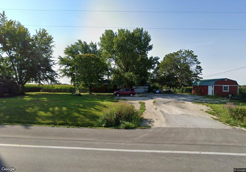
18758 Highway 19 New London, MO 63459
Estimated Value: $185,725 - $252,000
3
Beds
1
Bath
1,407
Sq Ft
$163/Sq Ft
Est. Value
About This Home
This home is located at 18758 Highway 19, New London, MO 63459 and is currently estimated at $229,931, approximately $163 per square foot. 18758 Highway 19 is a home located in Ralls County with nearby schools including Mark Twain Senior High School.
Ownership History
Date
Name
Owned For
Owner Type
Purchase Details
Closed on
May 4, 2012
Sold by
Reed Heather R and Reed Brian L
Bought by
Reed Brian L and Reed Heather R
Current Estimated Value
Purchase Details
Closed on
May 25, 2011
Sold by
Newlon John S and Newlon Louretta M
Bought by
Hays Heather R
Home Financials for this Owner
Home Financials are based on the most recent Mortgage that was taken out on this home.
Original Mortgage
$89,067
Interest Rate
4.81%
Mortgage Type
Stand Alone First
Create a Home Valuation Report for This Property
The Home Valuation Report is an in-depth analysis detailing your home's value as well as a comparison with similar homes in the area
Home Values in the Area
Average Home Value in this Area
Purchase History
| Date | Buyer | Sale Price | Title Company |
|---|---|---|---|
| Reed Brian L | -- | -- | |
| Hays Heather R | -- | Accurate Land Title Co Po Bo |
Source: Public Records
Mortgage History
| Date | Status | Borrower | Loan Amount |
|---|---|---|---|
| Previous Owner | Hays Heather R | $89,067 |
Source: Public Records
Tax History Compared to Growth
Tax History
| Year | Tax Paid | Tax Assessment Tax Assessment Total Assessment is a certain percentage of the fair market value that is determined by local assessors to be the total taxable value of land and additions on the property. | Land | Improvement |
|---|---|---|---|---|
| 2024 | $805 | $16,570 | $3,040 | $13,530 |
| 2023 | $781 | $16,570 | $3,040 | $13,530 |
| 2022 | $781 | $16,570 | $3,040 | $13,530 |
| 2021 | $760 | $16,040 | $3,040 | $13,000 |
| 2020 | $770 | $16,040 | $3,040 | $13,000 |
| 2019 | $740 | $16,040 | $3,040 | $13,000 |
| 2018 | $711 | $15,310 | $3,040 | $12,270 |
| 2017 | $710 | $15,310 | $3,040 | $12,270 |
| 2016 | $714 | $15,490 | $3,040 | $12,450 |
| 2015 | -- | $15,490 | $3,040 | $12,450 |
| 2014 | -- | $13,770 | $1,270 | $12,500 |
| 2013 | -- | $13,390 | $1,270 | $12,120 |
Source: Public Records
Map
Nearby Homes
- 19475 Otter Rd
- 40 Brush Creek Rd
- 54043 Haden Place
- 19358 Hwy Ff
- 19720 Highway Ff
- 19358 Highway Ff
- 400 West St
- 201 S Main St
- 408 E 4th St
- 501 E 4th St
- Sunny Unit WPLot001
- 17267 Wolf Dr
- 21287 Highway H
- 0 Sunnyside Ln Unit MIS25069708
- 0 Osage Dr
- 302 S Main St
- 306 S Public St
- 17094 Hwy H
- 55199 Highway M
- 21816 Pinyon Dr