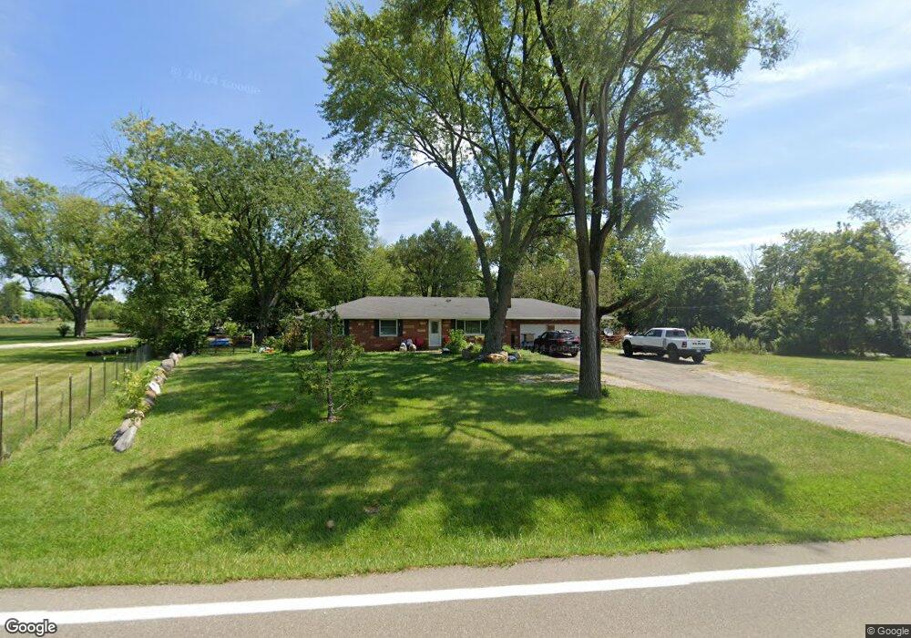
1876 N State Route 741 Franklin, OH 45005
Turtlecreek Township NeighborhoodEstimated Value: $367,604 - $411,000
4
Beds
1
Bath
1,350
Sq Ft
$285/Sq Ft
Est. Value
About This Home
This home is located at 1876 N State Route 741, Franklin, OH 45005 and is currently estimated at $384,401, approximately $284 per square foot. 1876 N State Route 741 is a home located in Warren County with nearby schools including Bowman Primary School, Berry Intermediate School, and Donovan Elementary School.
Ownership History
Date
Name
Owned For
Owner Type
Purchase Details
Closed on
Jul 17, 2018
Sold by
Losekamp Tiffany and Roberts Randy Lee
Bought by
Thompson Lawrence and Thompson Virginia
Current Estimated Value
Home Financials for this Owner
Home Financials are based on the most recent Mortgage that was taken out on this home.
Original Mortgage
$220,797
Outstanding Balance
$192,897
Interest Rate
4.87%
Mortgage Type
FHA
Estimated Equity
$191,504
Purchase Details
Closed on
Sep 18, 2012
Sold by
Back J David
Bought by
Losekamp Tiffany
Home Financials for this Owner
Home Financials are based on the most recent Mortgage that was taken out on this home.
Original Mortgage
$154,850
Interest Rate
3.66%
Mortgage Type
Future Advance Clause Open End Mortgage
Purchase Details
Closed on
Jul 20, 2011
Sold by
Estate Of James Douglas Back
Bought by
Back J David
Create a Home Valuation Report for This Property
The Home Valuation Report is an in-depth analysis detailing your home's value as well as a comparison with similar homes in the area
Home Values in the Area
Average Home Value in this Area
Purchase History
| Date | Buyer | Sale Price | Title Company |
|---|---|---|---|
| Thompson Lawrence | $230,000 | Terry Monnie Title | |
| Losekamp Tiffany | $163,000 | Lawyers Title Of Cinti | |
| Back J David | -- | None Available |
Source: Public Records
Mortgage History
| Date | Status | Borrower | Loan Amount |
|---|---|---|---|
| Open | Thompson Lawrence | $220,797 | |
| Previous Owner | Losekamp Tiffany | $154,850 |
Source: Public Records
Tax History Compared to Growth
Tax History
| Year | Tax Paid | Tax Assessment Tax Assessment Total Assessment is a certain percentage of the fair market value that is determined by local assessors to be the total taxable value of land and additions on the property. | Land | Improvement |
|---|---|---|---|---|
| 2024 | $4,041 | $101,000 | $47,940 | $53,060 |
| 2023 | $3,404 | $76,881 | $29,890 | $46,991 |
| 2022 | $3,361 | $76,881 | $29,890 | $46,991 |
| 2021 | $3,118 | $76,881 | $29,890 | $46,991 |
| 2020 | $3,044 | $62,503 | $24,301 | $38,203 |
| 2019 | $3,061 | $62,503 | $24,301 | $38,203 |
| 2018 | $2,775 | $62,503 | $24,301 | $38,203 |
| 2017 | $2,741 | $55,594 | $21,133 | $34,461 |
| 2016 | $2,834 | $55,594 | $21,133 | $34,461 |
| 2015 | $2,856 | $55,594 | $21,133 | $34,461 |
| 2014 | $2,758 | $51,220 | $20,180 | $31,050 |
| 2013 | $2,545 | $55,010 | $22,000 | $33,010 |
Source: Public Records
Map
Nearby Homes
- 1782 Ohio 741
- 3822 Greentree Rd
- 1369 New England Way
- 417 Bethpage Way
- 417 Bethpage Way Unit 7-302
- 4289 Yellow Prairie Dr
- 4284 Yellow Prairie Dr
- 1537 Golf Club Dr
- 4343 Hunting Hawk Dr
- 1932 Meadowsweet Dr
- 1899 Meadowsweet Dr
- 1255 Lake Run Dr
- 1535 Canterbury Ct
- 449 Bethpage Way
- 445 Bethpage Way Unit 7-304
- 445 Bethpage Way
- 1291 Lake Run Dr
- 2266 N St Rt 123
- 2266 N St Rt 123 Unit Site D
- 2266 Ohio 123
- 1876 N State Route 741
- 1848 N State Route 741
- 1848 N State Route 741
- 1848 Ohio 741
- 1900 S Route 741
- 1900 Ohio 741
- 1899 N State Route 741
- 1832 N State Route 741
- 1828 N State Route 741
- 1828 N State Route 741
- 1917 N State Route 741
- 1936 N State Route 741
- 1802 N State Route 741
- 1841 N State Route 741
- 1949 N State Route 741
- 1832 Ohio 741
- 1815 N State Route 741
- 1815 N St Rt 741
- 1782 N State Route 741
- 1779 Ohio 741