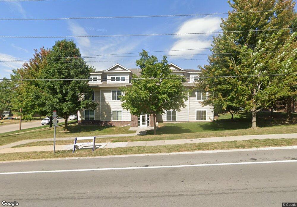
1876 W Benton St Unit 101 Iowa City, IA 52246
Estimated Value: $219,457 - $232,000
3
Beds
1
Bath
1,192
Sq Ft
$190/Sq Ft
Est. Value
About This Home
This home is located at 1876 W Benton St Unit 101, Iowa City, IA 52246 and is currently estimated at $226,114, approximately $189 per square foot. 1876 W Benton St Unit 101 is a home located in Johnson County with nearby schools including Ernest Horn Elementary School, Northwest Junior High School, and West High School.
Ownership History
Date
Name
Owned For
Owner Type
Purchase Details
Closed on
Mar 19, 2018
Sold by
Andrade James P De and Deandrade Lindsay De
Bought by
Lig Llc
Current Estimated Value
Home Financials for this Owner
Home Financials are based on the most recent Mortgage that was taken out on this home.
Original Mortgage
$151,300
Outstanding Balance
$121,596
Interest Rate
4.4%
Mortgage Type
Commercial
Estimated Equity
$104,518
Create a Home Valuation Report for This Property
The Home Valuation Report is an in-depth analysis detailing your home's value as well as a comparison with similar homes in the area
Home Values in the Area
Average Home Value in this Area
Purchase History
| Date | Buyer | Sale Price | Title Company |
|---|---|---|---|
| Lig Llc | $178,000 | None Available |
Source: Public Records
Mortgage History
| Date | Status | Borrower | Loan Amount |
|---|---|---|---|
| Open | Lig Llc | $151,300 |
Source: Public Records
Tax History Compared to Growth
Tax History
| Year | Tax Paid | Tax Assessment Tax Assessment Total Assessment is a certain percentage of the fair market value that is determined by local assessors to be the total taxable value of land and additions on the property. | Land | Improvement |
|---|---|---|---|---|
| 2025 | $3,710 | $215,290 | $24,910 | $190,380 |
| 2024 | $3,662 | $194,720 | $23,530 | $171,190 |
| 2023 | $3,986 | $194,720 | $23,530 | $171,190 |
| 2022 | $3,810 | $183,930 | $20,760 | $163,170 |
| 2021 | $3,936 | $183,930 | $20,760 | $163,170 |
| 2020 | $3,936 | $182,080 | $19,380 | $162,700 |
| 2019 | $3,746 | $182,080 | $19,380 | $162,700 |
| 2018 | $3,746 | $170,480 | $17,990 | $152,490 |
| 2017 | $3,446 | $170,480 | $17,990 | $152,490 |
| 2016 | $3,376 | $165,320 | $16,610 | $148,710 |
| 2015 | $3,376 | $165,320 | $16,610 | $148,710 |
| 2014 | $3,292 | $160,900 | $16,610 | $144,290 |
Source: Public Records
Map
Nearby Homes
- 1848 W Benton St Unit 101
- 7 Westgate Cir
- 556 Mahaska Ct
- 1950 Calvin Ave
- 124 Penfro Dr
- 500 Grandview Ct Unit 524
- 2314 Macbride Dr
- 328 Koser Ave
- 2283 Cae Dr
- 2271 Cae Dr
- 1207 Cambria Ct
- 1153 Cambria Ct
- 2259 Cae Dr
- 600 Grandview Ct Unit 618
- 922 Wylde Green Rd
- 2365 Cae Dr
- 1295 Dolen Place
- 8 Wrexham Dr
- 1339 Dolen Place
- 2423 Walden Ct
- 1876 W Benton St Unit 201
- 1876 W Benton St Unit 202
- 1876 W Benton St Unit 204
- 1876 W Benton St Unit 104
- 1876 W Benton St Unit 103
- 1876 W Benton St Unit 203
- 1876 W Benton St Unit 102
- 760 Westgate St
- 1820 W Benton St Unit 203
- 1820 W Benton St Unit 103
- 1820 W Benton St Unit 304
- 1820 W Benton St Unit 303
- 1820 W Benton St Unit 302
- 1820 W Benton St Unit 301
- 1820 W Benton St Unit 204
- 1820 W Benton St Unit 202
- 1820 W Benton St Unit 104
- 1820 W Benton St Unit 201
- 1820 W Benton St Unit 102
- 754 Westgate St