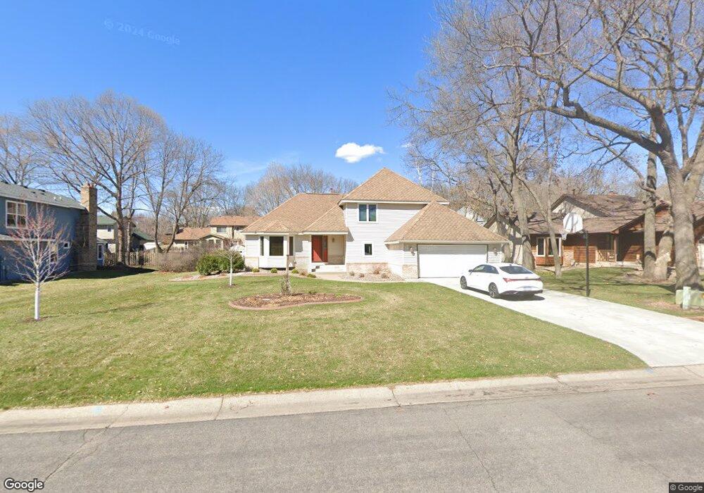
1877 131st Ln NW Coon Rapids, MN 55448
Estimated Value: $411,000 - $452,000
3
Beds
2
Baths
2,812
Sq Ft
$152/Sq Ft
Est. Value
About This Home
This home is located at 1877 131st Ln NW, Coon Rapids, MN 55448 and is currently estimated at $426,398, approximately $151 per square foot. 1877 131st Ln NW is a home located in Anoka County with nearby schools including Lucile Bruner Elementary School, Morris Bye Elementary School, and Laughlin Junior/Senior High School.
Ownership History
Date
Name
Owned For
Owner Type
Purchase Details
Closed on
Aug 25, 2020
Sold by
Erickson Gary A and Erickson Beverly D
Bought by
Eberhardt Susan J and Eberhardt David L
Current Estimated Value
Home Financials for this Owner
Home Financials are based on the most recent Mortgage that was taken out on this home.
Original Mortgage
$220,000
Outstanding Balance
$195,235
Interest Rate
2.9%
Mortgage Type
New Conventional
Estimated Equity
$231,163
Create a Home Valuation Report for This Property
The Home Valuation Report is an in-depth analysis detailing your home's value as well as a comparison with similar homes in the area
Home Values in the Area
Average Home Value in this Area
Purchase History
| Date | Buyer | Sale Price | Title Company |
|---|---|---|---|
| Eberhardt Susan J | $319,000 | Legacy Title |
Source: Public Records
Mortgage History
| Date | Status | Borrower | Loan Amount |
|---|---|---|---|
| Open | Eberhardt Susan J | $220,000 |
Source: Public Records
Tax History Compared to Growth
Tax History
| Year | Tax Paid | Tax Assessment Tax Assessment Total Assessment is a certain percentage of the fair market value that is determined by local assessors to be the total taxable value of land and additions on the property. | Land | Improvement |
|---|---|---|---|---|
| 2025 | $4,516 | $417,600 | $94,500 | $323,100 |
| 2024 | $4,516 | $416,300 | $91,400 | $324,900 |
| 2023 | $4,045 | $403,200 | $75,600 | $327,600 |
| 2022 | $3,675 | $407,700 | $75,600 | $332,100 |
| 2021 | $3,498 | $326,100 | $58,800 | $267,300 |
| 2020 | $3,619 | $309,900 | $58,800 | $251,100 |
| 2019 | $3,423 | $307,000 | $58,800 | $248,200 |
| 2018 | $3,306 | $283,400 | $0 | $0 |
| 2017 | $2,915 | $266,300 | $0 | $0 |
| 2016 | $2,936 | $230,300 | $0 | $0 |
| 2015 | -- | $230,300 | $50,000 | $180,300 |
| 2014 | -- | $191,000 | $35,400 | $155,600 |
Source: Public Records
Map
Nearby Homes
- 1776 133rd Ave NW
- 1687 131st Ln NW
- 13416 Swallow St NW
- 1930 127th Cir NW
- 13519 Partridge Cir NW
- 1520 129th Ave NW
- 12760 Raven St NW
- 12554 Grouse St NW
- 12796 Bluebird St NW
- 1593 126th Ln NW
- 1450 126th Ln NW
- 2147 125th Ln NW
- 2270 137th Ln NW
- 13182 Zion St NW
- 1234 128th Cir NW
- 12365 Jay St NW
- 2068 124th Ln NW
- 1625 124th Ave NW
- 12463 Drake St NW
- 2201 139th Ave NW
- 1867 131st Ln NW
- 1887 131st Ln NW
- 1866 132nd Ave NW
- 1876 132nd Ave NW
- 1857 131st Ln NW
- 1872 131st Ln NW
- 13155 Martin St NW
- 1882 131st Ln NW
- 1862 131st Ln NW
- 1886 132nd Ave NW
- 1856 132nd Ave NW
- 1847 131st Ln NW
- 1852 131st Ln NW
- 13135 Martin St NW
- 1837 131st Ln NW
- 13205 Killdeer St NW
- 1842 131st Ln NW
- 3023 132nd Ave NW
- 3042 132nd Ave NW
- 1848 132nd Ave NW