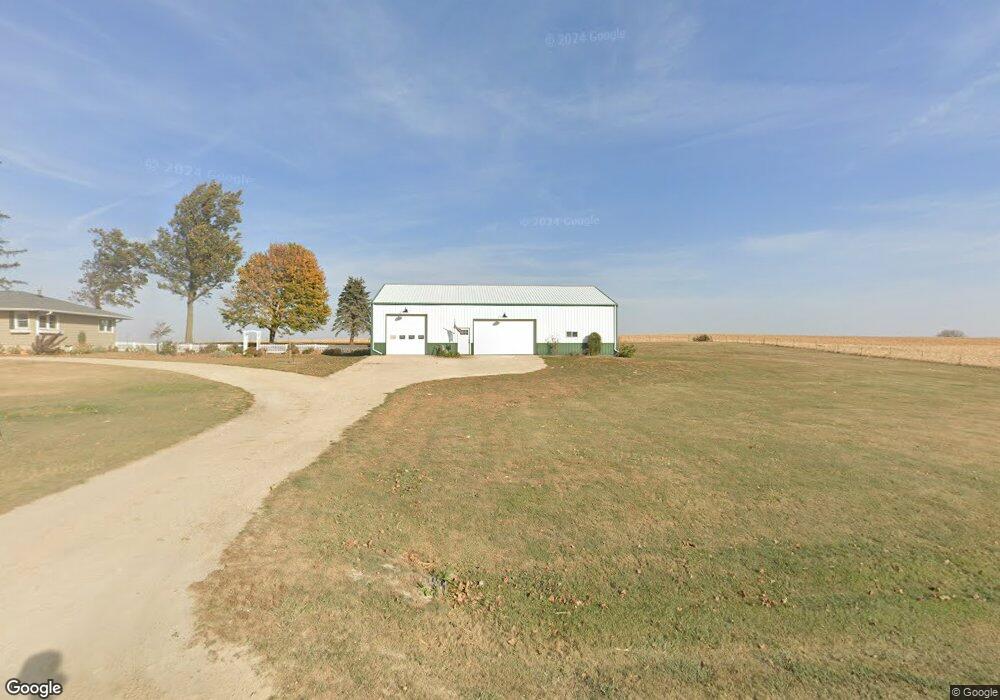
1877 Hutchinson Rd Coggon, IA 52218
Estimated Value: $206,000 - $369,000
3
Beds
2
Baths
1,344
Sq Ft
$227/Sq Ft
Est. Value
About This Home
This home is located at 1877 Hutchinson Rd, Coggon, IA 52218 and is currently estimated at $305,395, approximately $227 per square foot. 1877 Hutchinson Rd is a home located in Linn County with nearby schools including North Linn Elementary School, North-Linn Middle School, and North-Linn Senior High School.
Ownership History
Date
Name
Owned For
Owner Type
Purchase Details
Closed on
Oct 3, 2022
Sold by
Woods Jeffrey M and Woods Amy L
Bought by
Kurt Robert Francis and Kurt Erin Kathleen
Current Estimated Value
Home Financials for this Owner
Home Financials are based on the most recent Mortgage that was taken out on this home.
Original Mortgage
$297,000
Outstanding Balance
$283,878
Interest Rate
5.13%
Mortgage Type
VA
Estimated Equity
$21,517
Create a Home Valuation Report for This Property
The Home Valuation Report is an in-depth analysis detailing your home's value as well as a comparison with similar homes in the area
Home Values in the Area
Average Home Value in this Area
Purchase History
| Date | Buyer | Sale Price | Title Company |
|---|---|---|---|
| Kurt Robert Francis | $297,000 | River Ridge Escrow |
Source: Public Records
Mortgage History
| Date | Status | Borrower | Loan Amount |
|---|---|---|---|
| Open | Kurt Robert Francis | $297,000 |
Source: Public Records
Tax History Compared to Growth
Tax History
| Year | Tax Paid | Tax Assessment Tax Assessment Total Assessment is a certain percentage of the fair market value that is determined by local assessors to be the total taxable value of land and additions on the property. | Land | Improvement |
|---|---|---|---|---|
| 2025 | $3,272 | $305,400 | $65,000 | $240,400 |
| 2024 | $3,252 | $297,000 | $65,000 | $232,000 |
| 2023 | $3,252 | $297,000 | $65,000 | $232,000 |
| 2022 | $3,244 | $237,400 | $65,000 | $172,400 |
| 2021 | $2,926 | $237,400 | $65,000 | $172,400 |
| 2020 | $2,926 | $198,600 | $43,100 | $155,500 |
| 2019 | $2,884 | $198,600 | $43,100 | $155,500 |
| 2018 | $2,930 | $198,600 | $43,100 | $155,500 |
| 2017 | $2,994 | $194,100 | $43,100 | $151,000 |
| 2016 | $2,994 | $194,100 | $43,100 | $151,000 |
| 2015 | $3,032 | $194,100 | $43,100 | $151,000 |
| 2014 | $3,032 | $194,100 | $43,100 | $151,000 |
| 2013 | $2,960 | $194,100 | $43,100 | $151,000 |
Source: Public Records
Map
Nearby Homes
- 113 E Vinton St
- 403 3rd St S
- 321 3rd St S
- 110 E Linn St
- 104 5th Ave Ct
- 130 3rd Ave E
- 100 5th Ave Ct
- 215 2nd St N
- 517 E Linn St
- 531 E Linn St
- 5050 Shady Oak Ave
- 4889 Valley Farm Rd
- 504 Prairie Hills Dr
- 257 5th St N
- 1258 Rollins Rd
- 1900 Maine Ridge Rd
- 29 5th St N
- 43 River St S
- 832 E Main St
- 56 North Ave
- 1810 Hutchinson Rd
- 1955 Hutchinson Rd
- 1974 Hutchinson Rd
- 1773 Hutchinson Rd
- 1737 Hutchinson Rd
- 5646 Quality Ridge Rd
- 5467 Valley Farm Rd
- 197 N Linn Dr
- 199 N Linn Dr
- 0 Valley Farm Ln Unit 2108071
- 0 Valley Farm Ln Unit 6130580
- 0 Valley Farm Ln
- 192 N Linn Dr
- 201 N Linn Dr
- 194 N Linn Dr
- 203 N Linn Dr
- 196 N Linn Dr
- 205 N Linn Dr
- 1942 Valley Farm Ln
- 207 N Linn Dr