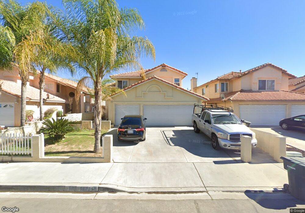
1877 Miramar St Perris, CA 92571
Central Perris NeighborhoodEstimated Value: $491,000 - $537,000
4
Beds
3
Baths
1,635
Sq Ft
$313/Sq Ft
Est. Value
About This Home
This home is located at 1877 Miramar St, Perris, CA 92571 and is currently estimated at $511,793, approximately $313 per square foot. 1877 Miramar St is a home located in Riverside County with nearby schools including Palms Elementary School, Pinacate Middle School, and Perris High School.
Ownership History
Date
Name
Owned For
Owner Type
Purchase Details
Closed on
Dec 19, 2000
Sold by
Hud
Bought by
Duenas Arnulfo and Duenas Ramona
Current Estimated Value
Home Financials for this Owner
Home Financials are based on the most recent Mortgage that was taken out on this home.
Original Mortgage
$105,600
Interest Rate
9.65%
Purchase Details
Closed on
Jul 5, 2000
Sold by
Lino Antonino and Lino Theresa
Bought by
Hud
Purchase Details
Closed on
Oct 15, 1994
Sold by
Anaya Genoveva L and Lino Antonino C
Bought by
Lino Antonino and Lino Theresa
Purchase Details
Closed on
Apr 11, 1994
Sold by
Lino Antonio C and Lino Theresa L
Bought by
Anaya Raul E and Anaya Genoveva L
Home Financials for this Owner
Home Financials are based on the most recent Mortgage that was taken out on this home.
Original Mortgage
$118,161
Interest Rate
7.79%
Mortgage Type
FHA
Create a Home Valuation Report for This Property
The Home Valuation Report is an in-depth analysis detailing your home's value as well as a comparison with similar homes in the area
Home Values in the Area
Average Home Value in this Area
Purchase History
| Date | Buyer | Sale Price | Title Company |
|---|---|---|---|
| Duenas Arnulfo | $132,000 | First American Title Co | |
| Hud | $166,374 | United Title Company | |
| Lino Antonino | -- | -- | |
| Anaya Raul E | -- | Stewart Title Co |
Source: Public Records
Mortgage History
| Date | Status | Borrower | Loan Amount |
|---|---|---|---|
| Previous Owner | Duenas Arnulfo | $105,600 | |
| Previous Owner | Anaya Raul E | $118,161 |
Source: Public Records
Tax History
| Year | Tax Paid | Tax Assessment Tax Assessment Total Assessment is a certain percentage of the fair market value that is determined by local assessors to be the total taxable value of land and additions on the property. | Land | Improvement |
|---|---|---|---|---|
| 2025 | $2,394 | $198,868 | $37,653 | $161,215 |
| 2023 | $2,394 | $191,147 | $36,192 | $154,955 |
| 2022 | $2,369 | $187,400 | $35,483 | $151,917 |
| 2021 | $2,326 | $183,727 | $34,788 | $148,939 |
| 2020 | $2,299 | $181,844 | $34,432 | $147,412 |
| 2019 | $2,249 | $178,279 | $33,757 | $144,522 |
| 2018 | $2,154 | $174,785 | $33,097 | $141,688 |
| 2017 | $2,446 | $171,359 | $32,449 | $138,910 |
| 2016 | $2,430 | $168,000 | $31,813 | $136,187 |
| 2015 | $2,410 | $165,479 | $31,336 | $134,143 |
| 2014 | $2,374 | $162,239 | $30,723 | $131,516 |
Source: Public Records
Map
Nearby Homes
- 507 Coudures Way
- 544 Turquoise Dr
- 2248 Ridge Ct
- 129 Olivetree Dr
- 1829 Springtree Dr
- 1942 Sandcastle Dr
- 560 Coudures Way
- 1562 Remembrance Dr
- 1900 Summertree Dr
- 21500 Orange Creek Rd
- 1509 Portrait St
- 1491 Portrait St
- 2269 Firebrand Ave
- 1486 Olivecrest Way
- 1455 Remembrance Dr
- 575 Prairie Way
- 1947 Neptune Dr
- 1462 Apple Creek Dr
- 316 Randy Ln
- 166 Ambrosia Ct
- 1869 Miramar St
- 1885 Miramar St
- 1861 Miramar St
- 1893 Miramar St
- 1880 Havasu St
- 1888 Havasu St
- 1872 Havasu St
- 1899 Miramar St
- 1853 Miramar St
- 1896 Havasu St
- 1882 Miramar St
- 1874 Miramar St
- 1890 Miramar St
- 1902 Havasu St
- 1856 Havasu St
- 1845 Miramar St
- 1907 Miramar St
- 1896 Miramar St
- 1910 Havasu St
- 1848 Havasu St
Your Personal Tour Guide
Ask me questions while you tour the home.