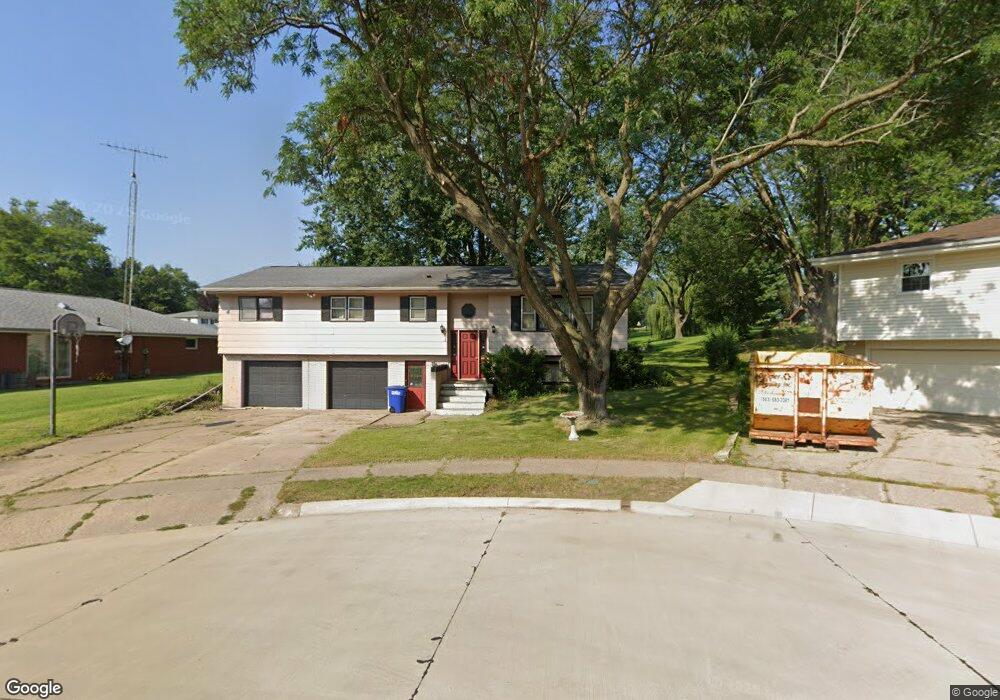
1878 Carter Ct Dubuque, IA 52001
Estimated Value: $266,610 - $313,000
4
Beds
3
Baths
2,393
Sq Ft
$121/Sq Ft
Est. Value
About This Home
This home is located at 1878 Carter Ct, Dubuque, IA 52001 and is currently estimated at $288,403, approximately $120 per square foot. 1878 Carter Ct is a home located in Dubuque County with nearby schools including Hoover Elementary School, Eleanor Roosevelt Middle School, and Dubuque Senior High School.
Ownership History
Date
Name
Owned For
Owner Type
Purchase Details
Closed on
Mar 20, 2009
Sold by
Lange Scott H and Lange Tracy L
Bought by
Brandt Scott A
Current Estimated Value
Home Financials for this Owner
Home Financials are based on the most recent Mortgage that was taken out on this home.
Original Mortgage
$144,827
Outstanding Balance
$92,432
Interest Rate
5.2%
Mortgage Type
FHA
Estimated Equity
$195,971
Purchase Details
Closed on
Oct 12, 2007
Sold by
Reed Charles W and Reed Kathryn L
Bought by
Lange Scott H and Lange Tracy L
Home Financials for this Owner
Home Financials are based on the most recent Mortgage that was taken out on this home.
Original Mortgage
$150,575
Interest Rate
6.49%
Mortgage Type
New Conventional
Create a Home Valuation Report for This Property
The Home Valuation Report is an in-depth analysis detailing your home's value as well as a comparison with similar homes in the area
Home Values in the Area
Average Home Value in this Area
Purchase History
| Date | Buyer | Sale Price | Title Company |
|---|---|---|---|
| Brandt Scott A | $147,500 | None Available | |
| Lange Scott H | $158,500 | None Available |
Source: Public Records
Mortgage History
| Date | Status | Borrower | Loan Amount |
|---|---|---|---|
| Open | Brandt Scott A | $144,827 | |
| Previous Owner | Lange Scott H | $150,575 |
Source: Public Records
Tax History Compared to Growth
Tax History
| Year | Tax Paid | Tax Assessment Tax Assessment Total Assessment is a certain percentage of the fair market value that is determined by local assessors to be the total taxable value of land and additions on the property. | Land | Improvement |
|---|---|---|---|---|
| 2025 | $3,304 | $264,800 | $45,800 | $219,000 |
| 2024 | $3,304 | $240,000 | $41,400 | $198,600 |
| 2023 | $3,204 | $240,000 | $41,400 | $198,600 |
| 2022 | $3,112 | $197,170 | $39,240 | $157,930 |
| 2021 | $3,112 | $197,170 | $39,240 | $157,930 |
| 2020 | $3,050 | $180,310 | $37,060 | $143,250 |
| 2019 | $3,054 | $180,310 | $37,060 | $143,250 |
| 2018 | $3,004 | $172,820 | $34,880 | $137,940 |
| 2017 | $2,942 | $172,820 | $34,880 | $137,940 |
| 2016 | $2,878 | $160,890 | $34,880 | $126,010 |
| 2015 | $2,878 | $160,890 | $34,880 | $126,010 |
| 2014 | $2,756 | $158,420 | $34,880 | $123,540 |
Source: Public Records
Map
Nearby Homes
- 1790 Horizon Ct
- 3080 Saint Anne Dr
- 1693 Butterfield Rd
- 1762 Churchill Dr
- 3130 Ideal Ln
- 2035 Broadlawn Rd
- 3424 Glencove Ln
- 1730 Chaney Rd
- 3427 Crestwood Dr
- 3428 Crestwood Dr
- 3455 Daniels St
- 1650 Drexel Ave
- 1568 Fairfax Ave
- 2095 Mullin Rd
- 2090 Key Largo Dr
- 1395 Brown Ave
- 1821 Glendale Ct
- 3519 Hillcrest Rd
- 1754 Vizaleea Dr
- 1896 Floraview Dr
- 1880 Carter Rd
- 1882 Carter Rd
- 1755 Horizon Ct
- 1884 Carter Rd
- 1874 Carter Ct
- 1750 Horizon Ct
- 1872 Carter Ct
- 1868 Carter Rd
- 1886 Carter Rd
- 1870 Carter Ct
- 1879 Carter Rd
- 1871 Carter Rd
- 1883 Carter Rd
- 1888 Carter Rd
- 1765 Horizon Ct
- 1760 Horizon Ct
- 1867 Carter Rd
- 1866 Carter Rd
- 3150 Saint Anne Dr Unit 600 Star Brewery Dr.
- 3150 Saint Anne Dr